Guest, Sign inJoin

Post to Marana

We’ll email a one-tap link to publish your post. No password, and nothing is public until you click it.
Already a member? Sign in
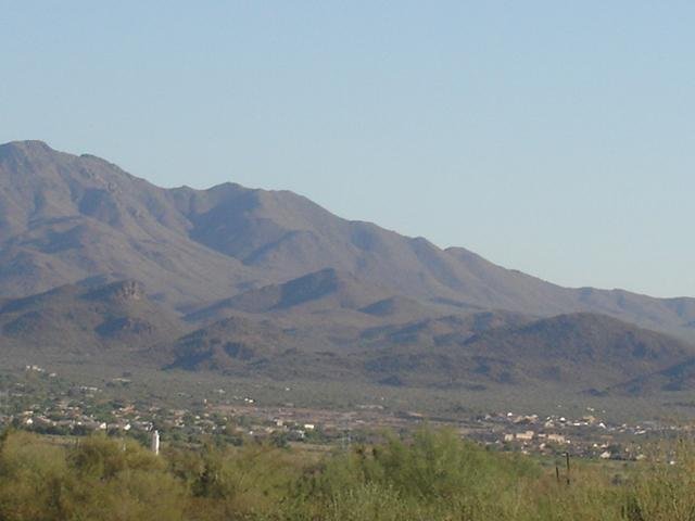
Marana ViewPhoto: Musicoceanfan88 at English Wikipedia · CC BY-SA 3.0
AOutdoors
Outdoors in Marana

47% of Marana’s land is conserved: 36,358 acres

189 miles of mapped trail cross Marana, 1.5 per square mile of land. The biggest trail networks: Los Morteros (1.6 mi), Sanctuary Cove (1.6 mi), Ora Mae Harn District Park (1.2 mi). 1,828 acres are parks and preserves, 32 per 1,000 residents.

Ahead of 94% of U.S. towns · #15 of 140 in Arizona. What drives it

Conserved land
47%
36,358 acres · of 121.7 sq mi of land
Trails
189 mi
1.5 per sq mi of land
Park land
1,828 ac
32 acres per 1,000 residents
Near a park
80%
of residents within ½ mile
Bike routes
124 mi
66 mi lanes · 55 mi paths
Lakes & rivers
2

What kind of outdoors town is Marana?

Read from the map. The page puts what stands out first.

Outdoors grade

How much outdoors does Marana have?

On conserved land, trails, park land and how close residents live to a park, Marana is ahead of 94% of U.S. towns, #15 of 140 in Arizona. All four inputs are above most U.S. towns; conserved land ranks highest, the share of residents near a park lowest.

A
OutdoorsA character grade: shown, never part of Marana’s overall grade.
All U.S. towns we grade (21,298)Ahead of 94%
LessMore
Arizona towns of 2,500+ (140)Ahead of 90%

Arizona towns conserve more land than most (a typical one, 14%; the U.S., 4%), so Marana’s 47% is ahead of 81% of Arizona towns, while its trails per square mile lead 68% of them.

How sure. Graded on any three of the four inputs instead, the letter would still be A. Trails and many small parks come from OpenStreetMap, mapped by volunteers, so coverage varies from town to town; the half mile is a straight line from each census block, so a river or highway in the way isn’t counted against it.

PAD-US, OpenStreetMap (© OpenStreetMap contributors), Census 2025 Gazetteer and 2020 blocks; details in Sources below. How TownRatings grades the outdoors →

The map

Conserved land, trails & bike routes

Tap a number to zoom to a park. Tap a layer to hide it.

123456
Easements protect land from building but are usually private.© OpenStreetMap contributors · USGS PAD-US
Places to walk

Pick a walk

The longest trail network is Los Morteros, with 1.6 miles. Directions go to the nearest trailhead or public parking.

Los Morteros

Nature preserve
153 acres1.6 mi of trail
Dog rules not recorded
Directionsto the parking lot

Sanctuary Cove

Nature preserve
78 acres1.6 mi of trail
Dog rules not recorded
No trailhead mapped yet

Ora Mae Harn District Park

Park
37 acres1.2 mi of trail
Dog rules not recorded
Directionsto the parking lot

Crossroads at Silverbell District Park

Park
38 acres0.4 mi of trail
Dog rules not recorded
Directionsto the parking lot

Mike Jacob Sports Park

Park
53 acres0.3 mi of trail
Dog rules not recorded
Directionsto the parking lot

Tangerine Sky Park

Park
19 acres0.3 mi of trail
Dog rules not recorded
Directionsto Overflow Parking
All 34 parks & preserves
Los Morteros153 acres · 1.6 mi of trail
Directions
Sanctuary Cove78 acres · 1.6 mi of trail
Ora Mae Harn District Park37 acres · 1.2 mi of trail
Directions
Crossroads at Silverbell District Park38 acres · 0.4 mi of trail
Directions
Mike Jacob Sports Park53 acres · 0.3 mi of trail
Directions
Tangerine Sky Park19 acres · 0.3 mi of trail
Directions
Cascada North Donation378 acres · 0.2 mi of trail · Pima County
Gladden Farms Community Park99 acres · 0.2 mi of trail
Directions
Continental Reserve Park10 acres · 0.2 mi of trail
Directions
Santa Cruz River Park1,415 acres · 0.1 mi of trail · Pima County
Directions
El Rio Preserve74 acres · 0.1 mi of trail · Marana Parks and Recreation
Directions
FLAP14 acres · 0.1 mi of trail
Dove Mountain Neighborhood Park6 acres · 0.1 mi of trail
Directions
Countryside Ridge Community Park1 acres · 0.1 mi of trail
Lower Santa Cruz Replenishment109 acres
Ina Silverbell Parcel55 acres
Directions
Cañada del Oro River Park40 acres · Pima County
Directions
Marana Heritage River Park26 acres
Directions
San Lucas Community Park25 acres
Avra Valley I-10 Wildlife Corridor22 acres
Continental Ranch Community Park22 acres
Directions
Countryside Vistas18 acres
The Village at Barnett Park13 acres
Farm Field Five Park10 acres
Rancho Marana Park10 acres
Ted Walker Park10 acres
Directions
Windmill Park8 acres
Fianchetto Farms Park8 acres
Marana Cottonwoods6 acres · Pima County
Directions
Silverbell Hills Estates3 acres
South Preserves Park2 acres
Directions
Twin Peaks Highlands Park2 acres
Directions
Continental Ranch Community Park II1 acres
Directions
SC Ranch Park1 acres
Who protects it

36,358 conserved acres

47% of Marana’s land. Who manages Marana’s conserved land, from the USGS Protected Areas Database. Approximate, because parcels can overlap.

Town or city25,650 ac
State Department of Land10,666 ac
Bureau of Reclamation1,612 ac
County847 ac
State Resource Management Area · 32,522 acLocal Park · 2,788 acLocal Conservation Area · 1,853 acFederal Other or Unknown · 1,612 ac
Good to know

Conserved doesn’t always mean open to visitors. Public access isn’t recorded for 11 of 38 parcels. The walks above are places people visit.

The biggest protected parcels
Parcel (PAD-US)Managed byAcresPublic access
State Trust Land
State Resource Management Area
State Department of Land32,522Restricted
Tortolita Preserve
Local Park
Town or city2,401Open
Usbr
Federal Other or Unknown
Bureau of Reclamation1,612Unknown
Section 36
Local Conservation Area
Town or city441Open
Sky Ranch
Local Conservation Area
Town or city394Open
Flap
Local Conservation Area
County269Unknown
Hartman Vistas
Local Conservation Area
Town or city223Open
Los Morteros
Local Conservation Area
County145Unknown
Lower Santa Cruz Replenishment
Local Conservation Area
County110Unknown
Cap Tangerine Road Park
Local Park
County89Open

5 smaller protected places aren’t shown.

Things to do

58 places to go in Marana

Beaches, playgrounds, peaks, falls and more. Pick a kind.

Public pools in Marana
Aventura Pool
Directions
Turquesa Pool
Directions

Plus 1 public pool without a name on the map. Tap “Show all on map” to see it.

Trails & water

13 named trails and 2 lakes & rivers

Named trails
Open to bikes · 33.5 miHorses · 6.3 miUnpaved · 41.6 mi
Tortolita Preserve Loop9.4 mi
Dove Mountain Community4.7 mi
Cochie Springs2.9 mi
Alamo Spring Trail2.7 mi
Upper Javelina Trail2.5 mi
Wild Burro2.4 mi
Wild Mustang Trail2.0 mi
Lower Javelina Trail1.9 mi
Wild Burro Trail1.2 mi
Camino Horizante0.7 mi
3 more trails
Alamo Springs Spur
0.5 mi
Hotel Spur Trail
0.4 mi
West Camino de Manana
0.3 mi
Lakes & rivers tap for directions
Biking & sports

124 miles of bike routes

Bike lanes are often missing from the map in smaller towns, so that number is likely low.

66 mi
painted or protected bike lanes
55 mi
off-road bike paths
3.5 mi
shoulders & shared lanes
Courts & fields
34Basketball
31Tennis
29Baseball
10Soccer
7Equestrian
5Pickleball
4Volleyball
3Beach volleyball

Includes school and college facilities, which aren’t always open to the public.

When to get out

April is the best month for walking in Marana

NOAA’s 1991–2020 normals for the town and the daylight at its latitude. Outlined months have long days, highs of 59 to 86 °F and little rain for the place.

JanFebMarAprMayJunJulAugSepOctNovDec
Daylight (h)10.211.011.912.913.814.314.113.312.311.310.410.0
High (°F)666976839210210210096877565
Rain (in)1.01.20.80.30.30.21.62.11.20.60.81.2

June is the driest month (0.2 in) and the warmest (highs of 102 °F). 2.1 inches fall in August, the wettest month. Summer highs reach 102 °F, too hot for the outline. The climate in Marana →

Next door

Marana and its neighbors

Marana has the second most mapped trails of the 5 towns around it. Tap a town to see its outdoors.

TownConserved
of land
Trail mi
per sq mi
Park acres
per 1,000
Near a park
½ mile
Outdoors
Marana47%1.53280%A
Casas Adobes3%0.6868%B−
Picture Rocks20%1.2523%B
Tucson Mountains11%1.34647%A−
Tucson31%1.51188%A

The four inputs of the Outdoors grade, from the engine; shares are of land, not water.

Questions about parks and trails in Marana

Where can I hike in Marana?

The longest trail networks: Los Morteros, 1.6 miles; Sanctuary Cove, 1.6 miles; Ora Mae Harn District Park, 1.2 miles; Crossroads at Silverbell District Park, 0.4 miles. Each one is on the map above, with directions to the nearest trailhead or parking.

How much of Marana is conserved land?

47% of its land, against a typical 14% for an Arizona town and 4% nationally (PAD-US). Conserved doesn’t always mean open to visitors: easements are usually private land.

Are dogs allowed on Marana’s trails?

Los Morteros and Sanctuary Cove don’t have dog rules recorded on the map; check the signs at the trailhead.

Where can I bike in Marana?

124 miles of bike routes are on the map: 66 of painted or protected lanes, 55 of off-road paths and 3.5 of shoulders and shared lanes.

Is there public land near Marana?

56,258 acres of parks and open public land lie inside Marana or within 10 miles of it (PAD-US), 1,839 of them inside the town line.

How much outdoors does Marana have?

Ahead of 94% of U.S. towns on the Outdoors grade, #15 of 140 in Arizona. The grade combines the share of land that is conserved, miles of mapped trail per square mile of land, park acres per 1,000 residents and the share of residents within a half mile of a park. It’s a character grade, so it isn’t part of the overall grade. How it works.

Trail talk

Conditions, parking and favorite walks from Marana neighbors.
Town Square →
Share a tip
Sources

Where this page comes from

Conserved and public land: USGS Protected Areas Database of the United States (PAD-US), service updated July 2026. Parks, trails, playgrounds, beaches and other places: OpenStreetMap (© OpenStreetMap contributors, ODbL), map data as of 2026-10-28. Land and water area: Census 2025 Gazetteer. Residents near a park: 2020 Census blocks. National Register: National Park Service. How TownRatings grades the outdoors →