
Bellemont, Arizona (2012-01-01) (crop), 2012
Bellemont’s story
139 years in pictures
The archive holds 3 old photos and papers going back to 2012 and 2 maps from 1963 on.
- 1887Bellemont is settled
Each edition grades its towns against each other only.

The town, settled in 1887, counts 1,701 residents.
The best of Bellemont’s subject grades are an A+ for health and an A for the outdoors; the weakest is a D− for hazard risk. Bellemont’s typical July afternoon high is 83°F, below both Arizona’s towns (100°F) and U.S. towns (85°F). Only 1 of Arizona’s 207 towns score higher on health. Most errands need a car: it is less walkable than 82% of U.S. towns. 84% of the land in Bellemont is conserved, against 14% in Arizona’s towns and 4.3% across U.S. towns. The biggest place to walk is Coconino National Forest, 4,439 acres with 23.1 miles of trail. Bellemont has 1 place on the National Register. Bellemont has fewer than 2,500 residents, so it gets subject grades but no overall grade.
Where Bellemont beats most towns, and one thing worth knowing.
| Widest gap | Bellemont | AZ |
|---|---|---|
| Fewer adults with heart disease | 3.2% | 6.4% |
Where Bellemont’s working residents go each day. Line width shows the share.
Census LEHD 2023
Each subject compared with towns across the country (schools within Arizona), ordered by how far Bellemont is from typical.
How TownRatings grades towns →
The archive holds 3 old photos and papers going back to 2012 and 2 maps from 1963 on.
Bellemont is unincorporated, so Coconino County and regional agencies provide most services.
EPA SDWIS (Oct 9, 2026) · HIFLD + EIA-861 2025 · Census 2020 ZCTAs · NCES 2024–25 · registration: vote.gov, updated Sep 12, 2025.
Ordered by what stands out in Bellemont.
Across 1 park or preserve: 24 miles of trail. The trail density in Bellemont is 2.7 miles per square mile.
| Biggest places to walk | Trails | Acres |
|---|---|---|
| 1. Coconino National Forest | 23.1 mi | 4,439 |
Trails & parks © OpenStreetMap contributors · Conserved land: USGS PAD-US
Of 32 CDC measures, Bellemont beats the Arizona average on 21 and trails it on 3. No town among the 141 in Arizona we compare has a lower share of adults who have obesity than Bellemont. Bellemont: 6.1% of adults have diabetes. Only 2 of the 141 Arizona towns we compare have a higher share of adults who binge drink than Bellemont.
| Bellemont | Arizona towns | U.S. towns | |
|---|---|---|---|
| Obesity (CDC PLACES) | 21% | 32% | 35% |
| Diabetes (CDC PLACES) | 6.1% | 13% | 12% |
| Get no exercise (CDC PLACES) | 11% | 24% | 25% |
| High blood pressure (CDC PLACES) | 21% | 36% | 35% |
| What stands out | Bellemont | AZ |
|---|---|---|
| Fewer adults with heart disease | 3.2% | 6.4% |
| Fewer adults who get no exercise | 11.1% | 21.9% |
| More binge drinkers | 19.6% | 15.3% |
CDC PLACES 2025 · modeled estimates for adults · CMS · HRSA
For Bellemont, the FEMA hazard score is 96 of 100. Just over three fifths of the town’s expected losses from natural hazards come from wildfires, followed by inland flooding at 26%.
FEMA National Risk Index · OpenFEMA
Jobs based in Bellemont grew to 158 in 2023, 63 more than in 2013. The town’s average commute is 35 minutes. Half commute less than 12 miles. The top destinations are Flagstaff (50%), Phoenix (6%) and Grand Canyon Village (5%).
| Bellemont | Arizona towns | U.S. towns | |
|---|---|---|---|
| Average trip to work | 35 minutes | 24 minutes | 25 minutes |
| Median household income | $120,000 | $69,000 | $80,000 |
| Working residents who work in town | 0.8% | 10% | 8% |
Census LEHD 2023 · ACS
The share of households in Bellemont who live in a home they own: 94%. In the year to September 2026, typical home values climbed 1.2%. Homes sold in Bellemont spent a median 62 days on the market.
Census ACS, 2020–24 · Zillow Home Value Index · Redfin Data Center
NOAA U.S. Climate Normals, 1991–2020
Museums, parks, gardens and other places to visit around Bellemont. Close and well known come first.
 11 mi MountainHumphreys Peak
 9 mi Ski areaArizona Snowbowl53 runs · 2,368 ft vertical
 17 mi National MonumentSunset Crater Volcano National Monument108K visitors a year
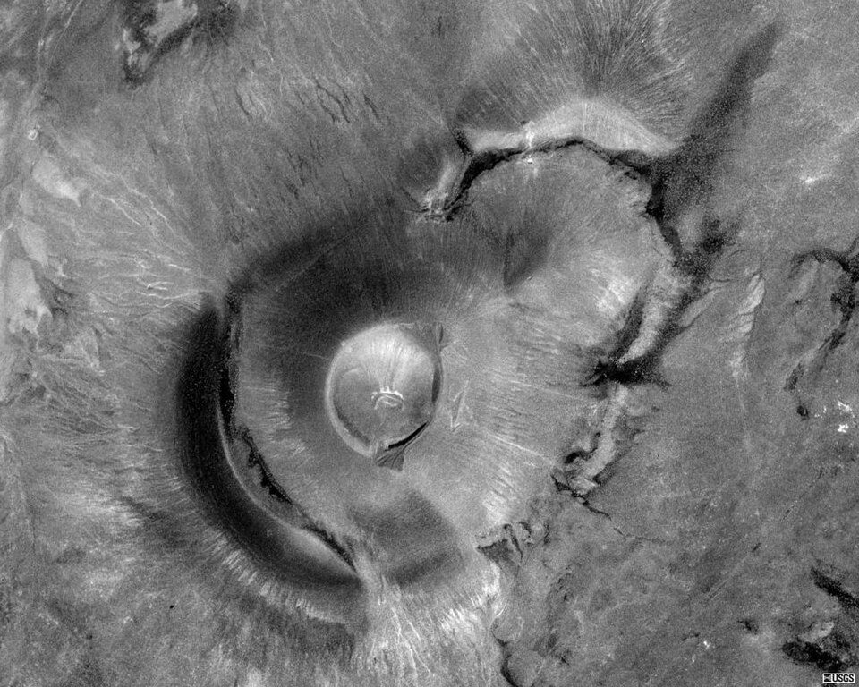 34 mi MountainRoden Crater
 29 mi MountainCathedral Rock
 16 mi National MonumentWalnut Canyon National Monument153K visitors a year
Humphreys Peak: Bob Blasi; Coconino National Forest, CC BY-SA 2.0 · Arizona Snowbowl: Frederick Dennstedt from los angeles, usa, CC BY-SA 2.0 · Sunset Crater Volcano National Monument: National Park Service, Public domain · Roden Crater: Unknown, Public domain · Cathedral Rock: Terrydarc, CC BY-SA 3.0 · Walnut Canyon National Monument: Daniel Schwen, CC BY-SA 3.0
3 within 15 miles of the center of Bellemont
About 1 of every 100 Bellemont residents are enrolled in college, against 6 across Arizona.
Unincorporated community in Coconino County, Arizona, US
Bellemont is an unincorporated community in Coconino County, Arizona, United States, located along Interstate 40, about 11 miles (18 km) west-northwest of Flagstaff. At an elevation of 7,132 feet (2,174 m), it is claimed to be the highest settlement along historic Route 66. It was a known water stop due to its local springs. As of June 2012, it had an estimated population of 893.
From Wikipedia, licensed CC BY-SA 4.0 · facts via Wikidata (CC0)
One town shares a border with Bellemont.
| Town | AZ rank | Overall | Cost | Safety | Schools | Health |
|---|---|---|---|---|---|---|
| Bellemont | — | — | B− | — | B | A+ |
| Fort Valley | — | — | D | — | B | A+ |
Bellemont and Fort Valley have fewer than 2,500 residents, so they get subject grades but no overall grade. Bellemont and Fort Valley report no FBI crime data of their own. Compare Bellemont with a neighbor →
Short answers, built from the data on this page.
That is 7.3 years of the area's median household income ($72,966 across the Flagstaff, AZ metro area). Cost of living, which also weighs rents, property taxes and how many households pay 30% or more of their income for housing, grades B−.


