
Rainbow Bridge National Monument
Rainbow Bridge is a natural arch in southern Utah, United States. It is 32 mi southwest of Halls Crossing. Its operator is the National Park Service. In 2025, it drew 11K visitors.

A national monument, 32 mi southwest of Halls Crossing
Little or no visiting in Jan and Feb
The Park Service records almost no visits in January and February. Check the official site before planning a trip then. When to go ↓
Summers are hot
July highs run 100–100°, and about 106 days a year reach 90°. When to go ↓
Plan where you’ll sleep
The nearest town with many places to stay is Page, 32 miles west. Where to stay ↓
Best months: Apr and May
April and May are mild and quieter than average, with highs of 72–82°. When to go ↓
Established in 1909
Rainbow Bridge National Monument dates from 1909 and is run by National Park Service. About ↓
Written from National Park Service visitor counts, NOAA 1991–2020 normals, Overture places to stay, Census town figures, Wikidata and Wikipedia. Updated when the Park Service posts a new month.
The busy season and the weather
Use the months below to time a visit to Rainbow Bridge.
Rainbow Bridge National Monument
Rainbow Bridge is a natural arch in southern Utah, United States. With a span of 275 feet (84 m), as reported in 1974 by the Bureau of Reclamation, and height of 290 feet (88 m), it is one of the largest natural arches in the world. At the top it is 42 feet (13 m) thick and 33 feet (10 m) wide. The bridge, which is of cultural importance to a number of area Native American tribes, has been designated a Traditional Cultural Property by the National Park Service. Rainbow Bridge National Monument was protected in 1910, and it is administered by Glen Canyon National Recreation Area.
- Type
- National Monument
- Established
- 1909
- Area
- 161 acres
- Run by
- National Park Service
- Listed
- International Dark Sky Sanctuary (2018)
- Wikipedia readers
- 17K a year
- Official site
- nps.gov/rabr
Plan your visit
Towns to stay in near Rainbow Bridge National Monument
For a bed close by, look to Page (43) and Halls Crossing (3).
Page
The closest town with somewhere to stay.
7,147 people
32 mi west of Rainbow Bridge · 31 mi to the park
Greenehaven
325 people · 37% vacation homes
33 mi west of Rainbow Bridge · 33 mi to the park
Compare 3 towns
| Town | From Rainbow Bridge | Drive | Places to stay | People | Typical home | Safety |
|---|---|---|---|---|---|---|
| Page | 32 mi west | 50 min | 43 25 hotels · 8 motels · 3 inns & B&Bs · 2 lodges & cabins · 2 campgrounds · 3 RV parks | 7,147 | $304K | D |
| Halls Crossing | 32 mi northeast | 45 min | 3 3 hotels | — | — | — |
| Greenehaven 37% vacation homes | 33 mi west | 50 min | 1 1 campground | 325 | $235K | — |
Getting there
Nearest airports with airline service
Close to Rainbow Bridge
These lie within 47 miles as the crow flies.
 Big draw30 mi LakeLake Powell
 127 mi Canyon & gorgeAntelope Canyon
 230 mi DamGlen Canyon Dam
 45 mi Park & preserveGrand Staircase–Escalante National Monument
 313 mi LandmarkHole in the Rock
 47 mi Park & preserveVermilion Cliffs National Monument
 36 mi National MonumentNavajo National Monument44K visitors a year
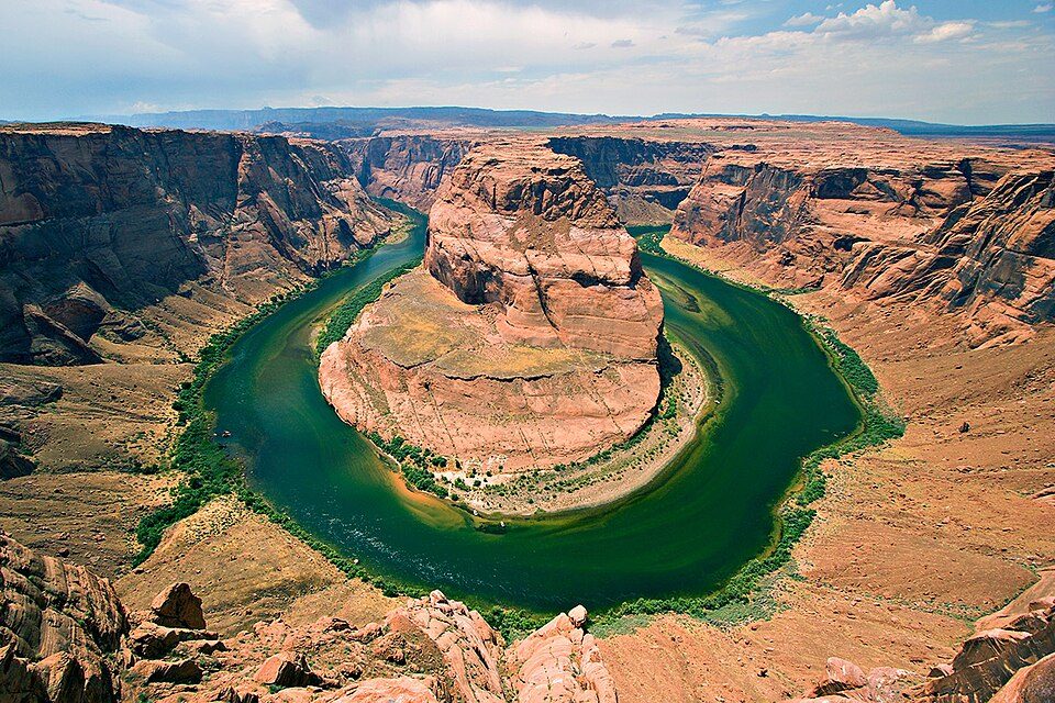 429 mi National Recreation AreaGlen Canyon National Recreation Area3.7M visitors a year
Photo credits
Lake Powell: Copernicus Sentinel-2, ESA, CC BY-SA 3.0 igo · Antelope Canyon: Lucas Löffler, Public domain · Glen Canyon Dam: W. Bulach, CC BY-SA 4.0 · Grand Staircase–Escalante National Monument: John Fowler from Placitas, NM, USA, CC BY 2.0 · Hole in the Rock: G. Thomas at en.wikipedia, Public domain · Vermilion Cliffs National Monument: Lobineau, CC BY 2.5 · Navajo National Monument: Jon Sullivan, Public domain · Glen Canyon National Recreation Area: User:Moondigger, CC BY-SA 2.5


Visitor numbers: 11,404 in 2025
Here are the yearly counts from 2016 to 2025.
Good to know about Rainbow Bridge
What town is Rainbow Bridge National Monument near?
Halls Crossing, UT, about 32 miles northeast.
When is the best time to visit Rainbow Bridge National Monument?
April and May, with highs of 72–82°. July is the busiest month (about 2,089 visitors).
How many people visit Rainbow Bridge National Monument each year?
11,404 in 2025, according to the National Park Service. The record is 115,108, set in 2019.
What is the closest airport to Rainbow Bridge National Monument?
Page Municipal (PGA), about 29 miles away. The nearest big hub is Harry Reid (LAS), about 242 miles.
Where should I stay near Rainbow Bridge National Monument?
Page (32 mi, 43 places to stay) and Halls Crossing (32 mi, 3 places to stay).
Ask people in Halls Crossing
Share what you know in Halls Crossing’s Town Square.
Sources: National Park Service · ski areas © OpenSkiMap / OpenStreetMap contributors · Wikidata · Wikipedia readership · National Park Service visitor use statistics · NOAA climate normals · U.S. Census.