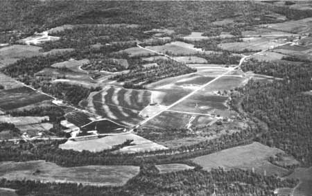
Poverty Point National Monument
Poverty Point State Historic Site/Poverty Point National Monument (French: Pointe de Pauvreté; 16 WC 5) is a prehistoric earthwork constructed by the Poverty Point culture, located in present-day northeastern Louisiana. Visitors find it 7 mi south of Pioneer. It is managed by the National Park Service.

A national monument, 7 mi south of Pioneer
Plan where you’ll sleep
The nearest town with many places to stay is Lake Providence, 18 miles northeast. Where to stay ↓
One of the most looked-up attractions in the U.S.
About 71K people a year read its Wikipedia article, more than for 95% of the 7,770 attractions we track.
Summers are hot
July and August highs run 92–93°, and about 79 days a year reach 90°. When to go ↓
Best months: Mar, Apr, May, Oct and Nov
March, April, May, October and November are the mild months, with highs of 67–84°. When to go ↓
Written from NOAA 1991–2020 normals, Overture places to stay, Census town figures, Wikidata and Wikipedia.
Highs and lows by month
A visit to Poverty Point can follow the seasons below.
Poverty Point National Monument
Poverty Point State Historic Site/Poverty Point National Monument (French: Pointe de Pauvreté; 16 WC 5) is a prehistoric earthwork constructed by the Poverty Point culture, located in present-day northeastern Louisiana. Evidence of the Poverty Point culture extends throughout much of the Southeastern Woodlands of the Southern United States. The culture extended more than 100 miles (160 km) laterally across the Mississippi Delta and an even greater distance southward to the Gulf Coast, with related or satellite cultures found further afield.
- Type
- National Monument
- Area
- 403 acres
- Run by
- National Park Service
- Listed
- National Historic Landmark (1962) · National Register of Historic Places (1966) · World Heritage Site (2014)
- Wikipedia readers
- 71K a year
- Official site
- nps.gov/popo
Practical details
Places to stay near Poverty Point National Monument
For a bed close by, look to Delhi (4) and Lake Providence (5), and Vicksburg has the most rooms in the area (57).
Delhi
The closest town with somewhere to stay.
2,519 people
14 mi south of Poverty Point World Heritage Site · 13 mi to the park
Lake Providence
3,147 people
18 mi northeast of Poverty Point World Heritage Site · 16 mi to the park
Tallulah
5,517 people
20 mi southeast of Poverty Point World Heritage Site · 20 mi to the park
Vicksburg
The most places to stay in the area, and a base for a longer trip.
19,830 people
37 mi southeast of Poverty Point World Heritage Site · 37 mi to the park
Compare 9 towns
| Town | From the visitor center | Drive | Places to stay | People | Typical home | Safety |
|---|---|---|---|---|---|---|
| Delhi | 14 mi south | 20 min | 4 3 hotels · 1 RV park | 2,519 | $118K | — |
| Lake Providence | 18 mi northeast | 25 min | 5 2 hotels · 1 motel · 1 inn or B&B · 1 RV park | 3,147 | $116K | — |
| Pioneer | 7 mi north | 10 min | 1 1 inn or B&B | 149 | $50K | — |
| Tallulah | 20 mi southeast | 30 min | 5 4 hotels · 1 motel | 5,517 | $79K | C |
| Rayville | 24 mi southwest | 35 min | 3 2 hotels · 1 RV park | 3,176 | $99K | — |
| Oak Grove | 16 mi north | 25 min | 1 1 hotel | 1,350 | $88K | — |
| Eagle Bend 45% vacation homes | 23 mi east | 35 min | 2 1 hotel · 1 lodge or cabins | 408 | $166K | — |
| Bastrop | 31 mi west | 45 min | 4 2 hotels · 1 motel · 1 inn or B&B | 8,908 | $88K | D− |
| Vicksburg | 37 mi southeast | 1 hr | 57 31 hotels · 7 motels · 8 inns & B&Bs · 4 lodges & cabins · 2 campgrounds · 5 RV parks | 19,830 | $126K | D |
Getting there
Nearest airports with airline service, from the visitor center
Around Poverty Point
Also within 46 miles are these.
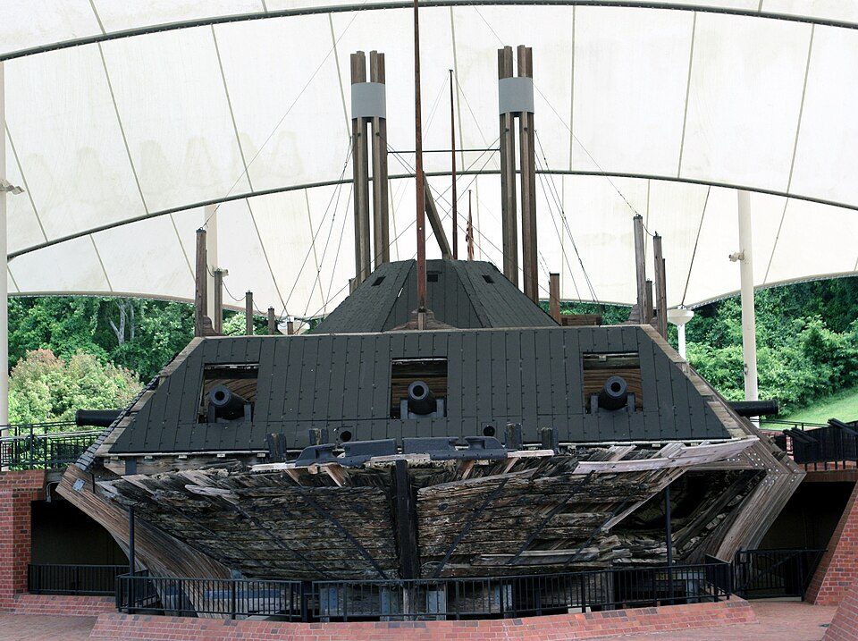 37 mi MuseumUSS Cairo
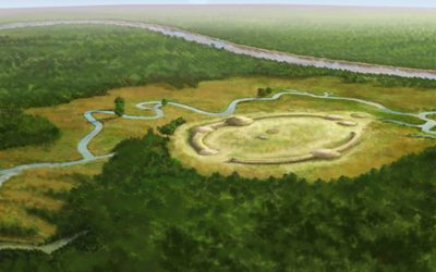 46 mi Ancient siteWatson Brake
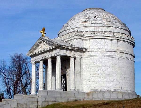 38 mi National Military ParkVicksburg National Military Park410K visitors a year
 38 mi MuseumChennault Aviation and Military Museum
 43 mi GardenBiedenharn Museum and Gardens
 37 mi MuseumThe Old Courthouse Museum41 mi Zoo & aquariumLouisiana Purchase Gardens and Zoo
 117 mi MuseumLouisiana State Cotton Museum
Photo credits
USS Cairo: Katyrw, CC BY-SA 3.0 · Watson Brake: Herb Roe, CC BY-SA 4.0 · Vicksburg National Military Park: Eoghanacht at English Wikipedia, Public domain · Chennault Aviation and Military Museum: Billy Hathorn, CC BY-SA 3.0 · Biedenharn Museum and Gardens: Billy Hathorn, CC BY-SA 3.0 · The Old Courthouse Museum: David.rorick, CC BY-SA 3.0 · Louisiana State Cotton Museum: Billy Hathorn, CC BY-SA 3.0


Good to know about Poverty Point
What town is Poverty Point National Monument near?
Pioneer, LA, about 7 miles north.
When is the best time to visit Poverty Point National Monument?
March, April, May, October and November, with highs of 67–84°.
What is the closest airport to Poverty Point National Monument?
Monroe Regional (MLU), about 38 miles away. The nearest big hub is Frederick W. Smith (MEM), about 185 miles.
Where should I stay near Poverty Point National Monument?
Delhi (14 mi, 4 places to stay), Vicksburg (37 mi, 57 places to stay) and Lake Providence (18 mi, 5 places to stay).
Pioneer has the answers
Nobody has posted a tip yet; ask or answer in Pioneer’s Town Square.
Sources: National Park Service · ski areas © OpenSkiMap / OpenStreetMap contributors · Wikidata · Wikipedia readership · NOAA climate normals · U.S. Census.