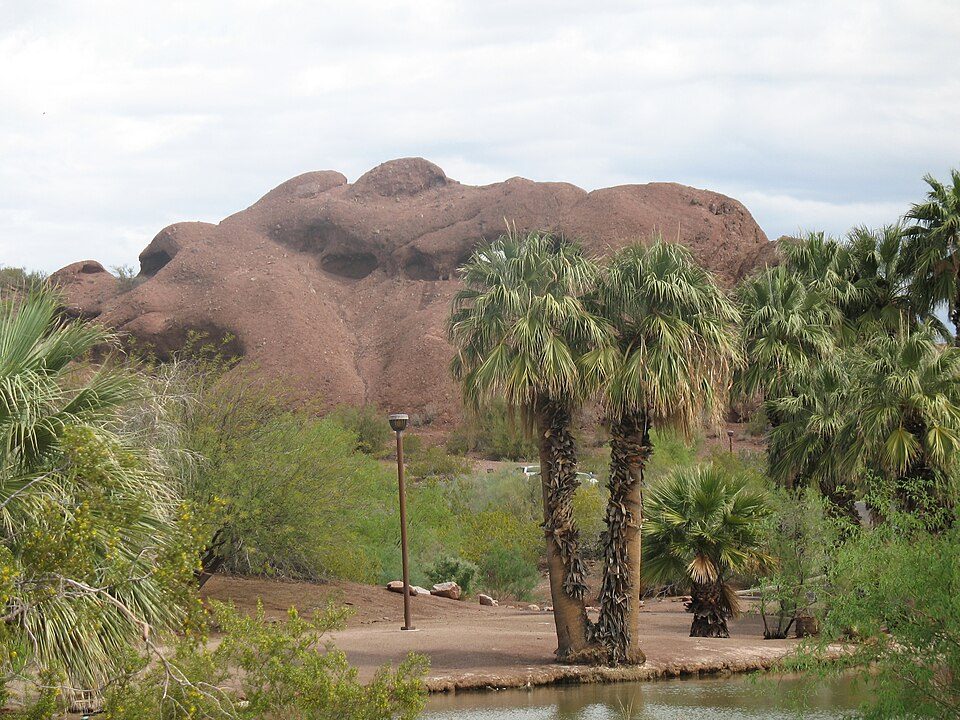
Papago Park
Papago Park is a municipal park of the cities of Phoenix and Tempe, Arizona, United States. Our list goes on with State Farm Stadium, 19 mi away. The mildest months are January, February, March, November and December, with highs of 66–78°F.

A garden inside Phoenix
Summers are hot
July and August highs run 104–105°, and about 175 days a year reach 90°. When to go ↓
You can stay in Phoenix
Papago Park is inside Phoenix, which has 316 places to stay, so you won’t need a base farther out. Where to stay ↓
Best months: Jan, Feb, Mar, Nov and Dec
January, February, March, November and December are the mild months, with highs of 66–78°. When to go ↓
An airport 4 miles away
Phoenix Sky Harbor (PHX) has airline service, about 4 miles from Papago Park.
Written from NOAA 1991–2020 normals, Overture places to stay, Census town figures, Wikidata and Wikipedia.
Weather, month by month
Here is how the weather at Papago Park changes month by month.
Papago Park
Papago Park is a municipal park of the cities of Phoenix and Tempe, Arizona, United States. It has been designated as a Phoenix Point of Pride.
It includes Hunt's Tomb, which is listed on the National Register of Historic Places.
- Type
- Garden
- Area
- 1,496 acres
- Wikipedia readers
- 11K a year
Lodging near Papago Park
The first towns with rooms are Phoenix (316) and Tempe (75).
- 1State Farm Stadium
- 2Mortgage Matchup Center
- 3Chase Field
- 4Mountain America Stadium
- 5Mullett Arena
- 6Desert Diamond Arena
- 7Camelback Mountain
- 8Tovrea Castle
Compare 8 towns
| Town | From Papago Park | Drive | Places to stay | People | Typical home | Safety |
|---|---|---|---|---|---|---|
| Phoenix | in town | — | 316 257 hotels · 22 motels · 10 inns & B&Bs · 9 lodges & cabins · 2 hostels · 5 campgrounds · 11 RV parks | 1,665,481 | $421K | D |
| Tempe | 4 mi south | 5 min | 75 66 hotels · 6 motels · 1 inn or B&B · 1 lodge or cabins · 1 campground | 190,571 | $455K | D |
| Mesa | 14 mi east | 20 min | 123 67 hotels · 17 motels · 4 inns & B&Bs · 3 lodges & cabins · 3 campgrounds · 29 RV parks | 513,656 | $408K | C− |
| Scottsdale | 17 mi north | 25 min | 108 100 hotels · 2 motels · 2 inns & B&Bs · 4 lodges & cabins | 243,006 | $790K | C |
| Chandler | 13 mi southeast | 20 min | 48 38 hotels · 4 motels · 1 lodge or cabins · 3 campgrounds · 2 RV parks | 278,748 | $508K | B− |
| Paradise Valley | 7 mi north | 10 min | 19 18 hotels · 1 inn or B&B | 12,251 | $2,000K | B+ |
| Glendale | 15 mi west | 25 min | 26 21 hotels · 2 motels · 1 inn or B&B · 1 lodge or cabins · 1 RV park | 260,572 | $388K | D |
| Gilbert | 15 mi southeast | 25 min | 21 17 hotels · 1 inn or B&B · 1 campground · 2 RV parks | 287,285 | $575K | B |
Getting there
Nearest airports with airline service
More near Papago Park
These well-known places are within 20 miles.
 Big draw119 mi Stadium & arenaState Farm Stadium
 27 mi Stadium & arenaMortgage Matchup Center
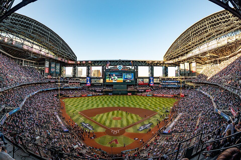 37 mi Stadium & arenaChase Field
 42 mi Stadium & arenaMountain America Stadium
 52 mi Stadium & arenaMullett Arena
 619 mi Stadium & arenaDesert Diamond Arena
 74 mi MountainCamelback Mountain
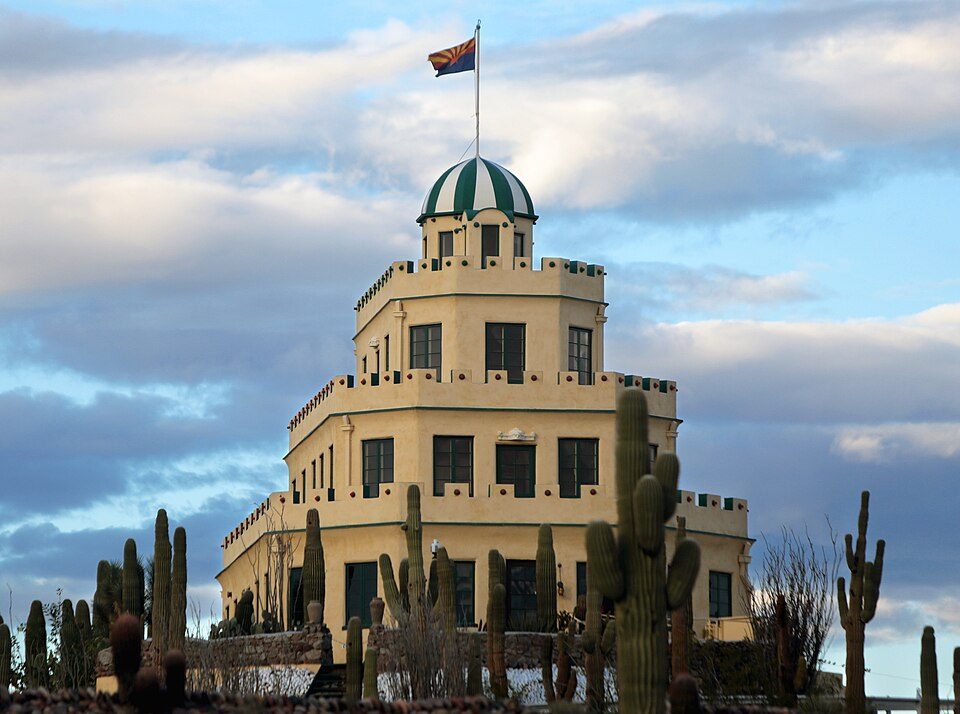 82 mi LandmarkTovrea Castle
Photo credits
State Farm Stadium: Taken by en:Flickr user MCSixth, CC BY-SA 2.0 · Mortgage Matchup Center: Troutfarm27, CC BY-SA 4.0 · Chase Field: U.S. Air Force photo by Staff Sgt. Tyler J. Bolken, Public domain · Mountain America Stadium: Clintus McGintus, CC BY-SA 2.0 · Mullett Arena: Kyvuh, CC0 · Desert Diamond Arena: Unknown, CC BY 2.0 · Camelback Mountain: Dru Bloomfield from Scottsdale, Arizona, USA, CC BY 2.0 · Tovrea Castle: Gage Skidmore, CC BY-SA 3.0


Papago Park, answered
Is Papago Park in Phoenix?
Yes. It’s inside Phoenix, AZ.
When is the best time to visit Papago Park?
January, February, March, November and December, with highs of 66–78°.
What is the closest airport to Papago Park?
Phoenix Sky Harbor (PHX), about 4 miles away.
Where should I stay near Papago Park?
Phoenix (in town, 316 places to stay), Tempe (4 mi, 75 places to stay) and Mesa (14 mi, 123 places to stay).
Locals’ advice in Phoenix
Start the conversation in Phoenix’s Town Square.
Sources: National Park Service · ski areas © OpenSkiMap / OpenStreetMap contributors · Wikidata · Wikipedia readership · NOAA climate normals · U.S. Census.