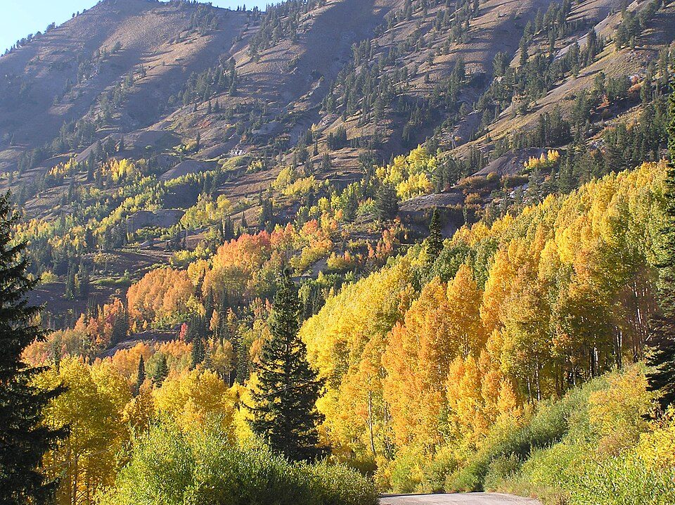
Little Cottonwood Canyon
Little Cottonwood Canyon lies within the Wasatch-Cache National Forest along the eastern side of the Salt Lake Valley, roughly 15 miles (24 km) from Salt Lake City, Utah. You will find it 5 mi west of Alta. For a second stop, Delta Center is 17 mi away.

A canyon & gorge, 5 mi west of Alta
Winters are cold
January nights drop to 16°, with about 458" of snow a year. When to go ↓
Alta is the nearest base
Alta is 5 miles east, with 22 places to stay. Where to stay ↓
Best months: Jun, Jul and Aug
June, July and August are the mild months, with highs of 64–72°. When to go ↓
Written from NOAA 1991–2020 normals, Overture places to stay, Census town figures, Wikidata and Wikipedia.
Weather through the year
Here are the months at Little Cottonwood Canyon, with their weather.
Little Cottonwood Canyon
Little Cottonwood Canyon lies within the Wasatch-Cache National Forest along the eastern side of the Salt Lake Valley, roughly 15 miles (24 km) from Salt Lake City, Utah. The canyon is part of Granite, a CDP and "Community Council" designated by Salt Lake County. The canyon is a glacial trough (U-shaped canyon), carved by an alpine glacier during the last ice age, 15,000 to 25,000 years ago. A number of rare and endemic plant species are found in the canyon's Albion Basin. Introduced Mountain goats inhabit the surrounding mountains.
The Salt Lake Temple of the Church of Jesus Christ of Latter-day Saints was built of blocks of quartz monzonite, granite, and granodiorite which Latter Day Saint pioneers quarried from the Little Cottonwood Stock near the mouth of the canyon.
- Type
- Canyon & gorge
- Elevation
- 5,138 ft
- Wikipedia readers
- 9.1K a year
Hotels and campgrounds near Little Cottonwood Canyon
Places to stay start in Park City (93) and Alta (22).
- 1Delta Center
- 2Rice–Eccles Stadium
- 3Lake Bonneville
- 4America First Field
- 5Park City Mountain
- 6Evermore Park
- 7Deer Valley
Park City
The closest town with somewhere to stay.
8,587 people · 49% vacation homes
13 mi northeast of Little Cottonwood Canyon
Compare 8 towns
| Town | From Little Cottonwood Canyon | Drive | Places to stay | People | Typical home | Safety |
|---|---|---|---|---|---|---|
| Park City 49% vacation homes | 13 mi northeast | 20 min | 93 66 hotels · 4 inns & B&Bs · 22 lodges & cabins · 1 hostel | 8,587 | $1,758K | C− |
| Alta 59% vacation homes | 5 mi east | 5 min | 22 12 hotels · 10 lodges & cabins | 227 | $2,000K | — |
| Salt Lake City | 18 mi northwest | 25 min | 109 85 hotels · 9 motels · 7 inns & B&Bs · 3 hostels · 3 campgrounds · 2 RV parks | 218,428 | $540K | D− |
| Brighton 73% vacation homes | 6 mi northeast | 10 min | 22 9 hotels · 1 inn or B&B · 9 lodges & cabins · 3 campgrounds | 429 | $888K | — |
| Snyderville 36% vacation homes | 13 mi northeast | 20 min | 37 34 hotels · 2 lodges & cabins · 1 RV park | 5,948 | $1,104K | — |
| Sandy | 8 mi west | 10 min | 16 12 hotels · 1 motel · 1 inn or B&B · 2 lodges & cabins | 92,386 | $614K | C |
| Midvale | 10 mi west | 15 min | 14 11 hotels · 3 motels | 36,099 | $437K | — |
| Draper | 10 mi southwest | 15 min | 13 10 hotels · 2 lodges & cabins · 1 RV park | 50,652 | $785K | B− |
Getting there
Nearest airports with airline service
Beyond Little Cottonwood Canyon
More places people know lie within 62 miles.
 Big draw117 mi Stadium & arenaDelta Center
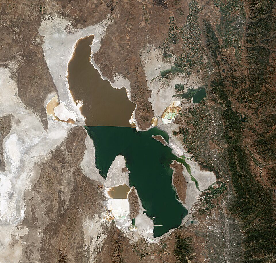 Big draw62 mi LakeGreat Salt Lake
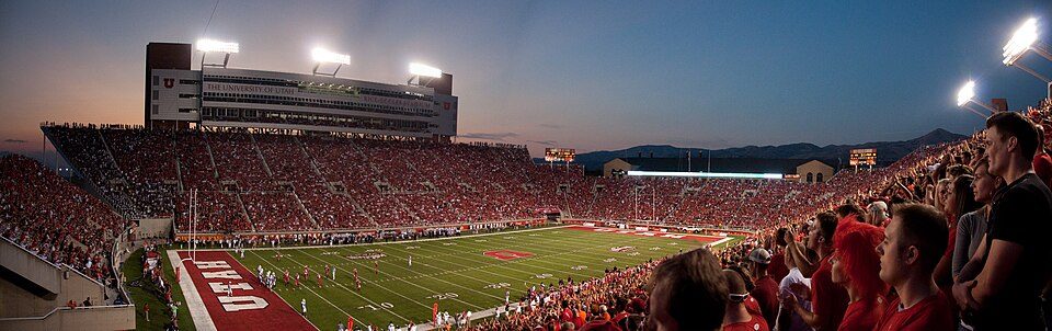 215 mi Stadium & arenaRice–Eccles Stadium
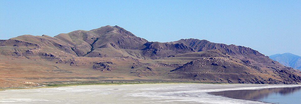 329 mi LakeLake Bonneville
 410 mi Stadium & arenaAmerica First Field
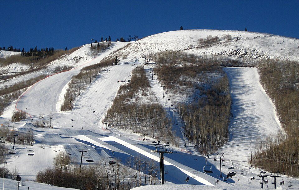 511 mi Ski areaPark City Mountain Resort393 runs · 3,100 ft vertical615 mi Theme parkEvermore Park
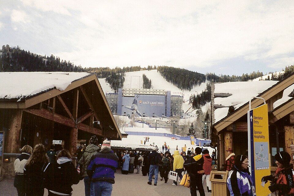 712 mi Ski areaDeer Valley Resort351 runs · 3,110 ft vertical
Photo credits
Delta Center: Lomrjyo, CC BY-SA 4.0 · Great Salt Lake: Copernicus Sentinel-2, ESA, CC BY-SA 3.0 igo · Rice–Eccles Stadium: Brenton Walker, CC BY 2.0 · Lake Bonneville: Wilson44691, Public domain · America First Field: Scott Catron, CC BY-SA 2.0 · Park City Mountain Resort: Rudi Riet from Washington, DC, United States, CC BY-SA 2.0 · Deer Valley Resort: Ken Lund from Las Vegas, Nevada, USA, CC BY-SA 2.0


Before visiting Little Cottonwood Canyon
What town is Little Cottonwood Canyon near?
Alta, UT, about 5 miles east.
When is the best time to visit Little Cottonwood Canyon?
June, July and August, with highs of 64–72°.
What is the closest airport to Little Cottonwood Canyon?
Salt Lake City (SLC), about 21 miles away.
Where should I stay near Little Cottonwood Canyon?
Park City (13 mi, 93 places to stay), Alta (5 mi, 22 places to stay) and Salt Lake City (18 mi, 109 places to stay).
Ask a local in Alta
Nobody has posted a tip yet; ask or answer in Alta’s Town Square.
Sources: National Park Service · ski areas © OpenSkiMap / OpenStreetMap contributors · Wikidata · Wikipedia readership · NOAA climate normals · U.S. Census.