
Lake Pleasant Regional Park
Lake Pleasant Regional Park is a large outdoors recreation area straddling the Maricopa and Yavapai county border northwest of Phoenix, Arizona. Peoria is where it stands. Its mildest months, January, February, March, April, November and December, bring highs of 64–82°F.

A park & preserve inside Peoria
Summers are hot
July and August highs run 102–103°, and about 175 days a year reach 90°. When to go ↓
You can stay in Peoria
Lake Pleasant Regional Park is inside Peoria, which has 26 places to stay, so you won’t need a base farther out. Where to stay ↓
A day trip from Mesa
Mesa is about 47 miles southeast (straight-line). Where to stay ↓
Best months: Jan, Feb, Mar, Apr, Nov and Dec
January, February, March, April, November and December are the mild months, with highs of 64–82°. When to go ↓
Written from NOAA 1991–2020 normals, Overture places to stay, Census town figures and Wikipedia.
Warm months and cold ones
The weather near Lake Pleasant Regional Park shifts through the year, as below.
Lake Pleasant Regional Park
Lake Pleasant Regional Park is a large outdoors recreation area straddling the Maricopa and Yavapai county border northwest of Phoenix, Arizona. The park is located within the municipal boundaries of Peoria, Arizona, and serves as a major recreation hub for the northwest Phoenix metropolitan area. It is operated by the Maricopa County Parks and Recreation Department.
- Type
- Park & preserve
- Wikipedia readers
- 14K a year
Where to base yourself for Lake Pleasant Regional Park
Hotels, motels or campgrounds are closest in Peoria (26) and Phoenix (316).
Compare 8 towns
| Town | From Lake Pleasant Regional Park | Drive | Places to stay | People | Typical home | Safety |
|---|---|---|---|---|---|---|
| Peoria | in town | — | 26 16 hotels · 1 lodge or cabins · 3 campgrounds · 6 RV parks | 200,881 | $464K | C+ |
| Phoenix | 25 mi southeast | 35 min | 316 257 hotels · 22 motels · 10 inns & B&Bs · 9 lodges & cabins · 2 hostels · 5 campgrounds · 11 RV parks | 1,665,481 | $421K | D |
| Scottsdale | 28 mi southeast | 40 min | 108 100 hotels · 2 motels · 2 inns & B&Bs · 4 lodges & cabins | 243,006 | $790K | C |
| New River | 11 mi east | 15 min | 6 1 hotel · 1 inn or B&B · 2 lodges & cabins · 2 RV parks | 18,240 | $641K | — |
| Surprise | 19 mi southwest | 30 min | 13 9 hotels · 1 inn or B&B · 1 campground · 2 RV parks | 175,304 | $435K | B |
| Glendale | 26 mi south | 40 min | 26 21 hotels · 2 motels · 1 inn or B&B · 1 lodge or cabins · 1 RV park | 260,572 | $388K | D |
| Black Canyon City | 15 mi northeast | 20 min | 5 1 motel · 4 RV parks | 2,181 | $289K | — |
| Cave Creek | 17 mi east | 25 min | 7 4 hotels · 1 inn or B&B · 2 campgrounds | 5,160 | $906K | — |
Getting there
Nearest airports with airline service
More to see nearby
Each of these is within 55 miles.
 Big draw126 mi Stadium & arenaState Farm Stadium
 33 mi Stadium & arenaMortgage Matchup Center
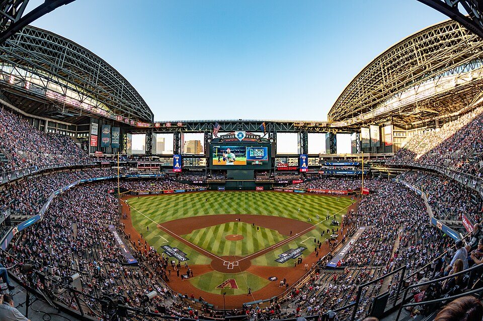 34 mi Stadium & arenaChase Field
 225 mi Stadium & arenaDesert Diamond Arena
 38 mi Stadium & arenaMountain America Stadium
 55 mi National MonumentMontezuma Castle National Monument320K visitors a year
 38 mi Stadium & arenaMullett Arena
 32 mi MountainCamelback Mountain
Photo credits
State Farm Stadium: Taken by en:Flickr user MCSixth, CC BY-SA 2.0 · Mortgage Matchup Center: Troutfarm27, CC BY-SA 4.0 · Chase Field: U.S. Air Force photo by Staff Sgt. Tyler J. Bolken, Public domain · Desert Diamond Arena: Unknown, CC BY 2.0 · Mountain America Stadium: Clintus McGintus, CC BY-SA 2.0 · Montezuma Castle National Monument: Bernard Gagnon, CC BY-SA 3.0 · Mullett Arena: Kyvuh, CC0 · Camelback Mountain: Dru Bloomfield from Scottsdale, Arizona, USA, CC BY 2.0


Asked about Lake Pleasant Regional Park
Is Lake Pleasant Regional Park in Peoria?
Yes. It’s inside Peoria, AZ.
When is the best time to visit Lake Pleasant Regional Park?
January, February, March, April, November and December, with highs of 64–82°.
How far is Lake Pleasant Regional Park from Mesa?
About 47 miles southeast of Mesa, as the crow flies.
What is the closest airport to Lake Pleasant Regional Park?
Phoenix Sky Harbor (PHX), about 36 miles away.
Where should I stay near Lake Pleasant Regional Park?
Peoria (in town, 26 places to stay), Phoenix (25 mi, 316 places to stay) and Scottsdale (28 mi, 108 places to stay).
Inside knowledge from Peoria
Nobody has posted a tip yet; ask or answer in Peoria’s Town Square.
Sources: National Park Service · ski areas © OpenSkiMap / OpenStreetMap contributors · Wikidata · Wikipedia readership · NOAA climate normals · U.S. Census.