
Katy Trail State Park
The Katy Trail State Park is a state park in the U.S. state of Missouri that contains the Katy Trail, the country's longest continuous recreational rail trail. Its address puts it 7 mi southeast of Grafton. It dates from 1982.

A state park, 7 mi southeast of Grafton
Grafton is the nearest base
Grafton is 7 miles northwest, with 13 places to stay. Where to stay ↓
Best months: Apr, May, Sep and Oct
April, May, September and October are the mild months, with highs of 66–79°. When to go ↓
An airport 11 miles away
St. Louis Lambert (STL) has airline service, about 11 miles from Katy Trail State Park.
Established in 1982
Katy Trail State Park dates from 1982. About ↓
Written from NOAA 1991–2020 normals, Overture places to stay, Census town figures, Wikidata and Wikipedia.
Month by month
The months below show the weather around Katy Trail.
Katy Trail State Park
The Katy Trail State Park is a state park in the U.S. state of Missouri that contains the Katy Trail, the country's longest continuous recreational rail trail. It runs 240 miles (390 km), largely along the northern bank of the Missouri River, in the former right-of-way of the Missouri–Kansas–Texas Railroad. Open year-round from sunrise to sunset, it serves hikers, joggers, and cyclists. Its hard, flat surface is of "limestone pug" (crushed limestone).
The nickname "Katy" comes from the phonetic pronunciation of "KT", a short form of the railroad's abbreviated name, MKT. Sections of the Katy are also part of the Lewis and Clark National Historic Trail and the American Discovery Trail.
- Type
- State park
- Established
- 1982
- Wikipedia readers
- 16K a year
Overnight near Katy Trail State Park
To stay close, try St. Louis (99) and Bridgeton (21).
- 1Cahokia
- 2The Dome at America's Center
- 3Piasa
- 4Busch Stadium
- 5Gateway Arch
- 6Monks Mound
- 7Enterprise Center
St. Louis
The closest town with somewhere to stay.
278,144 people
19 mi south of Katy Trail
Compare 8 towns
| Town | From Katy Trail | Drive | Places to stay | People | Typical home | Safety |
|---|---|---|---|---|---|---|
| St. Louis | 19 mi south | 30 min | 99 78 hotels · 5 motels · 12 inns & B&Bs · 3 lodges & cabins · 1 campground | 278,144 | $198K | D− |
| Bridgeton | 10 mi southwest | 15 min | 21 18 hotels · 2 motels · 1 inn or B&B | 11,277 | $238K | D− |
| St. Charles | 12 mi southwest | 20 min | 28 19 hotels · 1 motel · 6 inns & B&Bs · 1 lodge or cabins · 1 RV park | 72,561 | $299K | B |
| Hazelwood | 8 mi southwest | 10 min | 15 14 hotels · 1 motel | 24,849 | $167K | D |
| Grafton | 7 mi northwest | 10 min | 13 7 hotels · 5 inns & B&Bs · 1 lodge or cabins | 773 | $276K | — |
| Maryland Heights | 15 mi southwest | 25 min | 34 30 hotels · 2 motels · 1 inn or B&B · 1 lodge or cabins | 27,559 | $227K | C+ |
| Quarry Township | 10 mi northwest | 15 min | 17 7 hotels · 6 inns & B&Bs · 3 lodges & cabins · 1 campground | 1,158 | $262K | — |
| Alton | 10 mi east | 15 min | 14 10 hotels · 3 inns & B&Bs · 1 lodge or cabins | 25,013 | $104K | D |
Getting there
Nearest airports with airline service
Around Katy Trail
More places people know lie within 33 miles.
 Big draw122 mi State parkCahokia
 Big draw220 mi Stadium & arenaThe Dome at America's Center
 37 mi Ancient sitePiasa
 421 mi Stadium & arenaBusch Stadium
 521 mi National ParkGateway Arch National Park2.2M visitors a year
 622 mi LandmarkMonks Mound
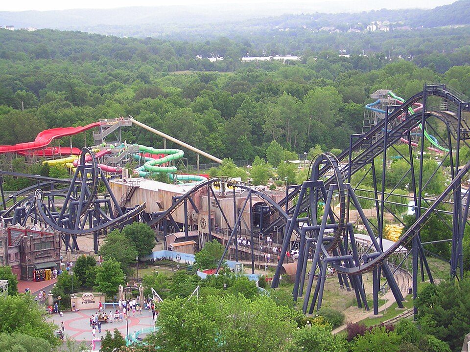 33 mi Theme parkMid America Adventure
 720 mi Stadium & arenaEnterprise Center
Photo credits
Cahokia: Thank You (24 Millions ) views, CC BY 2.0 · The Dome at America's Center: Paul Sableman, CC BY 2.0 · Piasa: Burfalcy, CC BY-SA 3.0 · Busch Stadium: Lee Ann Ratledge, CC BY 4.0 · Gateway Arch National Park: Daniel Schwen, CC BY-SA 4.0 · Monks Mound: Skubasteve834, CC BY-SA 3.0 · Mid America Adventure: Chris Hagerman from New Port Richey, FL, US, CC BY 2.0 · Enterprise Center: Haaron755, CC BY-SA 3.0


Asked about Katy Trail
What town is Katy Trail State Park near?
Grafton, IL, about 7 miles northwest.
When is the best time to visit Katy Trail State Park?
April, May, September and October, with highs of 66–79°.
What is the closest airport to Katy Trail State Park?
St. Louis Lambert (STL), about 11 miles away.
Where should I stay near Katy Trail State Park?
St. Louis (19 mi, 99 places to stay), Bridgeton (10 mi, 21 places to stay) and St. Charles (12 mi, 28 places to stay).
Local know-how from Grafton
Questions and tips go in Grafton’s Town Square.
Sources: National Park Service · ski areas © OpenSkiMap / OpenStreetMap contributors · Wikidata · Wikipedia readership · NOAA climate normals · U.S. Census.