101 years in pictures
Census counts: 8,805 in 1970, a low of 5,676 in 1980, 28,284 in 2020. The archive holds 6 old photos and papers going back to 2004 and 6 maps from 1933 on.
- 1925Maryland Heights is settled
Each edition grades its towns against each other only.
Maryland Heights grades A overall, 22nd among Missouri's 247 graded towns, with clear strengths and some subjects that lag. The median household earns $86K and its public schools beat 85% of Missouri towns on state tests and graduation. It also does better than most on health: CDC estimates put its residents' health ahead of 85% of the country. Its lowest everyday mark is in safety: it reports more crime per resident than 60% of U.S. towns, including 63 violent crimes reported to the FBI in 2025. A typical home there costs about $262K, 3.3 years of the St. Louis metro’s $80K median household income. 51% of adults 25 and older hold a bachelor’s degree or more in Maryland Heights, where Missouri’s towns sit at 22% and U.S. towns at 29%. Maryland Heights is home to Chamberlain University-Missouri. Only 21 of Missouri’s 419 towns score lower on history.
Where Maryland Heights beats most towns.
| School | Grades | Students |
|---|---|---|
| McKelvey Intermediate | 2–5 | 432 |
| Parkwood Elem. | PK–5 | 409 |
| Traditional SCH. | K–8 | 392 |
| Widest gap | Maryland Heights | MO |
|---|---|---|
| Fewer adults with COPD | 5.2% | 8% |
Where Maryland Heights’s working residents go each day. Line width shows the share.
Census LEHD 2023
Each subject compared with towns across the country (schools within Missouri), ordered by how far Maryland Heights is from typical.
How TownRatings grades towns →
Census counts: 8,805 in 1970, a low of 5,676 in 1980, 28,284 in 2020. The archive holds 6 old photos and papers going back to 2004 and 6 maps from 1933 on.
Museums, parks, gardens and other places to visit around Maryland Heights. Close and well known come first.
Big draw22 mi State parkCahokia
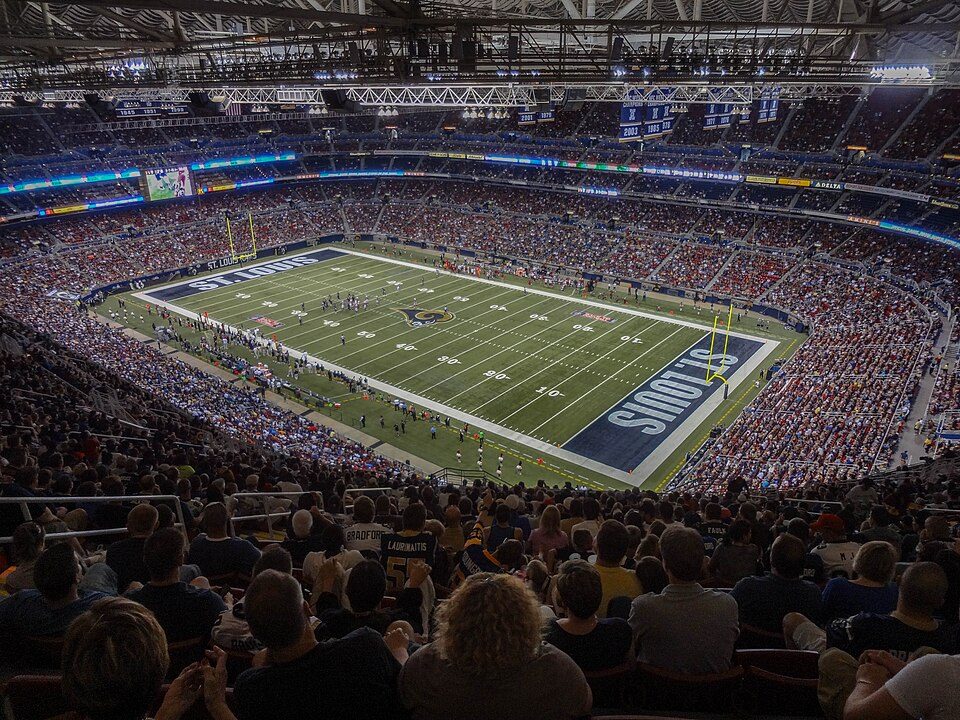
Big draw16 mi Stadium & arenaThe Dome at America's Center
16 mi Stadium & arenaBusch Stadium
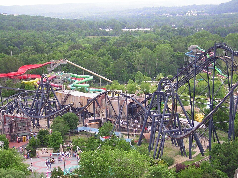
18 mi Theme parkMid America Adventure
17 mi National ParkGateway Arch National Park2.2M visitors a year
22 mi LandmarkMonks MoundCahokia: Thank You (24 Millions ) views, CC BY 2.0 · The Dome at America's Center: Paul Sableman, CC BY 2.0 · Busch Stadium: Lee Ann Ratledge, CC BY 4.0 · Mid America Adventure: Chris Hagerman from New Port Richey, FL, US, CC BY 2.0 · Gateway Arch National Park: Daniel Schwen, CC BY-SA 4.0 · Monks Mound: Skubasteve834, CC BY-SA 3.0
Who provides power, water and the rest in Maryland Heights, and how to reach them.
EPA SDWIS (Oct 9, 2026) · HIFLD + EIA-861 2025 · Census 2020 ZCTAs · NCES 2024–25 · registration: vote.gov, updated Nov 18, 2024.
Ordered by what stands out in Maryland Heights.
Maryland Heights draws workers from St. Louis and beyond, fares better on crime within Missouri than nationally and has less COPD than most of Missouri.
56,155 jobs are based in Maryland Heights, 4 for every working resident, so most of the people who work here commute in. 23.2% of workers work from home, against 13% across Missouri.
Among workers in Maryland Heights, 23% work from home. Commuting out is the norm here: just over a tenth of working residents work locally. Maryland Heights’ typical journey to work is 21 minutes. It had 56,155 jobs in 2023, up 5,026 from 2013.
| Maryland Heights | Missouri towns | U.S. towns | |
|---|---|---|---|
| Work from home | 23% | 9% | 11% |
| Below the poverty line | 4.7% | 14% | 9.6% |
| Median household income | $86,000 | $62,000 | $80,000 |
| Average trip to work | 21 minutes | 22 minutes | 25 minutes |
Census LEHD 2023 · ACS
Its public schools are run by Pattonville R-III. Below: Three of its 8 schools, each with why it was picked. 5 public schools serve Maryland Heights, with 2,301 students in all.
| School | Level | Students | Letter |
|---|---|---|---|
| Pattonville Heights MiddleLargest public middle schoolGrades 6–8 | Grades 6–8 | 680 | C |
| Pattonville SR. HighLargest public high schoolGrades 9–12 | Grades 9–12 | 1,945 | B+ |
| McKelvey IntermediateTop results in townGrades 2–5 | Grades 2–5 | 432 | A+ |
NCES · EDFacts · graded within MO on state tests and graduation
The concentration of trails for Maryland Heights comes to 0.6 miles per square mile. Count the trails in 9 parks and preserves and they come to 15 miles. Creve Coeur Lake Memorial Park, at 2,008 acres with 9.6 miles of trail, is the biggest park or preserve.
| Maryland Heights | Missouri towns | U.S. towns | |
|---|---|---|---|
| Miles of trail per square mile | 0.6 miles per square mile | 0.3 | 0.4 |
| Conserved land | 2.5% | 2.1% | 4.3% |
| Biggest places to walk | Trails | Acres |
|---|---|---|
| 1. Creve Coeur Lake Memorial Park | 9.6 mi | 2,008 |
| 2. Parkwood Park | 0.4 mi | 3 |
| 3. Vago Park | 0.3 mi | 19 |
Trails & parks © OpenStreetMap contributors · Conserved land: USGS PAD-US
Its widest gap with Missouri is COPD: 5.2% of its 22,752 adults have COPD, against 8% statewide.
Among adults here, 11% report frequent physical distress and 33% sleep under 7 hours. 77% of adults had a checkup this year in Maryland Heights.
| Maryland Heights | Missouri towns | U.S. towns | |
|---|---|---|---|
| Obesity (CDC PLACES) | 28% | 38% | 35% |
| Frequent physical distress (CDC PLACES) | 11% | 15% | 14% |
| Sleep under 7 hours (CDC PLACES) | 33% | 38% | 36% |
| Diabetes (CDC PLACES) | 9% | 12% | 12% |
| What stands out | Maryland Heights | MO |
|---|---|---|
| Fewer adults with COPD | 5.2% | 8% |
| Fewer adults with heart disease | 4.7% | 6.8% |
CDC PLACES 2025 · modeled estimates for adults · CMS · HRSA
The midsummer high in Maryland Heights is 89°F.
NOAA U.S. Climate Normals, 1991–2020
At 22.9 crimes per 1,000 residents a year, it reports less crime than 52% of Missouri’s graded towns. Reported crimes fell from 574 to 366 over the last three FBI years, a drop beyond ordinary year-to-year swings.
For Maryland Heights, the violent offense rate is 2.3 per 1,000 residents. Maryland Heights’ rate of thefts and burglaries stands at 11 per 1,000 residents.
| Maryland Heights | Missouri towns | U.S. towns | |
|---|---|---|---|
| Violent crimes per 1,000 (2025) | 2.3 per 1,000 residents | 2.2 | 1.6 |
| Property crimes per 1,000 (2025) | 11 per 1,000 residents | 12.5 | 9.9 |
FBI crime data, 2025 · crimes reported to police
Federal aid has come to Maryland Heights households in 10 declared disasters; the latest was in 2025. Expected damage from storms and floods is higher here than in 56% of U.S. communities. FEMA puts 37% of the town’s expected hazard losses down to heat waves, and 32% to inland flooding. Also worth knowing: 43 flood insurance claims have been paid here since 1993.
FEMA disaster declarations and aid · FEMA flood insurance claims · FEMA National Risk Index · OpenFEMA
The median property tax bill is $2,942, against $1,948 across Missouri, another input to its cost-of-living grade.
The share of renter households in Maryland Heights who spend 30% or more of their income on rent: 27%. The typical Maryland Heights home is worth about $262,000, up 4.5% in a year, close to the Missouri typical home. In Maryland Heights, the rent at the middle of the market is $1,312 a month.
| Maryland Heights | Missouri towns | U.S. towns | |
|---|---|---|---|
| Renters paying 30%+ of income on rent | 27% | 43% | 48% |
| Households that own their home | 57% | 64% | 73% |
| Median rent | $1,312 a month | $970 a month | $1,185 a month |
Census ACS, 2020–24 · Zillow Home Value Index · Redfin Data Center
23 within 15 miles of the center of Maryland Heights
About 5 of every 100 Maryland Heights residents are enrolled in college, about the same as Missouri.
City in Missouri, United States
Maryland Heights is a second-ring west-northwest suburb of St. Louis, located in St. Louis County, Missouri, United States. As of the 2020 census, Maryland Heights had a population of 28,284. The city was incorporated in 1985. Edwin L. Dirck was appointed the city's first mayor by then County Executive Gene McNary. Mark M. Levin served as City Administrator from August 1985 to 2015.
From Wikipedia, licensed CC BY-SA 4.0 · facts via Wikidata (CC0)
3 towns share a border with Maryland Heights.
| Town | MO rank | Overall | Cost | Safety | Schools | Health |
|---|---|---|---|---|---|---|
| Maryland Heights | #22 | A | B− | C+ | A | A− |
| Bridgeton | #211 | D | C+ | D− | C− | B− |
| Champ | — | — | — | — | — | — |
| Chesterfield | #27 | A | D | B | A | A+ |
Champ isn’t graded (fewer than 1,000 residents, or not enough data). Compare Maryland Heights with a neighbor →
Short answers, built from the data on this page.
By most measures, yes. Maryland Heights grades A overall, better than 88% of U.S. towns and #22 of 247 in Missouri. It grades A− for health, C+ for safety and A for schools.
2 notable people were born here, including Daniel Munie and Martin Nance.