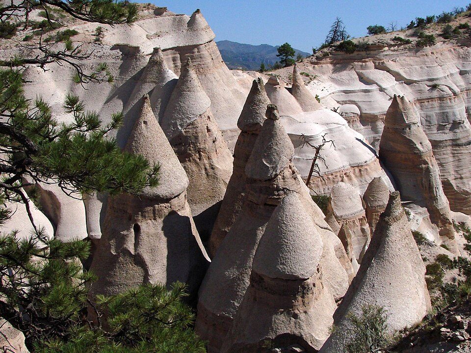
Kasha-Katuwe Tent Rocks National Monument
Kasha-Katuwe Tent Rocks National Monument is a U.S.

A park & preserve, 5 mi northwest of Cochiti Lake
Plan where you’ll sleep
The nearest town with many places to stay is Jemez Springs, 17 miles northwest. Where to stay ↓
Summers are hot
June and July highs run 90–92°, and about 70 days a year reach 90°. When to go ↓
Winters are cold
January nights drop to 20°. When to go ↓
Best months: May and Sep
May and September are the mild months, with highs of 80–83°. When to go ↓
Established in 2001
Kasha-Katuwe Tent Rocks National Monument dates from 2001 and is run by United States Bureau of Land Management. About ↓
Written from NOAA 1991–2020 normals, Overture places to stay, Census town figures, Wikidata and Wikipedia.
Weather, month by month
Typical highs and lows in Cochiti Lake. Green months are the mild ones.
Kasha-Katuwe Tent Rocks National Monument
Kasha-Katuwe Tent Rocks National Monument is a U.S. National Monument located approximately 40 miles (64 km) southwest of Santa Fe, New Mexico, near Cochiti Pueblo. Managed by the Bureau of Land Management (BLM) and the Cochiti Pueblo tribe, it was established as a national monument by President Bill Clinton in January 2001. Kasha-Katuwe (Káshyạ Khatowetsịsh) means "white cliffs" in the Keresan Pueblo language . The monument is a unit of the BLM's National Conservation Lands.
Kasha-Katuwe Tent Rocks National Monument, a popular recreation area between Santa Fe and Albuquerque, was closed in March 2020 due to the COVID-19 pandemic and remained closed until November 2024. To prevent crowding the BLM introduced a reservation system, which will allow about 75,000 visitors annually, a reduction from a peak of 130,000.
- Type
- Park & preserve
- Established
- 2001
- Run by
- United States Bureau of Land Management
- Wikipedia readers
- 9.5K a year
Where to stay near Kasha-Katuwe Tent Rocks National Monument
The closest towns with hotels, motels or campgrounds are Santa Fe (100) and Cochiti Lake (3), and Albuquerque has the most rooms in the area (244).
Santa Fe
The closest town with somewhere to stay.
89,837 people
25 mi east of Kasha-Katuwe Tent Rocks
Albuquerque
The most places to stay in the area, and a base for a longer trip.
556,588 people
41 mi south of Kasha-Katuwe Tent Rocks
Compare 9 towns
| Town | From Kasha-Katuwe Tent Rocks | Drive | Places to stay | People | Typical home | Safety |
|---|---|---|---|---|---|---|
| Santa Fe | 25 mi east | 35 min | 100 65 hotels · 8 motels · 19 inns & B&Bs · 4 lodges & cabins · 1 hostel · 1 campground · 2 RV parks | 89,837 | $445K | D− |
| Cochiti Lake | 5 mi southeast | 5 min | 3 3 campgrounds | 476 | $255K | — |
| Jemez Springs 21% vacation homes | 17 mi northwest | 25 min | 10 4 hotels · 3 inns & B&Bs · 3 lodges & cabins | 205 | $249K | — |
| Los Alamos | 17 mi northeast | 25 min | 10 6 hotels · 3 inns & B&Bs · 1 lodge or cabins | 13,317 | $502K | — |
| La Cueva 70% vacation homes | 19 mi northwest | 30 min | 4 1 inn or B&B · 1 lodge or cabins · 2 campgrounds | 162 | $245K | — |
| Bernalillo | 26 mi south | 40 min | 8 4 hotels · 2 motels · 2 campgrounds | 9,159 | $256K | C− |
| La Cienega | 18 mi east | 30 min | 3 2 hotels · 1 RV park | 3,543 | $517K | — |
| White Rock | 15 mi northeast | 25 min | 1 1 hotel | 5,716 | $501K | — |
| Albuquerque | 41 mi south | 1 hr | 244 190 hotels · 27 motels · 11 inns & B&Bs · 5 lodges & cabins · 6 campgrounds · 5 RV parks | 556,588 | $292K | D− |
Getting there
Nearest airports with airline service
Also near Kasha-Katuwe Tent Rocks
Other well-known places within 44 miles. Numbered ones are on the map above.
 19 mi National MonumentBandelier National Monument248K visitors a year
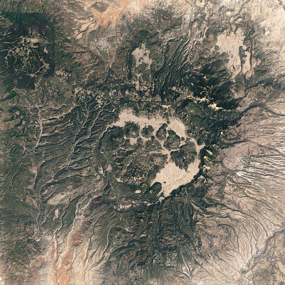 216 mi National PreserveValles Caldera National Preserve85K visitors a year
 44 mi Stadium & arenaUniversity Stadium
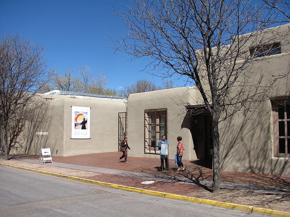 327 mi MuseumGeorgia O'Keeffe Museum
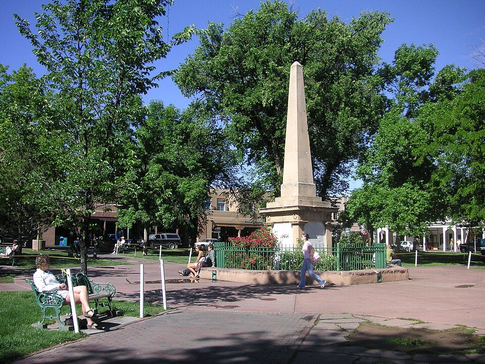 427 mi Park & preserveSanta Fe Plaza
 42 mi National Historical ParkPecos National Historical Park37K visitors a year
 529 mi Stadium & arenaRio Rancho Events Center
 42 mi National MonumentPetroglyph National Monument311K visitors a year
Photo credits
Bandelier National Monument: Andrew Dunn (talk · contribs), CC BY-SA 2.0 · Valles Caldera National Preserve: Jesse Allen and Robert Simmon, Public domain · University Stadium: Kenneth C. Zirkel, CC BY 4.0 · Georgia O'Keeffe Museum: John Phelan, CC BY 3.0 · Santa Fe Plaza: See above, CC BY 2.0 · Pecos National Historical Park: Mosamiazaz at English Wikipedia, Public domain · Rio Rancho Events Center: Maryabm2009, CC BY-SA 4.0 · Petroglyph National Monument: Unknown, Public domain


Visiting Kasha-Katuwe Tent Rocks
What town is Kasha-Katuwe Tent Rocks National Monument near?
Cochiti Lake, NM, about 5 miles southeast.
When is the best time to visit Kasha-Katuwe Tent Rocks National Monument?
May and September, with highs of 80–83°.
What is the closest airport to Kasha-Katuwe Tent Rocks National Monument?
Santa Fe Municipal (SAF), about 19 miles away. The nearest big hub is Albuquerque International Sunport (ABQ), about 45 miles.
Where should I stay near Kasha-Katuwe Tent Rocks National Monument?
Santa Fe (25 mi, 100 places to stay), Albuquerque (41 mi, 244 places to stay) and Cochiti Lake (5 mi, 3 places to stay).
Tips from people in Cochiti Lake
No tips yet. Ask, or answer, in Cochiti Lake’s Town Square.
Sources: National Park Service · ski areas © OpenSkiMap / OpenStreetMap contributors · Wikidata · Wikipedia readership · NOAA climate normals · U.S. Census.