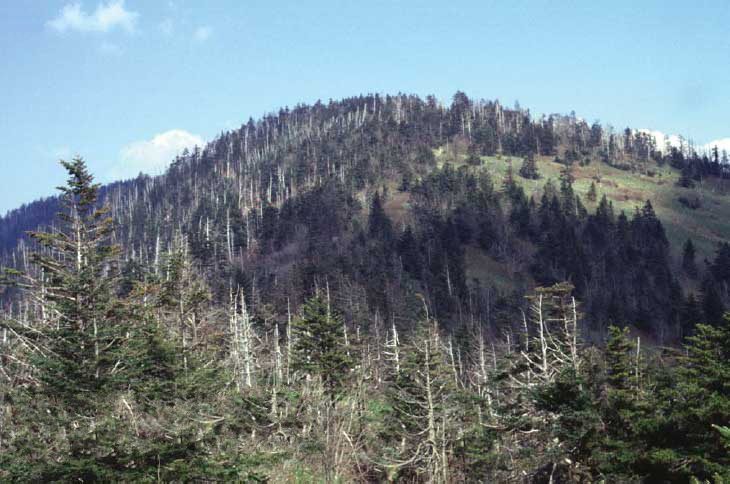
Kuwohi
Kuwohi (Cherokee: ᎫᏬᎯ), also known as Clingmans Dome (its former official name), is a mountain in the Great Smoky Mountains of Tennessee and North Carolina in the Southeastern United States.

A mountain, 10 mi north of Bryson City
One of the most looked-up attractions in the U.S.
About 104K people a year read its Wikipedia article, more than for 97% of the 7,799 attractions we track.
Bryson City is the nearest base
Bryson City is 10 miles south, with 61 places to stay. Where to stay ↓
Best months: Apr, May, Jun, Sep and Oct
April, May, June, September and October are the mild months, with highs of 71–84°. When to go ↓
Written from NOAA 1991–2020 normals, Overture places to stay, Census town figures, Wikidata and Wikipedia.
Weather, month by month
Typical highs and lows in Bryson City. Green months are the mild ones.
Kuwohi
Kuwohi (Cherokee: ᎫᏬᎯ), also known as Clingmans Dome (its former official name), is a mountain in the Great Smoky Mountains of Tennessee and North Carolina in the Southeastern United States.
At an elevation of 6,643 feet (2,025 m), it is the highest mountain in the Great Smoky Mountains National Park, the highest point in the state of Tennessee, and the highest point along the 2,192-mile (3,528 km) Appalachian Trail. It is also the third highest point in eastern mainland North America, after Mount Mitchell (6,684 feet or 2,037 meters) and Mount Craig (6,647 feet or 2,026 meters).
- Type
- Mountain
- Elevation
- 6,644 ft
- Wikipedia readers
- 104K a year
Where to stay near Kuwohi
The closest towns with hotels, motels or campgrounds are Gatlinburg (352) and Pigeon Forge (358).
- 1Dollywood
- 2Great Smoky Mountains
- 3Mount Le Conte
- 4Ghost Town in the Sky
- 5Alcatraz East
- 6Nantahala National Forest
Gatlinburg
The closest town with somewhere to stay.
3,715 people · 34% vacation homes
11 mi north of Kuwohi
Compare 8 towns
| Town | From Kuwohi | Drive | Places to stay | People | Typical home | Safety |
|---|---|---|---|---|---|---|
| Gatlinburg 34% vacation homes | 11 mi north | 15 min | 352 105 hotels · 11 motels · 14 inns & B&Bs · 216 lodges & cabins · 1 hostel · 4 campgrounds · 1 RV park | 3,715 | $332K | D |
| Pigeon Forge | 17 mi north | 25 min | 358 140 hotels · 8 motels · 10 inns & B&Bs · 171 lodges & cabins · 20 campgrounds · 9 RV parks | 6,598 | $292K | D− |
| Bryson City | 10 mi south | 15 min | 61 12 hotels · 3 motels · 5 inns & B&Bs · 29 lodges & cabins · 11 campgrounds · 1 RV park | 1,525 | $243K | C− |
| Cherokee | 12 mi southeast | 20 min | 59 17 hotels · 13 motels · 2 inns & B&Bs · 12 lodges & cabins · 15 campgrounds | 2,059 | $190K | — |
| Pittman Center 20% vacation homes | 15 mi northeast | 20 min | 67 11 hotels · 3 inns & B&Bs · 52 lodges & cabins · 1 campground | 462 | $432K | — |
| Townsend 29% vacation homes | 16 mi northwest | 25 min | 58 13 hotels · 2 motels · 6 inns & B&Bs · 22 lodges & cabins · 14 campgrounds · 1 RV park | 640 | $371K | — |
| Whittier | 12 mi southeast | 20 min | 24 3 hotels · 3 motels · 8 lodges & cabins · 6 campgrounds · 4 RV parks | — | — | — |
| Sevierville | 23 mi north | 35 min | 95 49 hotels · 4 motels · 4 inns & B&Bs · 28 lodges & cabins · 4 campgrounds · 6 RV parks | 19,010 | $290K | D |
Getting there
Nearest airports with airline service
Also near Kuwohi
Other well-known places within 51 miles. Numbered ones are on the map above.
 Big draw116 mi Theme parkDollywood3.1M visitors a year
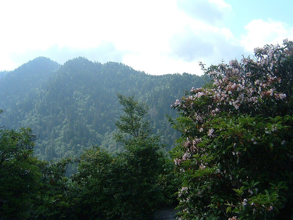 Big draw25 mi National ParkGreat Smoky Mountains National Park11.5M visitors a year
 Big draw36 mi Stadium & arenaNeyland Stadium
 37 mi MountainMount Le Conte422 mi Theme parkGhost Town in the Sky
 517 mi MuseumAlcatraz East
 623 mi National forestNantahala National Forest
 51 mi MountainBrasstown Bald
Photo credits
Dollywood: Brian Stansberry (photographer), CC BY 2.5 · Great Smoky Mountains National Park: Scott Basford, CC BY-SA 3.0 · Neyland Stadium: Neomrbungle, CC BY-SA 4.0 · Mount Le Conte: No machine-readable author provided. Blinutne assumed (based on copyright claims, CC BY-SA 3.0 · Alcatraz East: EricaLewHouse, CC BY-SA 4.0 · Nantahala National Forest: Sdrtm at English Wikipedia, CC BY-SA 3.0 · Brasstown Bald: Unknown, Public domain


Visiting Kuwohi
What town is Kuwohi near?
Bryson City, NC, about 10 miles south.
When is the best time to visit Kuwohi?
April, May, June, September and October, with highs of 71–84°.
What is the closest airport to Kuwohi?
McGhee Tyson (TYS), about 33 miles away.
Where should I stay near Kuwohi?
Gatlinburg (11 mi, 352 places to stay), Pigeon Forge (17 mi, 358 places to stay) and Bryson City (10 mi, 61 places to stay).
Tips from people in Bryson City
No tips yet. Ask, or answer, in Bryson City’s Town Square.
Sources: National Park Service · ski areas © OpenSkiMap / OpenStreetMap contributors · Wikidata · Wikipedia readership · NOAA climate normals · U.S. Census.