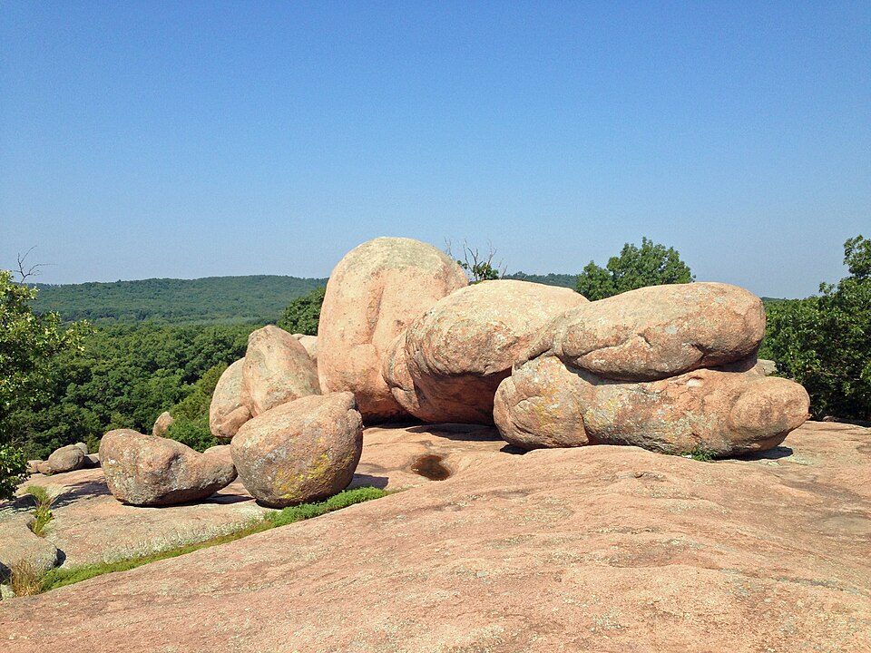
Elephant Rocks State Park
Elephant Rocks State Park is a geologic reserve and public recreation area encompassing an outcropping of Precambrian granite in the Saint Francois Mountains in the U.S.

A state park, 3 mi northwest of Pilot Knob
Pilot Knob is the nearest base
Pilot Knob is 3 miles southeast, with 5 places to stay. Where to stay ↓
Best months: Apr, May, Jun, Sep and Oct
April, May, June, September and October are the mild months, with highs of 68–84°. When to go ↓
Established in 1967
Elephant Rocks State Park dates from 1967. About ↓
Written from NOAA 1991–2020 normals, Overture places to stay, Census town figures, Wikidata and Wikipedia.
Weather, month by month
Typical highs and lows in Pilot Knob. Green months are the mild ones.
Elephant Rocks State Park
Elephant Rocks State Park is a geologic reserve and public recreation area encompassing an outcropping of Precambrian granite in the Saint Francois Mountains in the U.S. state of Missouri. The state park is named for a string of large granite boulders which resemble a train of pink circus elephants. The park was created following the donation of the land to the state in 1967 by geologist Dr. John Stafford Brown. The park is used for picnicking, rock climbing, and trail exploration. It is managed by the Missouri Department of Natural Resources.
- Type
- State park
- Established
- 1967
- Wikipedia readers
- 9.1K a year
Where to stay near Elephant Rocks State Park
The closest towns with hotels, motels or campgrounds are Pilot Knob (5) and Arcadia (5).
Pilot Knob
The closest town with somewhere to stay.
701 people
3 mi southeast of Elephant Rocks
Compare 8 towns
| Town | From Elephant Rocks | Drive | Places to stay | People | Typical home | Safety |
|---|---|---|---|---|---|---|
| Pilot Knob | 3 mi southeast | 5 min | 5 1 hotel · 2 lodges & cabins · 2 campgrounds | 701 | $108K | — |
| Arcadia | 6 mi southeast | 10 min | 5 1 hotel · 4 inns & B&Bs | 605 | $155K | — |
| Farmington | 17 mi northeast | 25 min | 10 9 hotels · 1 hostel | 19,226 | $197K | D |
| Caledonia | 9 mi northwest | 15 min | 3 1 inn or B&B · 2 lodges & cabins | 134 | $55K | — |
| Ironton | 5 mi southeast | 10 min | 2 1 hotel · 1 campground | 1,408 | $120K | — |
| Bonne Terre | 20 mi northeast | 30 min | 5 2 hotels · 2 inns & B&Bs · 1 campground | 6,636 | $153K | B− |
| Bismarck | 9 mi northeast | 15 min | 1 1 campground | 1,224 | $108K | — |
| Knob Lick | 18 mi east | 25 min | 3 3 campgrounds | 41 | — | — |
Getting there
Nearest airports with airline service
Also near Elephant Rocks
Other well-known places within 65 miles. Numbered ones are on the map above.
 16 mi MountainTaum Sauk Mountain
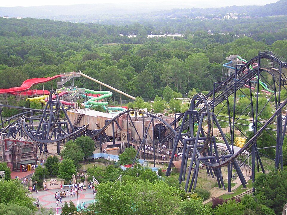 59 mi Theme parkMid America Adventure
 222 mi National forestMark Twain National Forest
 312 mi State parkJohnson's Shut-Ins State Park
 41 mi LandmarkFort de Chartres46 mi CaveMeramec Caverns
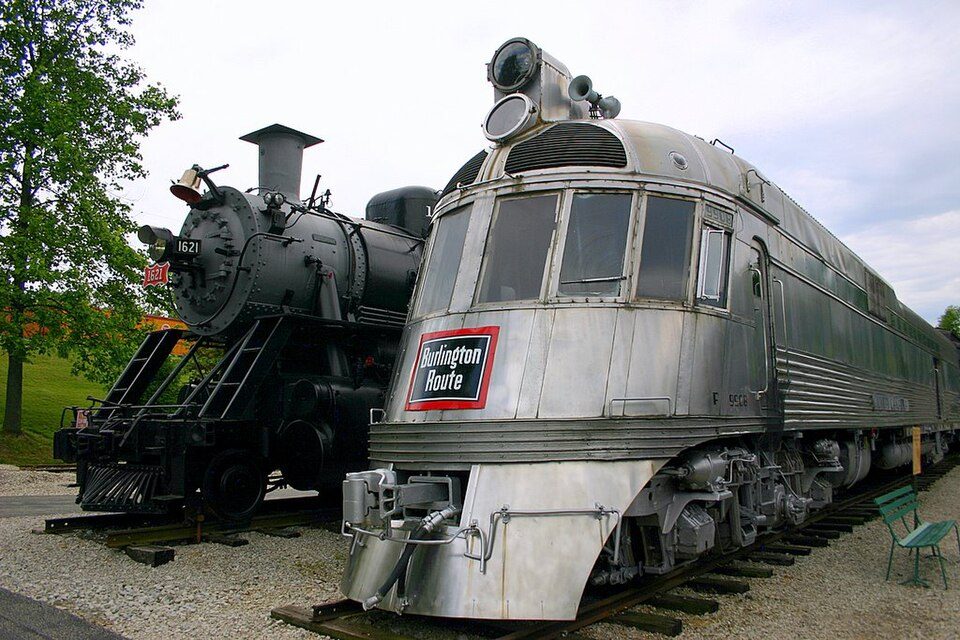 65 mi MuseumNational Museum of Transportation
 62 mi LandmarkJefferson Barracks National Cemetery
Photo credits
Taum Sauk Mountain: Kbh3rd, CC BY-SA 3.0 · Mid America Adventure: Chris Hagerman from New Port Richey, FL, US, CC BY 2.0 · Mark Twain National Forest: Kbh3rd, CC BY-SA 3.0 · Johnson's Shut-Ins State Park: Kbh3rd, CC BY-SA 3.0 · Fort de Chartres: Kbh3rd, CC BY 3.0 · National Museum of Transportation: Nate Beal, CC BY 2.0 · Jefferson Barracks National Cemetery: Robert Lawton, CC BY-SA 2.5


Visiting Elephant Rocks
What town is Elephant Rocks State Park near?
Pilot Knob, MO, about 3 miles southeast.
When is the best time to visit Elephant Rocks State Park?
April, May, June, September and October, with highs of 68–84°.
What is the closest airport to Elephant Rocks State Park?
Cape Girardeau Regional (CGI), about 68 miles away. The nearest big hub is St. Louis Lambert (STL), about 78 miles.
Where should I stay near Elephant Rocks State Park?
Pilot Knob (3 mi, 5 places to stay), Arcadia (6 mi, 5 places to stay) and Farmington (17 mi, 10 places to stay).
Tips from people in Pilot Knob
No tips yet. Ask, or answer, in Pilot Knob’s Town Square.
Sources: National Park Service · ski areas © OpenSkiMap / OpenStreetMap contributors · Wikidata · Wikipedia readership · NOAA climate normals · U.S. Census.