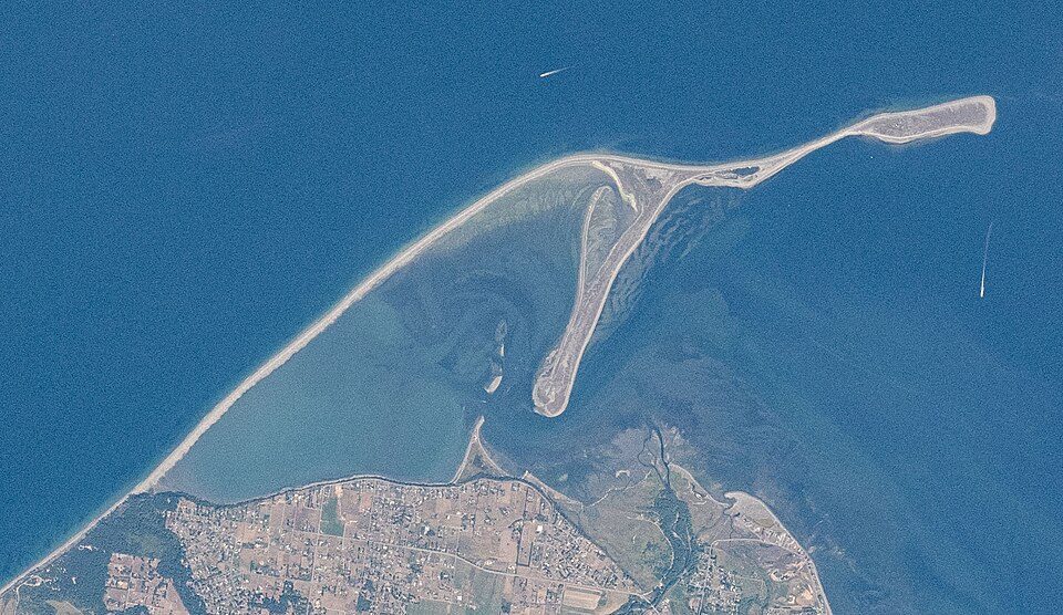
Dungeness Spit
Dungeness Spit is a sand spit jutting out approximately 5 miles (8 km) from the northern edge of the Olympic Peninsula in northeastern Clallam County, Washington into the Strait of Juan de Fuca. On the map, it sits 4 mi northwest of Jamestown. For mild weather, aim for June to September (66–71°F highs).

A beach, 4 mi northwest of Jamestown
Carlsborg is the nearest base
Carlsborg is 6 miles south, with 6 places to stay. Where to stay ↓
A day trip from Seattle
Seattle is about 53 miles southeast (straight-line). Where to stay ↓
Best months: Jun, Jul, Aug and Sep
June, July, August and September are the mild months, with highs of 66–71°. When to go ↓
Written from NOAA 1991–2020 normals, Overture places to stay, Census town figures and Wikipedia.
Month by month
The weather near Dungeness Spit shifts through the year, as below.
Dungeness Spit
Dungeness Spit is a sand spit jutting out approximately 5 miles (8 km) from the northern edge of the Olympic Peninsula in northeastern Clallam County, Washington into the Strait of Juan de Fuca. It is the longest natural sand spit in the United States. The spit is growing in length by about 15 feet (4.6 m) per year. The body of water it encloses is called Dungeness Bay.
- Type
- Beach
- Wikipedia readers
- 12K a year
A base for Dungeness Spit
For a bed close by, look to Sequim (11) and Port Angeles (25).
Compare 8 towns
| Town | From Dungeness Spit | Drive | Places to stay | People | Typical home | Safety |
|---|---|---|---|---|---|---|
| Sequim | 8 mi south | 10 min | 11 6 hotels · 1 motel · 1 inn or B&B · 1 lodge or cabins · 1 campground · 1 RV park | 8,215 | $409K | C |
| Port Angeles | 14 mi west | 20 min | 25 8 hotels · 9 motels · 4 inns & B&Bs · 2 lodges & cabins · 1 hostel · 1 RV park | 20,146 | $370K | D |
| Port Townsend | 17 mi east | 25 min | 28 13 hotels · 1 motel · 10 inns & B&Bs · 3 lodges & cabins · 1 campground | 10,678 | $543K | C+ |
| Carlsborg | 6 mi south | 10 min | 6 2 inns & B&Bs · 2 lodges & cabins · 2 RV parks | 1,231 | $317K | — |
| Jamestown | 4 mi southeast | 5 min | 2 1 inn or B&B · 1 lodge or cabins | 390 | $481K | — |
| Port Angeles East | 11 mi southwest | 15 min | 4 1 hotel · 1 campground · 2 RV parks | 3,137 | $348K | — |
| Friday Harbor | 26 mi north | 40 min | 25 9 hotels · 12 inns & B&Bs · 1 lodge or cabins · 2 hostels · 1 campground | 2,729 | $570K | — |
| Coupeville | 22 mi east | 35 min | 14 2 hotels · 8 inns & B&Bs · 2 lodges & cabins · 2 campgrounds | 1,920 | $561K | — |
Getting there
Nearest airports with airline service
Beyond Dungeness Spit
These well-known sights sit within 56 miles.
 Big draw53 mi LookoutSpace Needle
 Big draw53 mi Stadium & arenaClimate Pledge Arena
 Big draw55 mi Stadium & arenaLumen Field
 Big draw43 mi National ParkOlympic National Park3.6M visitors a year
 55 mi Stadium & arenaT-Mobile Park
 55 mi Ancient siteSeattle Underground
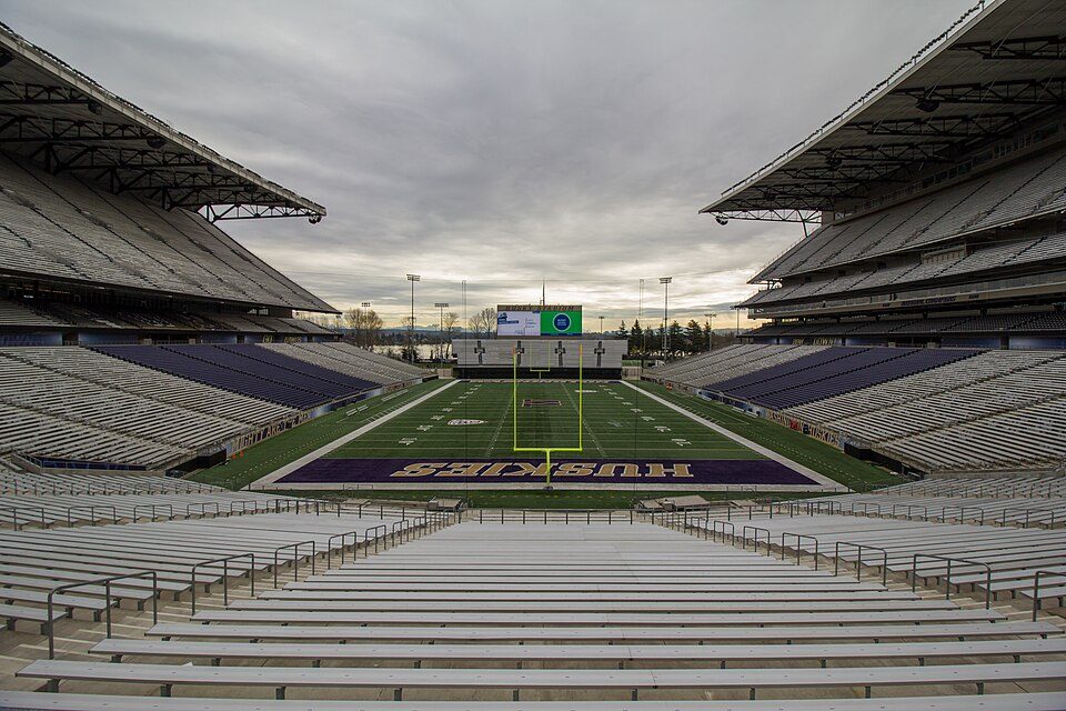 53 mi Stadium & arenaHusky Stadium
 42 mi Park & preserveHoh Rainforest
Photo credits
Space Needle: Another Believer, CC BY-SA 4.0 · Climate Pledge Arena: Sea Cow, CC BY-SA 4.0 · Lumen Field: "Smart Destinations", GoSeattleCard.com, and Go Seattle Card Blog, CC BY-SA 2.0 · Olympic National Park: Wsiegmund, CC BY 2.5 · T-Mobile Park: MyName (Cacophony), CC BY-SA 3.0 · Seattle Underground: Mark Hursh, CC BY-SA 3.0 · Husky Stadium: Atomic Taco, CC BY-SA 2.0 · Hoh Rainforest: User:Doug Dolde, CC BY-SA 3.0


Good to know about Dungeness Spit
What town is Dungeness Spit near?
Jamestown, WA, about 4 miles southeast.
When is the best time to visit Dungeness Spit?
June, July, August and September, with highs of 66–71°.
How far is Dungeness Spit from Seattle?
About 53 miles southeast of Seattle, as the crow flies.
What is the closest airport to Dungeness Spit?
Friday Harbor (FRD), about 25 miles away. The nearest big hub is Seattle–Tacoma (SEA), about 63 miles.
Where should I stay near Dungeness Spit?
Sequim (8 mi, 11 places to stay), Port Angeles (14 mi, 25 places to stay) and Port Townsend (17 mi, 28 places to stay).
Tips from Jamestown
Nobody has posted a tip yet; ask or answer in Jamestown’s Town Square.
Sources: National Park Service · ski areas © OpenSkiMap / OpenStreetMap contributors · Wikidata · Wikipedia readership · NOAA climate normals · U.S. Census.