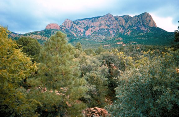
Cibola National Forest
The Cibola National Forest is a 1,633,783 acre (6,611.7 km2) United States National Forest in New Mexico, US. Head 17 mi northwest of Magdalena to reach it. It goes back to 1931.

A national forest, 17 mi northwest of Magdalena
Plan where you’ll sleep
The nearest town with many places to stay is Magdalena, 17 miles southeast. Where to stay ↓
A day trip from Albuquerque
Albuquerque is about 71 miles northeast (straight-line). Where to stay ↓
Best months: May, Aug and Sep
May, August and September are the mild months, with highs of 76–82°. When to go ↓
Established in 1931
Cibola National Forest dates from 1931. About ↓
Written from NOAA 1991–2020 normals, Overture places to stay, Census town figures, Wikidata and Wikipedia.
Weather through the year
Below are typical highs and lows near Cibola National Forest.
Cibola National Forest
The Cibola National Forest is a 1,633,783 acre (6,611.7 km2) United States National Forest in New Mexico, US. The name Cibola is thought to be the original Zuni Indian name for their pueblos or tribal lands. The name was later interpreted by the Spanish to mean "buffalo". The forest is disjointed with lands spread across central and northern New Mexico, west Texas and Oklahoma. The Cibola National Forest is divided into four Ranger Districts: the Sandia, Mountainair, Mt. Taylor, and Magdalena. The Forest includes the San Mateo, Magdalena, Datil, Bear, Gallina, Manzano, Sandia, Mt. Taylor, and Zuni Mountains of west-central New Mexico. The Forest also manages four National Grasslands that stretch from northeastern New Mexico eastward into the Texas Panhandle and western Oklahoma.
- Type
- National forest
- Established
- 1931
- Area
- 2,553 square miles
- Wikipedia readers
- 8.8K a year
Where to sleep near Cibola National Forest
Places to stay start in Magdalena (6), and Socorro has the most rooms in the area (21).
Magdalena
The closest town with somewhere to stay.
776 people
17 mi southeast of Cibola National Forest
Socorro
The most places to stay in the area, and a base for a longer trip.
8,261 people
34 mi southeast of Cibola National Forest
Compare 4 towns
| Town | From Cibola National Forest | Drive | Places to stay | People | Typical home |
|---|---|---|---|---|---|
| Magdalena | 17 mi southeast | 25 min | 6 4 hotels · 1 motel · 1 inn or B&B | 776 | $100K |
| Datil | 27 mi southwest | 40 min | 1 1 motel | 17 | — |
| Polvadera | 29 mi east | 45 min | 1 1 inn or B&B | 1,033 | $124K |
| Socorro | 34 mi southeast | 50 min | 21 14 hotels · 4 motels · 1 inn or B&B · 2 RV parks | 8,261 | $153K |
Getting there
Nearest airports with airline service
Close to Cibola National Forest
All of these are within 70 miles.
 69 mi Stadium & arenaUniversity Stadium
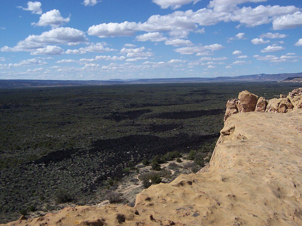 54 mi National MonumentEl Malpais National Monument152K visitors a year
 69 mi National MonumentPetroglyph National Monument311K visitors a year
 44 mi Park & preserveBosque del Apache National Wildlife Refuge
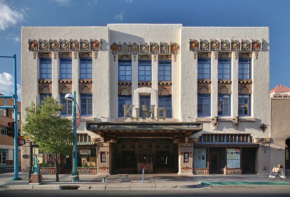 70 mi TheatreKiMo Theater
 69 mi Zoo & aquariumABQ BioPark Zoo
 70 mi MuseumNew Mexico Museum of Natural History and Science
 70 mi MuseumAlbuquerque Museum
Photo credits
University Stadium: Kenneth C. Zirkel, CC BY 4.0 · El Malpais National Monument: Original uploader was Chackerman at en.wikipedia, CC BY 2.5 · Petroglyph National Monument: Unknown, Public domain · Bosque del Apache National Wildlife Refuge: Unknown, CC BY-SA 3.0 · KiMo Theater: Daniel Schwen, CC BY-SA 4.0 · ABQ BioPark Zoo: en:User:Cburnett, CC BY-SA 3.0 · New Mexico Museum of Natural History and Science: John Phelan, CC BY-SA 3.0 · Albuquerque Museum: PerryPlanet at English Wikipedia, Public domain


Visiting Cibola National Forest: the answers
What town is Cibola National Forest near?
Magdalena, NM, about 17 miles southeast.
When is the best time to visit Cibola National Forest?
May, August and September, with highs of 76–82°.
How far is Cibola National Forest from Albuquerque?
About 71 miles northeast of Albuquerque, as the crow flies.
What is the closest airport to Cibola National Forest?
Albuquerque International Sunport (ABQ), about 69 miles away.
Where should I stay near Cibola National Forest?
Magdalena (17 mi, 6 places to stay) and Socorro (34 mi, 21 places to stay).
Local tips in Magdalena
Be the first to share a tip in Magdalena’s Town Square.
Sources: National Park Service · ski areas © OpenSkiMap / OpenStreetMap contributors · Wikidata · Wikipedia readership · NOAA climate normals · U.S. Census.