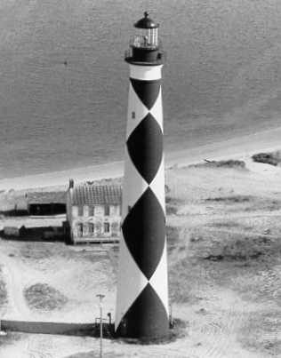
Cape Lookout Lighthouse
The Cape Lookout Lighthouse is a 163-foot-high lighthouse located on the southern Outer Banks of North Carolina. Its setting is 5 mi south of Harkers Island. It dates back to 1859.

A lighthouse, 5 mi south of Harkers Island
Beaufort is the nearest base
Beaufort is 10 miles northwest, with 14 places to stay. Hotels nearby ↓
Established in 1859
Cape Lookout Lighthouse dates from 1859. About ↓
Best months: Mar, Apr, May, Sep, Oct and Nov
March, April, May, September, October and November are the mild months, with highs of 64–83°. When to go ↓
Written from NOAA 1991–2020 normals, Overture places to stay, Census town figures, Wikidata and Wikipedia.
Picking a season
The months below show the weather around Cape Lookout Lighthouse.
Cape Lookout Lighthouse
The Cape Lookout Lighthouse is a 163-foot-high lighthouse located on the southern Outer Banks of North Carolina. It flashes every 15 seconds and is visible at least 12 miles out to sea and up to 19 miles. It is one of the very few lighthouses that operate during the day. It became fully automated in 1950. The Cape Lookout Lighthouse is the only such structure in the United States to bear the checkered daymark, intended not only for differentiation between similar light towers, but also to show direction. The center of the black diamonds points in a north-south direction, while the center of the white diamonds points east-west.
- Type
- Lighthouse
- Established
- 1859
- Listed
- National Register of Historic Places (1972) · National Register of Historic Places contributing property (2000)
- Wikipedia readers
- 7.3K a year
Sleeping near Cape Lookout Lighthouse
The closest is Cape Lookout Rv Park, 4.8 miles away.
Closest places to stay
- 1Cape Lookout Rv ParkRV park · 4.8 mi northDirections
- 2Cape Look Out Bed & Breakfastinn or B&B · 5.2 mi northDirections
- 3Harkers Island RV Resort & CampgroundRV park · 5.5 mi northDirections
- 4Gloucester Househotel · 7.2 mi northDirections
- 5Beaufort Hotelhotel · 8.5 mi northwestDirections
- 6Down East RV ResortRV park · 9.9 mi northDirections
Compare 8 towns to stay in
| Town | From Cape Lookout Lighthouse | Drive | Places to stay | People | Typical home | Safety |
|---|---|---|---|---|---|---|
| Beaufort 20% vacation homes | 10 mi northwest | 15 min | 14 6 hotels · 8 inns & B&Bs | 4,912 | $355K | C |
| Atlantic Beach 80% vacation homes | 14 mi northwest | 20 min | 16 8 hotels · 5 motels · 1 inn or B&B · 2 lodges & cabins | 1,408 | $498K | D |
| Morehead City | 14 mi northwest | 20 min | 12 9 hotels · 1 inn or B&B · 1 lodge or cabins · 1 campground | 10,434 | $357K | C− |
| Harkers Island 54% vacation homes | 5 mi north | 5 min | 3 1 inn or B&B · 2 RV parks | 1,060 | $313K | — |
| Pine Knoll Shores 65% vacation homes | 18 mi west | 30 min | 9 5 hotels · 2 inns & B&Bs · 1 lodge or cabins · 1 campground | 1,423 | $592K | A− |
| Gloucester | 8 mi north | 10 min | 2 1 hotel · 1 RV park | 385 | $354K | — |
| Davis | 12 mi north | 20 min | 3 1 inn or B&B · 1 campground · 1 RV park | 261 | $201K | — |
| Emerald Isle 69% vacation homes | 29 mi west | 45 min | 16 8 hotels · 1 motel · 1 inn or B&B · 1 lodge or cabins · 2 campgrounds · 3 RV parks | 3,970 | $604K | C |
Getting there
Nearest airports with airline service
Pair Cape Lookout Lighthouse with these
Pair a visit with these, within 50 miles.
 Big draw10 mi Ancient siteQueen Anne's Revenge
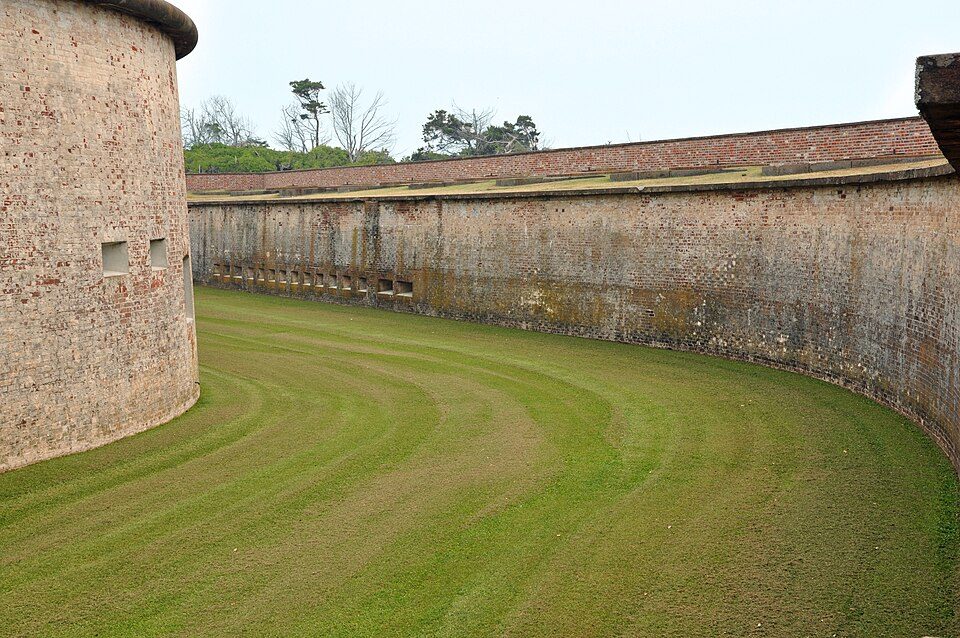 11 mi State parkFort Macon State Park
 in town National SeashoreCape Lookout National Seashore513K visitors a year
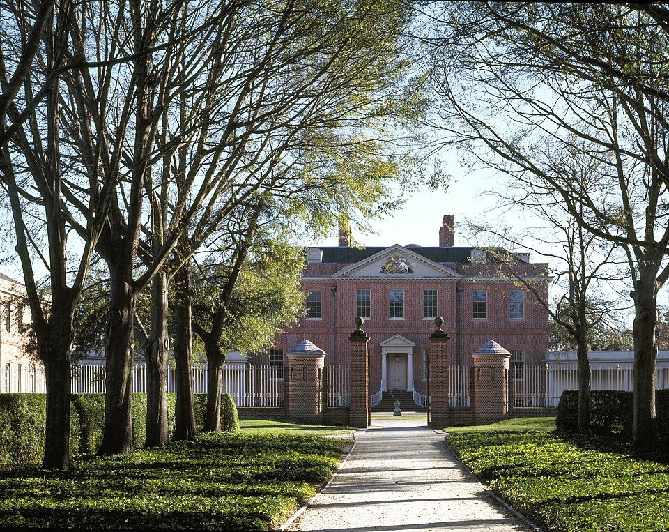 45 mi MuseumTryon Palace
 27 mi Ancient siteU-352
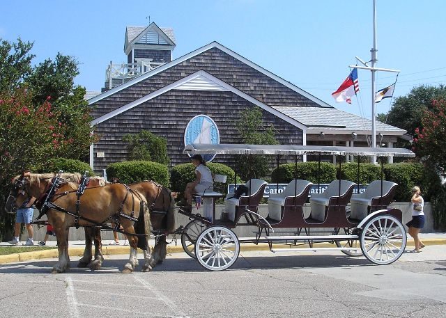 10 mi MuseumNorth Carolina Maritime Museum
 45 mi TheatreMasonic Temple and Theater
 49 mi MuseumAurora Fossil Museum
Photo credits
Queen Anne's Revenge: Joseph Nicholls, Public domain · Fort Macon State Park: Kevinbercaw, CC BY-SA 3.0 · Cape Lookout National Seashore: Jarek Tuszyński, CC BY 3.0 · Tryon Palace: Carol M. Highsmith, Public domain · U-352: Barry Peters`, CC BY 2.0 · North Carolina Maritime Museum: Kd5463, CC BY-SA 3.0 · Masonic Temple and Theater: Archie A. Biggs, Photographer, Public domain · Aurora Fossil Museum: RadioFan, CC BY-SA 3.0


Before visiting Cape Lookout Lighthouse
What town is Cape Lookout Lighthouse near?
Harkers Island, NC, about 5 miles north.
When is the best time to visit Cape Lookout Lighthouse?
March, April, May, September, October and November, with highs of 64–83°.
What is the closest airport to Cape Lookout Lighthouse?
Coastal Carolina Regional (EWN), about 43 miles away. The nearest big hub is Myrtle Beach (MYR), about 152 miles.
What hotels are near Cape Lookout Lighthouse?
Cape Lookout Rv Park (4.8 mi), Cape Look Out Bed & Breakfast (5.2 mi) and Harkers Island RV Resort & Campground (5.5 mi).
Harkers Island has the answers
Be the first to share a tip in Harkers Island’s Town Square.
Sources: National Park Service · ski areas © OpenSkiMap / OpenStreetMap contributors · Wikidata · Wikipedia readership · NOAA climate normals · U.S. Census.