
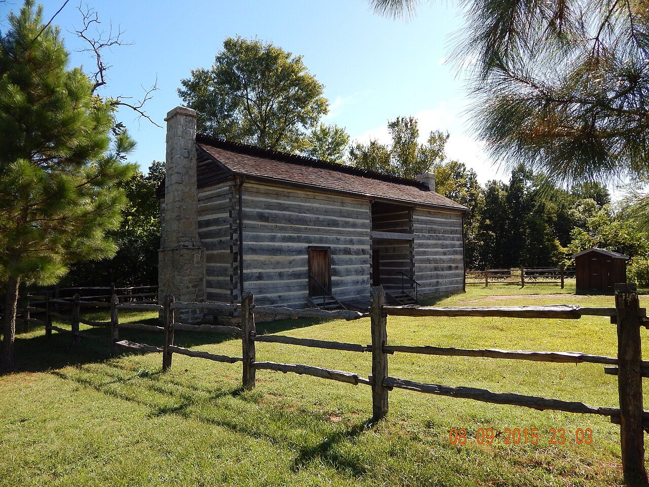
Hillyard Cabin · National Register of Historic Places
Warm Springs’s story
148 years in pictures
The archive holds 2 maps from 1967 on.
1 place on the National Register of Historic Places.
- 1878Warm Springs is settled
Each edition grades its towns against each other only.
The town was settled in 1878 and has 87 residents today.
Warm Springs’ midpoint age is 20.3 years, below both Arkansas’ towns (36.6 years) and U.S. towns (40.5 years). Of the 124 Arkansas towns we compare, none has a higher home-ownership rate than Warm Springs. Looney- French House and Rice-Upshaw House is on the National Register of Historic Places. Warm Springs has fewer than 1,000 residents, too few for fair grades; the figures below are still real.
The archive holds 2 maps from 1967 on.
1 place on the National Register of Historic Places.
In a town this size, neighbors are the best guide. Ask them anything.
Ordered by what stands out in Warm Springs.
Federal aid has come to Warm Springs households in 6 declared disasters; the latest was in 2025. On expected storm and flood damage, Warm Springs sits above 77% of U.S. communities. FEMA puts 29% of the town’s expected hazard losses down to earthquakes, and 21% to cold waves.
FEMA disaster declarations and aid · FEMA National Risk Index · OpenFEMA
In July, afternoons reach 90°; in January, nights fall to 26°, and about 6 inches of snow falls in a winter.
NOAA U.S. Climate Normals, 1991–2020
The share of adults in Warm Springs who say their health is fair or poor: 26%. CDC measures, 32 in all: Warm Springs beats Arkansas on 3 and trails on 6. In Warm Springs, 18% of adults report frequent physical distress, and 35% get no exercise outside work. Only 7 of the 124 Arkansas towns we compare have a lower share of adults who sleep under 7 hours than Warm Springs.
| Warm Springs | Arkansas towns | U.S. towns | |
|---|---|---|---|
| High blood pressure (CDC PLACES) | 44% | 41% | 35% |
| Frequent physical distress (CDC PLACES) | 18% | 16% | 14% |
| Get no exercise (CDC PLACES) | 35% | 34% | 25% |
| Diabetes (CDC PLACES) | 15% | 13% | 12% |
| What stands out | Warm Springs | AR |
|---|---|---|
| Fewer adults facing a utility shut-off | 8% | 10.4% |
| Fewer adults facing housing insecurity | 11.3% | 14.4% |
| More older adults who have lost all their teeth | 24.2% | 18.6% |
CDC PLACES 2025 · modeled estimates for adults · CMS · HRSA
Count the trails in 1 park or preserve and they come to 0.2 miles. The trail density in Warm Springs is 0.1 miles per square mile. One park or preserve covers 4 acres in the town.
| Biggest places to walk | Trails | Acres |
|---|---|---|
| 1. Fourche Creek Conservation Area | — | 4 |
Trails & parks © OpenStreetMap contributors · Conserved land: USGS PAD-US
Warm Springs is unincorporated, so Randolph County and regional agencies provide most services.
EPA SDWIS (Oct 9, 2026) · HIFLD + EIA-861 2025 · Census 2020 ZCTAs · NCES 2024–25 · registration: vote.gov, updated Nov 18, 2024.
None within 15 miles of Warm Springs; the nearest are
About 0 of every 100 Warm Springs residents are enrolled in college, against 5 across Arkansas.
Census-designated place in Arkansas, United States
Warm Springs is an unincorporated community and census-designated place (CDP) in Randolph County, Arkansas, United States. Warm Springs is located on Arkansas Highway 251, 15.5 miles (24.9 km) north-northwest of Pocahontas. It was first listed as a CDP in the 2020 census with a population of 47. Warm Springs has a ZIP Code of 72478, but does not have a post office nor a collection box.
From Wikipedia, licensed CC BY-SA 4.0 · facts via Wikidata (CC0)
Short answers, built from the data on this page.
Warm Springs has fewer than 1,000 residents, too few for fair grades; the figures below are still real.
Ask a question, answer one, post a photo or an event. Free, and the parts only a neighbor would know are the parts worth reading.