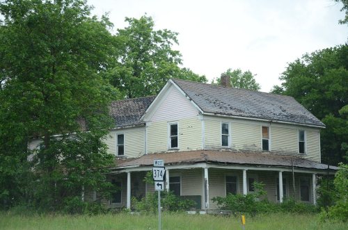
St. Joe dates to 1860, and 17% of its homes were built before 1940
Its Register listings are the Benjamin Franklin Henley House, the St. Joe Missouri and North Arkansas Railroad Depot and the Henley Hotel. Below: maps from 1893 on and the census since 1910.
The town of St. Joe, Arkansas, was founded a few miles north of the Buffalo River around 1860 by Bill Campbell, Ben Henley Sr., Dr. George Turney, Captain Harry Love, Decatur Robinson, and Matt Tyson. Mill Creek, near the current post office on U.S. Highway 65, was the original town location. Wagon trains traveled from the town to Springfield, Missouri, where produce was sold and goods were purchased and brought back to the stores. The History and Folklore of Searcy County Arkansas states that St. Joe was originally called Monkey Run. The area came by its current name around 1900, when six miners from St. Joseph, Missouri, received the largest quantity of mail to come into the post office. The outpost eventually became known as St. Joe, Arkansas. Mines, and rumors of mines, feature largely in the story of St. Joe's past. It is worth noting that one of the nearby settlements is named S…
Old hamlets and crossroads still carry their names on the map.
Hamlets and corners on the map
Saint Joe
US Post Offices dataset (Blevins & Helbock, CC0). Places and cemeteries from the USGS Geographic Names Information System (2021).
Questions about St. Joe’s history
What year was St. Joe founded?
In 1860, according to Wikipedia’s history of the town. St. Joe’s post office opened in 1877, and the census of 1910 counted 159 people here.
What is on the National Register in St. Joe?
Three places: the Benjamin Franklin Henley House (listed 1985), the St. Joe Missouri and North Arkansas Railroad Depot (1993) and the Henley Hotel (2011).
Founding dates: Wikidata, Wikipedia, the U.S. post office records of Blevins & Helbock (CC0) and the Census. Homes by year built: Census ACS 2020–24. National Register of Historic Places: National Park Service (list of May 22, 2026). Old photos, postcards and papers: Wikimedia Commons, the Library of Congress and other public archives, credited on each item’s page. Maps: U.S. Geological Survey historical topographic maps (via Esri) and Sanborn fire-insurance maps (Library of Congress). History text and census tables: Wikipedia (CC BY-SA 4.0). Places that used to be: USGS Geographic Names Information System (2021). How TownRatings grades history →
From Wikimedia Commons (4), Wikidata (1), the National Register of Historic Places (3), Wikipedia, Wikidata and Wikipedia for famous people, U.S. Geological Survey historical maps, U.S. Census counts (via Wikipedia), the US Post Offices dataset (Blevins & Helbock) and the USGS Geographic Names Information System. Archive images are copied here with their credits and licenses, shown on each photo’s page. Refreshed monthly.


 2024
 2016
 2015
 2005