Rison’s post office opened in 1883, and 7 of its places are on the National Register
Most of Rison was built recently: 1% of its homes predate 1940 and the median home dates from 1976. Below: maps from 1913 on and the census since 1900.
The Rison post office opened in 1883, the earliest record of the town by name. Another post office, Unionsville (1908), opened inside today’s city and later closed.
First census: 453 in 19002020 census: 967143 years
Founding year: the first Rison post office (Blevins & Helbock, CC0).The full story ↓
What stands out about Rison’s past
Read from the archive, the National Register and the record. The page puts what stands out first.
The Texas and St. Louis Railroad gave rise to Rison. The county seat of Dorsey County (present day Cleveland County) was originally Toledo. When the railroad was routed through the county in 1882, Rison did not exist. Samuel Fordyce of Huntsville, Alabama, a former Union army officer, was authorized to determine the route of the railroad from Texarkana to Birds Point, Missouri. According to unsubstantiated legend, when the leading citizens of Toledo snubbed his plans to route the railroad through that community, Fordyce planned a route three miles north and built a station through land that would later become Rison.
Every edition of the U.S. Geological Survey’s map of Rison. Tap a year, or press play to watch the town change.
1970Rison sheet · 1:24,000
U.S. Geological Survey historical topographic maps (public domain), via Esri’s collection of the scans. The red ring marks the center of Rison.
Every building
Rison, building by building, 1913–1921
Fire insurance maps drew every building, what it was made of and what it was used for, so insurers could price the risk of fire. Pick a year, then a sheet.
1913Sheet 1 of 1
Edition
Sheets
BrickWoodStone
Sanborn Map Company, via the Library of Congress. Editions published in 1930 or earlier, which are in the public domain.
Famous people
4 famous people were born in Rison
Writers, athletes, leaders and more, ranked by how widely they’re known.
Founding dates: Wikidata, Wikipedia, the U.S. post office records of Blevins & Helbock (CC0) and the Census. Homes by year built: Census ACS 2020–24. National Register of Historic Places: National Park Service (list of May 22, 2026). Old photos, postcards and papers: Wikimedia Commons, the Library of Congress and other public archives, credited on each item’s page. Maps: U.S. Geological Survey historical topographic maps (via Esri) and Sanborn fire-insurance maps (Library of Congress). History text and census tables: Wikipedia (CC BY-SA 4.0). Places that used to be: USGS Geographic Names Information System (2021). How TownRatings grades history →
From Wikimedia Commons (4), Wikidata (3), the National Register of Historic Places (7), Wikipedia, Wikidata and Wikipedia for famous people, U.S. Geological Survey historical maps, U.S. Census counts (via Wikipedia), the US Post Offices dataset (Blevins & Helbock), the USGS Geographic Names Information System and Sanborn fire insurance maps (Library of Congress). Archive images are copied here with their credits and licenses, shown on each photo’s page. Refreshed monthly.


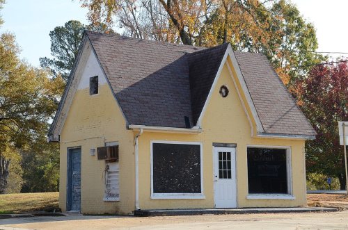


 2016
 2016
 2016
 2005


