Kingsland’s post office opened in 1883, and 2 of its places are on the National Register
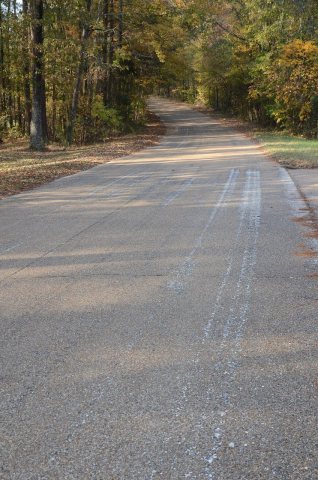
Most of Kingsland was built recently: 3% of its homes predate 1940 and the median home dates from 1991. Its Register listings are the Old US 79, Kingsland Segment and the Magnolia Petroleum Company Filling Station. Below: maps from 1914 on and the census since 1890.
Fire insurance maps drew every building, what it was made of and what it was used for, so insurers could price the risk of fire. Pick a year, then a sheet.
1914Sheet 1 of 1
Edition
Sheets
BrickWoodStone
Sanborn Map Company, via the Library of Congress. Editions published in 1930 or earlier, which are in the public domain.
In 1890, a two-story building was adapted for Kingsland's first public school. A new school was built in 1940 during the Great Depression as part of the Works Progress Administration projects initiated by the President Franklin D. Roosevelt administration.
Country singer Johnny Cash was born in Kingsland in 1932 during the Great Depression to parents who were poor cotton farmers. The family moved when he was three. Cash returned to the town in March 1994, for the dedication of the new post office named in his honor.
Founding dates: Wikidata, Wikipedia, the U.S. post office records of Blevins & Helbock (CC0) and the Census. Homes by year built: Census ACS 2020–24. National Register of Historic Places: National Park Service (list of May 22, 2026). Old photos, postcards and papers: Wikimedia Commons, the Library of Congress and other public archives, credited on each item’s page. Maps: U.S. Geological Survey historical topographic maps (via Esri) and Sanborn fire-insurance maps (Library of Congress). History text and census tables: Wikipedia (CC BY-SA 4.0). Places that used to be: USGS Geographic Names Information System (2021). How TownRatings grades history →
From Wikimedia Commons (2), the National Register of Historic Places (2), Wikipedia, Wikidata and Wikipedia for famous people, U.S. Geological Survey historical maps, U.S. Census counts (via Wikipedia), the US Post Offices dataset (Blevins & Helbock), the USGS Geographic Names Information System and Sanborn fire insurance maps (Library of Congress). Archive images are copied here with their credits and licenses, shown on each photo’s page. Refreshed monthly.


 2016
 2005


