Sam and Shirley Strauss House · Photo: Valis55 · CC BY-SA 3.0
–Not graded
History · Cammack Village
Cammack Village dates to 1943, and 1 of its places is on the National Register
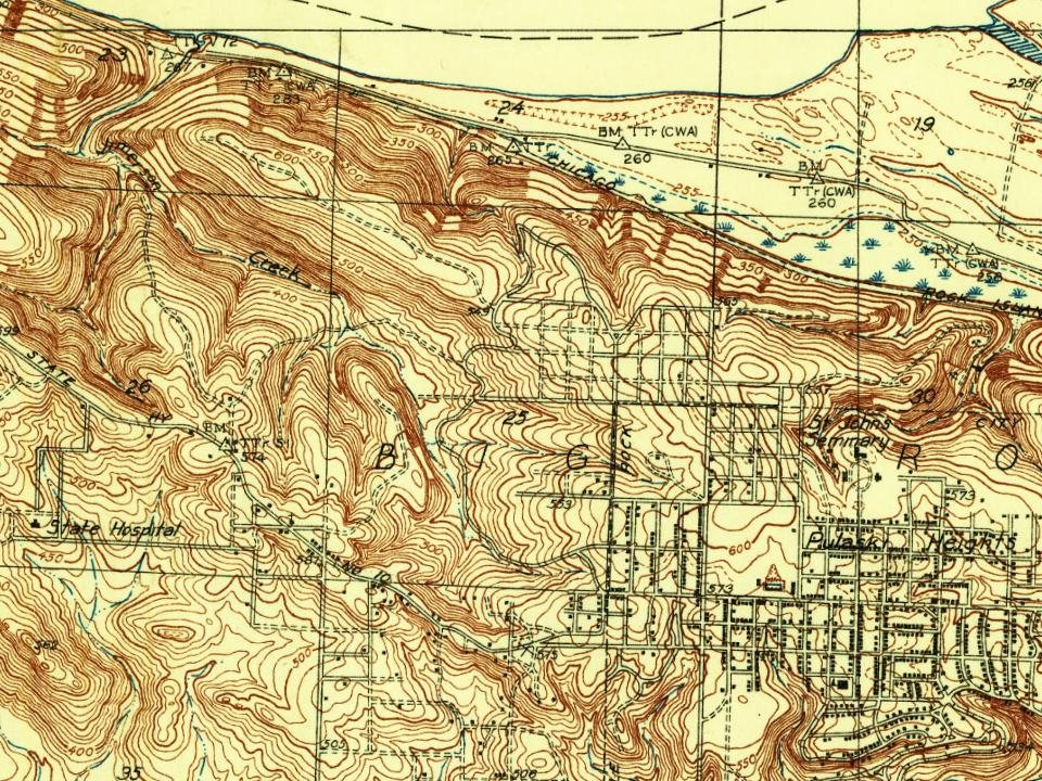
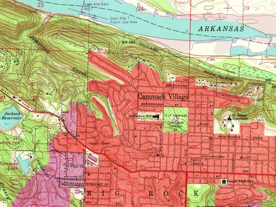
Most of Cammack Village was built recently: 2% of its homes predate 1940 and the median home dates from 1952. Its Register listing is the Sam and Shirley Strauss House. Below: maps from 1935 on and the census since 1950.
Cammack Village is located on land originally owned by Wiley Dan Cammack. During the 1930s, Cammack allowed the land to be used for a Works Progress Administration roads project. Sometime before 1943, Cammack attempted to have the land annexed by the city of Little Rock, which lay to the east, but the city demurred, stating the land was "too far west." Shortly after that, during World War II, Cammack turned the land over to the United States Government to alleviate military housing shortages at Camp Joseph T. Robinson, Little Rock's primary Army training base at the time. The houses were laid out in rows and built with 870 square feet (81 m2) per unit, according to U.S. Army specifications for family housing. In order to provide for police and fire protection, Cammack pushed for the incorporation of the new neighborhood, which occurred on April 5, 1943.
Every edition of the U.S. Geological Survey’s map of Cammack Village. Tap a year, or press play to watch the town change.
1935North Little Rock sheet · 1:24,000
U.S. Geological Survey historical topographic maps (public domain), via Esri’s collection of the scans. The red ring marks the center of Cammack Village.
On the National Register
1 historic place in Cammack Village
The country’s official list of buildings and places worth saving.
Founding dates: Wikidata, Wikipedia, the U.S. post office records of Blevins & Helbock (CC0) and the Census. Homes by year built: Census ACS 2020–24. National Register of Historic Places: National Park Service (list of May 22, 2026). Old photos, postcards and papers: Wikimedia Commons, the Library of Congress and other public archives, credited on each item’s page. Maps: U.S. Geological Survey historical topographic maps (via Esri) and Sanborn fire-insurance maps (Library of Congress). History text and census tables: Wikipedia (CC BY-SA 4.0). Places that used to be: USGS Geographic Names Information System (2021). How TownRatings grades history →
From Wikimedia Commons (2), the National Register of Historic Places (1), Wikipedia, U.S. Geological Survey historical maps, U.S. Census counts (via Wikipedia) and the USGS Geographic Names Information System. Archive images are copied here with their credits and licenses, shown on each photo’s page. Refreshed monthly.

 2016
 2005