131 years in pictures
Census counts: 10,987 in 1990, 7,215 in 2020. The archive holds 5 old photos and papers going back to 2004 and 3 maps from 1905 on.
3 places on the National Register of Historic Places.
- 1895Pinson is settled
Each edition grades its towns against each other only.

A town of 7,830, settled in 1895.
Pinson grades D overall, 146th of 187 graded towns in Alabama, mostly because of health. Residents are less healthy than 78% of U.S. towns on CDC estimates. One bright spot: it has 7 miles of trail. Most errands need a car: it is less walkable than 87% of U.S. towns. Pinson’s average trip to work is 31 minutes, where Alabama’s towns sit at 25 minutes and U.S. towns at 25 minutes. Pinson has 3 places on the National Register of Historic Places, among them Palmerdale Homesteads Historic District and Pinson Hills Historic District.
Where Pinson’s working residents go each day. Line width shows the share.
Census LEHD 2023
Each subject compared with towns across the country (schools within Alabama), ordered by how far Pinson is from typical.
How TownRatings grades towns →
Census counts: 10,987 in 1990, 7,215 in 2020. The archive holds 5 old photos and papers going back to 2004 and 3 maps from 1905 on.
3 places on the National Register of Historic Places.
Museums, parks, gardens and other places to visit around Pinson. Close and well known come first.
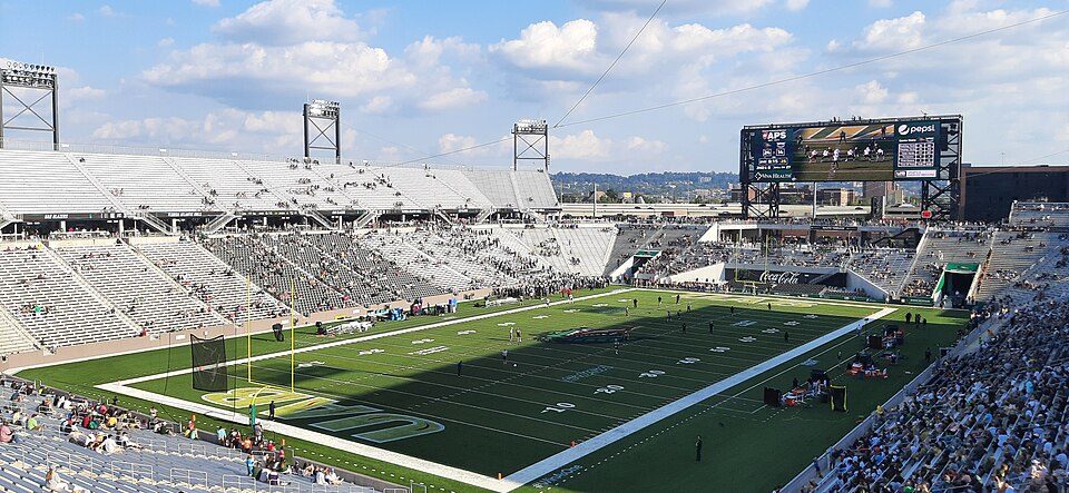
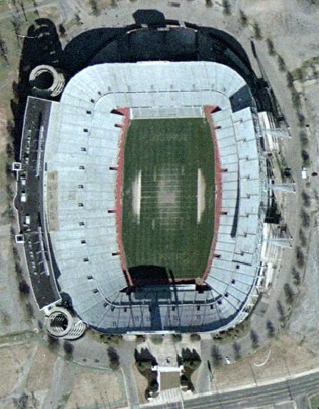
17 mi Stadium & arenaLegion Field
15 mi Stadium & arenaProtective Stadium
15 mi MuseumSloss Furnaces30 mi LakeLewis Smith Lake
15 mi Stadium & arenaLegacy Arena
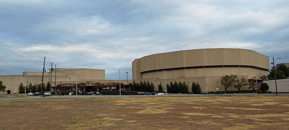
15 mi Stadium & arenaBirmingham–Jefferson Convention ComplexLegion Field: USGS, Public domain · Protective Stadium: Unknown, CC BY-SA 4.0 · Sloss Furnaces: DXR, CC BY-SA 4.0 · Legacy Arena: AuburnShuffle, CC0 · Birmingham–Jefferson Convention Complex: Chris Pruitt, CC BY-SA 3.0
Who provides power, water and the rest in Pinson, and how to reach them.
EPA SDWIS (Oct 9, 2026) · HIFLD + EIA-861 2025 · Census 2020 ZCTAs · NCES 2024–25 · registration: vote.gov, updated Nov 18, 2024.
Ordered by what stands out in Pinson.
7.1 miles of trail in 2 parks and preserves. Turkey Creek Nature Preserve, at 553 acres with 6.2 miles of trail, is the biggest park or preserve. Pinson’s trail density is 0.6 miles per square mile.
| Pinson | Alabama towns | U.S. towns | |
|---|---|---|---|
| Conserved land | 7.1% | 1.2% | 4.3% |
| Miles of trail per square mile | 0.6 miles per square mile | 0.1 | 0.4 |
| Biggest places to walk | Trails | Acres |
|---|---|---|
| 1. Turkey Creek Nature Preserve | 6.2 mi | 553 |
| 2. Bicentennial Park | 0.7 mi | 19 |
Trails & parks © OpenStreetMap contributors · Conserved land: USGS PAD-US
Its public schools are run by the Jefferson County school district. Two of its 5 schools are below, each with why it’s listed. The largest public high school is Pinson Valley High School, with 1,025 students.
| School | Level | Students | Letter |
|---|---|---|---|
| Pinson Elementary SchoolLargest public elementary schoolGrades PK–2 | Grades PK–2 | 753 | – |
| Pinson Valley High SchoolLargest public high schoolGrades 9–12 | Grades 9–12 | 1,025 | D |
NCES · EDFacts · graded within AL on state tests and graduation
Within Alabama it is less healthy than 57% of the 187 graded towns: much of Alabama scores lower on these measures.
39% of Pinson adults feel lonely. Pinson beats the Alabama average on 0 of 32 CDC measures and trails it on 4. 23% of Pinson adults worry about having enough food.
| Pinson | Alabama towns | U.S. towns | |
|---|---|---|---|
| Feel lonely (CDC PLACES) | 39% | 36% | 33% |
| Food insecurity (CDC PLACES) | 23% | 19% | 14% |
| Diabetes (CDC PLACES) | 15% | 15% | 12% |
| Get no exercise (CDC PLACES) | 31% | 30% | 25% |
| What stands out | Pinson | AL |
|---|---|---|
| More adults facing a utility shut-off | 12.2% | 9.6% |
| More adults facing housing insecurity | 16.9% | 13.9% |
| More adults facing food insecurity | 23% | 19.2% |
CDC PLACES 2025 · modeled estimates for adults · CMS · HRSA
Most working residents leave Pinson for work: only 1% work in town. The top destinations are Birmingham (38%), Hoover (6%) and Trussville (5%). Half commute less than 16 miles.
| Pinson | Alabama towns | U.S. towns | |
|---|---|---|---|
| Working residents who work in town | 1.3% | 10% | 8% |
| Below the poverty line | 11% | 16% | 9.6% |
| Work from home | 8.9% | 6.7% | 11% |
| Median household income | $76,000 | $62,000 | $80,000 |
Census LEHD 2023 · ACS
Pinson has mild winters and warm summers, with plenty of rain. The July high in Pinson is 90°F.
NOAA U.S. Climate Normals, 1991–2020
Expected storm and flood damage is higher than in 64% of U.S. communities. Since 2003, 14 flood insurance claims have been paid out in Pinson.
FEMA flood insurance claims · FEMA National Risk Index · OpenFEMA
The typical Pinson home is worth about $215,000, up 0.7% in a year, 10% below the Alabama typical home. 80% of households own their home in Pinson.
| Pinson | Alabama towns | U.S. towns | |
|---|---|---|---|
| Median rent | $1,509 a month | $940 a month | $1,185 a month |
| Households that own their home | 80% | 69% | 73% |
Census ACS, 2020–24 · Zillow Home Value Index · Redfin Data Center
1 within 15 miles of the center of Pinson
About 6 of every 100 Pinson residents are enrolled in college, about the same as Alabama.
3 places in Pinson on the National Register of Historic Places.
4 notable people were born in Pinson.
City in Alabama, United States
Pinson is a city in Jefferson County near Birmingham, Alabama, United States, northwest of Center Point. As of the 2020 census, Pinson had a population of 7,215.
From Wikipedia, licensed CC BY-SA 4.0 · facts via Wikidata (CC0)
3 towns share a border with Pinson.
| Town | AL rank | Overall | Cost | Safety | Schools | Health |
|---|---|---|---|---|---|---|
| Pinson | #146 | D | B− | — | C | C− |
| Center Point | #116 | C− | B | — | C | D− |
| Clay | #132 | D | C+ | — | C | C+ |
| Birmingham | #164 | D− | B | D− | D | D |
Pinson, Center Point and Clay report no FBI crime data of their own. Compare Pinson with a neighbor →
Short answers, built from the data on this page.
Pinson grades D overall, better than 10% of U.S. towns and #146 of 187 in Alabama. It grades C− for health and C for schools. Walkability is its weak spot, with a D.
That is 3 years of the area's median household income ($71,498 across the Birmingham, AL metro area). Cost of living, which also weighs rents, property taxes and how many households pay 30% or more of their income for housing, grades B−.
4 notable people were born here, including Zach Cunningham and Nico Collins.