
City Hall, 2012
Clay’s story
148 years in pictures
Census counts: 10,987 in 1990, a low of 4,947 in 2000, 10,291 in 2020. The archive holds 2 old photos and papers going back to 2004 and 3 maps from 1905 on.
- 1878Clay is settled
Each edition grades its towns against each other only.

A town of 10,198, settled in 1878.
Clay earns a D, ranked 132nd of 187 in Alabama. What it does well: natural-hazard risk is low. Clay’s median rent is $2,240 a month, against $940 a month in Alabama’s towns and $1,185 a month across U.S. towns. On cost of living, just 24 of Alabama’s 308 towns do worse. Most errands need a car: it is less walkable than 85% of U.S. towns.
Where Clay’s working residents go each day. Line width shows the share.
Census LEHD 2023
Each subject compared with towns across the country (schools within Alabama), ordered by how far Clay is from typical.
How TownRatings grades towns →
Census counts: 10,987 in 1990, a low of 4,947 in 2000, 10,291 in 2020. The archive holds 2 old photos and papers going back to 2004 and 3 maps from 1905 on.
Museums, parks, gardens and other places to visit around Clay. Close and well known come first.
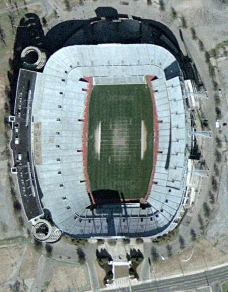 18 mi Stadium & arenaLegion Field
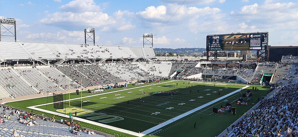 16 mi Stadium & arenaProtective Stadium
 15 mi MuseumSloss Furnaces
 16 mi Stadium & arenaLegacy Arena33 mi LakeLewis Smith Lake
 32 mi MuseumInternational Motorsports Hall of Fame
Legion Field: USGS, Public domain · Protective Stadium: Unknown, CC BY-SA 4.0 · Sloss Furnaces: DXR, CC BY-SA 4.0 · Legacy Arena: AuburnShuffle, CC0 · International Motorsports Hall of Fame: BWard 1997, CC BY 4.0
Who provides power, water and the rest in Clay, and how to reach them.
EPA SDWIS (Oct 9, 2026) · HIFLD + EIA-861 2025 · Census 2020 ZCTAs · NCES 2024–25 · registration: vote.gov, updated Nov 18, 2024.
Ordered by what stands out in Clay.
Clay looks healthier within Alabama than nationally and has hotter summers than most of the country, though not than most of Alabama; it also has little public open land.
Clay has 1,231 jobs for its 4,493 working residents: even if every job went to a resident, most would still commute out.
Most working residents leave Clay for work: only 1% work in town. Clay’s average trip to work is 32 minutes. Since 2013, Clay has added 185 jobs, to 1,231 in 2023.
| Clay | Alabama towns | U.S. towns | |
|---|---|---|---|
| Average trip to work | 32 minutes | 25 minutes | 25 minutes |
| Working residents who work in town | 1.5% | 10% | 8% |
| Below the poverty line | 17% | 16% | 9.6% |
| Work from home | 6.4% | 6.7% | 11% |
Census LEHD 2023 · ACS
Its public schools are run by the Jefferson County school district. Two of its 4 schools are below, each with why it’s listed. The largest public high school is ClayChalkville High School, with 1,377 students.
| School | Level | Students | Letter |
|---|---|---|---|
| ClayChalkville Middle SchoolLargest public middle schoolGrades 6–8 | Grades 6–8 | 952 | C− |
| ClayChalkville High SchoolLargest public high schoolGrades 9–12 | Grades 9–12 | 1,377 | D |
NCES · EDFacts · graded within AL on state tests and graduation
July afternoons average 89.5°: hotter than most of the country, but cooler than 83% of Alabama places with climate records; January nights average 32.4°.
Clay has mild winters and warm summers, with plenty of rain. The July high in Clay is 90°F. Snow is almost unheard of.
| Clay | Alabama towns | U.S. towns | |
|---|---|---|---|
| July high | 90°F | 91°F | 85°F |
| January low | 32°F | 33°F | 22°F |
NOAA U.S. Climate Normals, 1991–2020
Children under 18 are 28% of residents (22% statewide); adults 18 to 34 are 17% of residents (22% statewide). 23% of adults 25 and older have a bachelor’s degree or more, vs 28% across Alabama.
| Clay | Alabama towns | U.S. towns | |
|---|---|---|---|
| Bachelor’s degree or more, 25+ | 23% | 23% | 29% |
| Aged 65 or older | 19% | 18% | 18% |
53% women, 47% men
About 89 men for every 100 women (the survey’s margin: ±3.1 points). Across Alabama, 51.4% of residents are women.
| Clay | AL | U.S. | |
|---|---|---|---|
| Under 10 | 14.3% | 11.8% | 11.6% |
| 10 to 17 | 13.9% | 10.4% | 10.3% |
| 18 to 24 | 6.2% | 9.5% | 9.1% |
| 25 to 34 | 10.4% | 12.9% | 13.7% |
| 35 to 44 | 13% | 12.4% | 13.2% |
| 45 to 54 | 11.4% | 12.2% | 12.2% |
| 55 to 64 | 12% | 13% | 12.7% |
| 65 to 74 | 11% | 10.7% | 10.2% |
| 75 and older | 7.9% | 7.1% | 7% |
| No diploma | 6.9% | 11.4% | 10.4% |
| High school | 31.1% | 30.3% | 26% |
| Some college | 26.3% | 20.8% | 19.1% |
| Associate’s | 12.5% | 9.1% | 8.8% |
| Bachelor’s | 16.4% | 17.3% | 21.6% |
| Graduate | 6.8% | 11.1% | 14.1% |
U.S. Census Bureau · ACS 2020-2024 5-year estimates
Within Alabama it is healthier than 60% of the 187 graded towns: much of Alabama scores lower on these measures.
Clay tracks Alabama closely on all 32 CDC measures. 38% of Clay adults feel lonely.
| Clay | Alabama towns | U.S. towns | |
|---|---|---|---|
| Feel lonely (CDC PLACES) | 38% | 36% | 33% |
| High blood pressure (CDC PLACES) | 43% | 43% | 35% |
| Diabetes (CDC PLACES) | 15% | 15% | 12% |
| Food insecurity (CDC PLACES) | 19% | 19% | 14% |
CDC PLACES 2025 · modeled estimates for adults · CMS · HRSA
Expected storm and flood damage is lower than in 58% of U.S. communities. One flood insurance claim has been paid in Clay since 2013.
FEMA flood insurance claims · FEMA National Risk Index · OpenFEMA
The typical Clay home is worth about $249,000, up 0.9% in a year, close to the Alabama typical home. 91% of households own their home in Clay.
Census ACS, 2020–24 · Zillow Home Value Index · Redfin Data Center
Just 126 of its 7,239 acres are conserved, so there is little public open land in Clay itself; its outdoors grade is C−.
0.7 miles of trail in 1 park or preserve. The biggest park or preserve is Cosby Lake Park, at 31 acres.
| Clay | Alabama towns | U.S. towns | |
|---|---|---|---|
| Miles of trail per square mile | 0.1 miles per square mile | 0.1 | 0.4 |
| Conserved land | 1.7% | 1.2% | 4.3% |
| Biggest places to walk | Trails | Acres |
|---|---|---|
| 1. Cosby Lake Park | 0.6 mi | 31 |
Trails & parks © OpenStreetMap contributors · Conserved land: USGS PAD-US
1 within 15 miles of the center of Clay
About 3 of every 100 Clay residents are enrolled in college, against 6 across Alabama.
City in Alabama, United States
Clay is a city in northeastern Jefferson County, Alabama, United States. It is part of the Birmingham–Hoover–Cullman Combined Statistical Area in the north-central part of the state. Local government is run by a mayor and city council. As of the 2020 census, Clay had a population of 10,291. Before incorporation on June 6, 2000, it was a census-designated place (CDP). The oldest church in Jefferson County, Mount Calvary Presbyterian Church, is located in Clay. The congregation has been meeting continually since 1806, when it was established by early Scots-American settlers. On January 23, 2012, a total of 231 homes and businesses were either damaged or destroyed when an EF3 tornado passed th…
From Wikipedia, licensed CC BY-SA 4.0 · facts via Wikidata (CC0)
4 towns share a border with Clay.
| Town | AL rank | Overall | Cost | Safety | Schools | Health |
|---|---|---|---|---|---|---|
| Clay | #132 | D | C+ | — | C | C+ |
| Trussville | #21 | A− | C+ | C+ | A+ | A |
| Grayson Valley | #113 | C− | B− | — | C | B− |
| Pinson | #146 | D | B− | — | C | C− |
| Center Point | #116 | C− | B | — | C | D− |
Clay, Grayson Valley, Pinson and Center Point report no FBI crime data of their own. Compare Clay with a neighbor →
Short answers, built from the data on this page.
Clay grades D overall, better than 14% of U.S. towns and #132 of 187 in Alabama. It grades C+ for health and C for schools. Walkability is its weak spot, with a C−.
That is 3.5 years of the area's median household income ($71,498 across the Birmingham, AL metro area). Cost of living, which also weighs rents, property taxes and how many households pay 30% or more of their income for housing, grades C+.
2 notable people were born here, including Clayne Crawford and Hayden Moore.


