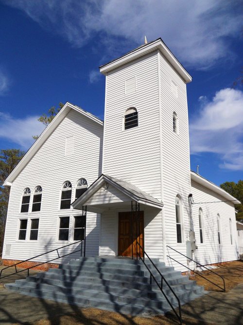
Notasulga’s post office opened in 1849, and 26% of its homes were built before 1940
3 places in town are on the National Register, among them two historic districts with 8 buildings between them. Below: 2 old photos and papers, maps from 1906 on, and the census since 1880.
The Notasulga post office opened in 1849, the earliest record of the town by name. Another post office, Moore's Cross Roads (1843), opened inside today’s town and later closed.
First census: 236 in 18802020 census: 914177 years
Founding year: the first Notasulga post office (Blevins & Helbock, CC0).
What stands out about Notasulga’s past
Read from the archive, the National Register and the record. The page puts what stands out first.
Wikipedia doesn’t have a history of Notasulga yet. The photos, dates and memories neighbors add here are how it gets written.
Notasulga is a town in Macon and Lee counties in the U.S. state of Alabama. As of the 2020 census, the population of the town was 914. The portion in Lee County is part of the Auburn Metropolitan Area. According to the 1910 U.S. Census, it incorporated in 1893. Author Zora Neale Hurston was born in Notasulga in 1891. The town name comes from the Creek words noti sulgi, which means "many teeth".
Its first post office opened in 1849. Between the 2010 and 2020 censuses its population fell from 965 to 914 (-5%).
Intro from Wikipedia. Population: U.S. Census Bureau.
Lost post offices, places now gone and burying grounds
Notasulga’s post office has been open since 1849. Another post office, Moore's Cross Roads, opened and closed inside today’s town.
Moore's Cross Roads
1843–1849
Notasulga
1849–today
18401930today
Gone or out of use
Apple Grove ChurchchurchMacedonia Schoolschool
2cemeteries and burying grounds inside Notasulga
BethlehemNotasulga City
US Post Offices dataset (Blevins & Helbock, CC0). Places and cemeteries from the USGS Geographic Names Information System (2021).
Questions about Notasulga’s history
What year was Notasulga founded?
The Notasulga post office opened in 1849, the earliest record of the town by name (U.S. post office records).
What is on the National Register in Notasulga?
Three places: the Shiloh Missionary Baptist Church and Rosenwald School (listed 2010), the Shiloh Missionary Baptist Church Cemetery (2016) and the Macon County High School (2020).
Founding dates: Wikidata, Wikipedia, the U.S. post office records of Blevins & Helbock (CC0) and the Census. Homes by year built: Census ACS 2020–24. National Register of Historic Places: National Park Service (list of May 22, 2026). Old photos, postcards and papers: Wikimedia Commons, the Library of Congress and other public archives, credited on each item’s page. Maps: U.S. Geological Survey historical topographic maps (via Esri) and Sanborn fire-insurance maps (Library of Congress). History text and census tables: Wikipedia (CC BY-SA 4.0). Places that used to be: USGS Geographic Names Information System (2021). How TownRatings grades history →
From Wikimedia Commons (6), the National Register of Historic Places (3), Wikidata and Wikipedia for famous people, U.S. Geological Survey historical maps, U.S. Census counts (via Wikipedia), the US Post Offices dataset (Blevins & Helbock) and the USGS Geographic Names Information System. Archive images are copied here with their credits and licenses, shown on each photo’s page. Refreshed monthly.


 Date?
 Date?
 2017
 2012
 2007
 2006