Loachapoka’s post office opened in 1874, and 1 of its places is on the National Register
Most of Loachapoka was built recently: 8% of its homes predate 1940 and the median home dates from 1974. 1 place in town is on the National Register, among them a historic district with 17 buildings. Below: 6 old photos and papers, maps from 1971 on, and the census since 1880.
Loachapoka was a Creek Indian town for some decades prior to white settlement. In the last census prior to the Native removal to Oklahoma, Loachapoka was found to have a population of 564. During the Creek War of 1836, Loachapoka was a center of rebellion; the town was destroyed by a force of Alabama and Georgia militia and friendly Creeks on May 15, 1836. Upon settlement by Euro-Americans, Loachapoka—temporarily renamed Ball's Fork—became the regional trade center, a position that was reinforced in 1845, when it became the easternmost point on the railroad to Montgomery. Loachapoka's influence peaked in the early 1870s, when its population reached nearly 1,300. Within a few years, a collapse of trade due to the Panic of 1873 and additional rail lines in the area sent Loachapoka into economic decline. Loachapoka roughly stabilized as a small farming community by the mid-20th century, an…
Nothing in the archives for these yearsWeddings on Main Street, storms, parades, school pictures, the old store. If it’s in your family album, it belongs here.
Founding dates: Wikidata, Wikipedia, the U.S. post office records of Blevins & Helbock (CC0) and the Census. Homes by year built: Census ACS 2020–24. National Register of Historic Places: National Park Service (list of May 22, 2026). Old photos, postcards and papers: Wikimedia Commons, the Library of Congress and other public archives, credited on each item’s page. Maps: U.S. Geological Survey historical topographic maps (via Esri) and Sanborn fire-insurance maps (Library of Congress). History text and census tables: Wikipedia (CC BY-SA 4.0). Places that used to be: USGS Geographic Names Information System (2021). How TownRatings grades history →
From Wikimedia Commons (21), the National Register of Historic Places (1), Wikipedia, Wikidata and Wikipedia for famous people, U.S. Geological Survey historical maps, U.S. Census counts (via Wikipedia), the US Post Offices dataset (Blevins & Helbock) and the USGS Geographic Names Information System. Archive images are copied here with their credits and licenses, shown on each photo’s page. Refreshed monthly.


 1933
 1933
 1933
 Date?
 Date?
 2012
 2012
 2012
 2007
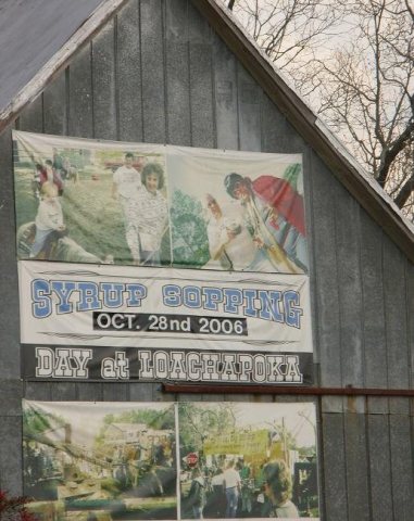 2007
 2007
 2007
 2007
 2007
 2007
 2007
 2007
 2007
 2007
 2006


