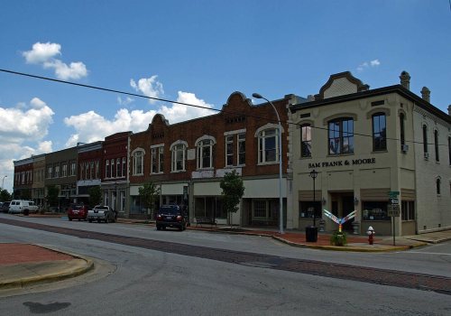
205 years in pictures
Census counts: 606 in 1850, 57,938 in 2020. The archive holds 18 old photos and papers going back to 1880 and 5 maps from 1936 on.
15 places on the National Register of Historic Places.
- 1821Decatur is settled
Each edition grades its towns against each other only.

Decatur gives you more for your money than most places: homes are within reach, about $220K for a typical one, or 3.2 years of the Decatur metro’s $68K median household income. It grades C− overall, ranked 110th of 187 in Alabama. The low prices come with trade-offs. Its police reported 366 violent crimes reported to the FBI in 2025, a higher rate per resident than 87% of U.S. towns, and residents are less healthy than 83% of U.S. towns on CDC estimates. 33% of working residents work locally in Decatur, above both the Alabama town median (9.8%) and the median of U.S. towns (8%). Its National Register listings include Southern Railway Depot and Bank Street Historic District. On the outdoors, just 10 of Alabama’s 308 towns do better.
Where Decatur beats most towns.
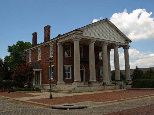
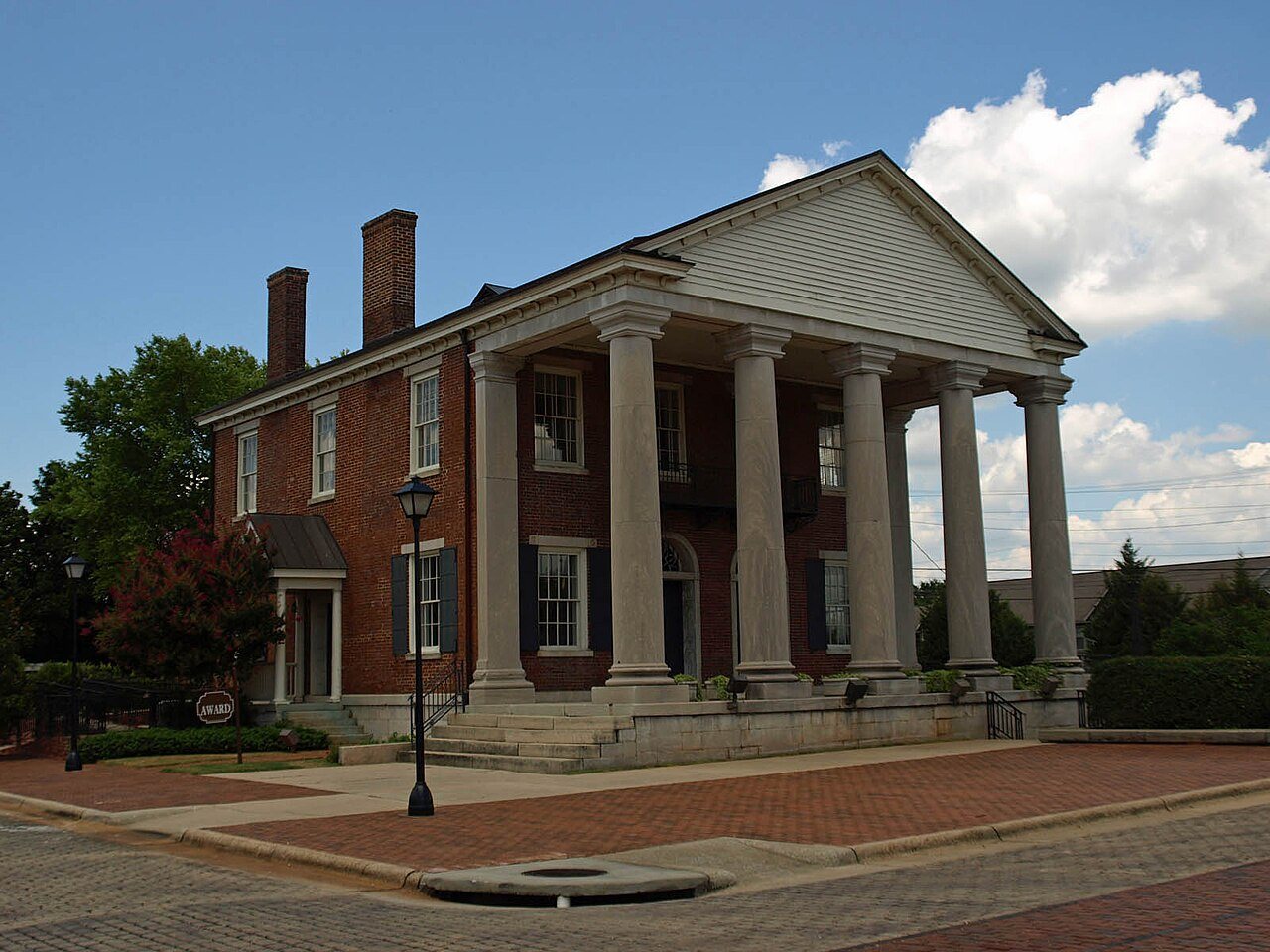
State Bank Building, Decatur Branch (Additional Documentation)
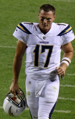
Mae Jemison
Census counts: 606 in 1850, 57,938 in 2020. The archive holds 18 old photos and papers going back to 1880 and 5 maps from 1936 on.
15 places on the National Register of Historic Places.
Each subject compared with towns across the country (schools within Alabama), ordered by how far Decatur is from typical.
How TownRatings grades towns →
Who provides power, water and the rest in Decatur, and how to reach them.
EPA SDWIS (Oct 9, 2026) · HIFLD + EIA-861 2025 · Census 2020 ZCTAs · NCES 2024–25 · registration: vote.gov, updated Nov 18, 2024.
Ordered by what stands out in Decatur.
Decatur has more 90° days than most of the country, though not than most of Alabama; it also reports more crime than Huntsville and its other graded neighbors and scores below Trinity and its other neighbors on health.
28 miles of trail in 26 parks and preserves. Wheeler National Wildlife Refuge, at 4,378 acres with 4.3 miles of trail, is the biggest park or preserve.
| Biggest places to walk | Trails | Acres |
|---|---|---|
| 1. Wheeler National Wildlife Refuge | 4.3 mi | 4,378 |
| 2. Wilson Morgan Park | 2.9 mi | 118 |
| 3. Point Mallard Park | 2.1 mi | 218 |
Trails & parks © OpenStreetMap contributors · Conserved land: USGS PAD-US
Its public schools are run by the Decatur City school district. Three of its 24 schools are below, each with why it’s listed.
| School | Level | Students | Letter |
|---|---|---|---|
| Decatur Middle SchoolLargest public middle schoolGrades 6–8 | Grades 6–8 | 818 | C+ |
| Austin High SchoolLargest public high schoolGrades 9–12 | Grades 9–12 | 999 | C |
| Leon Sheffield Magnet Elementary SchoolTop results in townGrades 3–5 | Grades 3–5 | 297 | A |
NCES · EDFacts · graded within AL on state tests and graduation
Each of the 4 graded towns on its borders reports less crime per resident, from Huntsville (C) to Priceville (B+).
Decatur’s violent crime rate is 6.3 per 1,000 residents. Decatur reports more crime per resident than most U.S. towns we grade: about 87% report less. Decatur’s property crime rate is 17.1 per 1,000 residents.
| Decatur | Alabama towns | U.S. towns | |
|---|---|---|---|
| Violent crimes per 1,000 (2025) | 6.3 per 1,000 residents | 2.9 | 1.6 |
| Property crimes per 1,000 (2025) | 17.1 per 1,000 residents | 16.9 | 9.9 |
FBI crime data, 2025 · crimes reported to police
All 4 graded neighbors score healthier than its C−, from Trinity (C+) to Priceville (A−).
46% of adults have high blood pressure in Decatur. Decatur beats the Alabama average on 0 of 32 CDC measures and trails it on 7. 16% of adults have diabetes in Decatur.
| Decatur | Alabama towns | U.S. towns | |
|---|---|---|---|
| High blood pressure (CDC PLACES) | 46% | 43% | 35% |
| Diabetes (CDC PLACES) | 16% | 15% | 12% |
| Food insecurity (CDC PLACES) | 24% | 19% | 14% |
| Fair or poor health (CDC PLACES) | 27% | 23% | 19% |
| What stands out | Decatur | AL |
|---|---|---|
| More uninsured adults | 14.1% | 9.9% |
| More adults facing food insecurity | 23.6% | 19.2% |
| More adults facing housing insecurity | 17% | 13.9% |
CDC PLACES 2025 · modeled estimates for adults · CMS · HRSA
The Belle Mina 2 N weather station, 10 miles away, records that about 61 days a year reach 90°: more than most of the country, but fewer than 92% of Alabama places with climate records. January nights average 30.8°: milder than most of the country, but colder than 90% of Alabama places with climate records; July afternoons average 90°.
Decatur has mild winters and warm summers, with plenty of rain. The July high in Decatur is 90°F. About 1 inches of snow falls in a winter.
| Decatur | Alabama towns | U.S. towns | |
|---|---|---|---|
| July high | 90°F | 91°F | 85°F |
| January low | 31°F | 33°F | 22°F |
NOAA U.S. Climate Normals, 1991–2020
About one in 3 of Decatur’s working residents works in town. Since 2013, Decatur has added 2,316 jobs, to 31,125 in 2023. The top destinations are Huntsville (21%), Madison (3%) and Athens (3%).
| Decatur | Alabama towns | U.S. towns | |
|---|---|---|---|
| Average trip to work | 21 minutes | 25 minutes | 25 minutes |
| Below the poverty line | 13% | 16% | 9.6% |
| Work from home | 6.6% | 6.7% | 11% |
| Median household income | $62,000 | $62,000 | $80,000 |
Census LEHD 2023 · ACS
Expected storm and flood damage is higher than in 62% of U.S. communities. Since 1980, 82 flood insurance claims have been paid out in Decatur.
FEMA flood insurance claims · FEMA National Risk Index · OpenFEMA
No broad age group is more than 4 points off the Alabama average. 22% of adults 25 and older have a bachelor’s degree or more, vs 28% across Alabama.
| Decatur | Alabama towns | U.S. towns | |
|---|---|---|---|
| Bachelor’s degree or more, 25+ | 22% | 23% | 29% |
| Under 18 | 24% | 23% | 22% |
50% women, 50% men
That’s an even split within the survey’s margin of ±1.3 points. Across Alabama, 51.4% of residents are women. Median age: women 41.3, men 37.7.
| Decatur | AL | U.S. | |
|---|---|---|---|
| Under 10 | 12.9% | 11.8% | 11.6% |
| 10 to 17 | 10.9% | 10.4% | 10.3% |
| 18 to 24 | 7.8% | 9.5% | 9.1% |
| 25 to 34 | 12.5% | 12.9% | 13.7% |
| 35 to 44 | 12.7% | 12.4% | 13.2% |
| 45 to 54 | 11% | 12.2% | 12.2% |
| 55 to 64 | 14.1% | 13% | 12.7% |
| 65 to 74 | 11% | 10.7% | 10.2% |
| 75 and older | 7% | 7.1% | 7% |
| No diploma | 15.2% | 11.4% | 10.4% |
| High school | 30.1% | 30.3% | 26% |
| Some college | 23.5% | 20.8% | 19.1% |
| Associate’s | 8.8% | 9.1% | 8.8% |
| Bachelor’s | 15.2% | 17.3% | 21.6% |
| Graduate | 7.2% | 11.1% | 14.1% |
U.S. Census Bureau · ACS 2020-2024 5-year estimates
The typical Decatur home is worth about $220,000, down 0.9% in a year, 8% below the Alabama typical home. 63% of Decatur households own their home.
| Decatur | Alabama towns | U.S. towns | |
|---|---|---|---|
| Households that own their home | 63% | 70% | 73% |
| Median rent | $896 a month | $943 a month | $1,185 a month |
Census ACS, 2020–24 · Zillow Home Value Index · Redfin Data Center
1 within 15 miles of the center of Decatur
About 5 of every 100 Decatur residents are enrolled in college, about the same as Alabama.
14.6% of the town is conserved land, across 26 parks and preserves.
15 places in Decatur on the National Register of Historic Places.
50 notable people were born in Decatur.
City in and county seat of Morgan County, Alabama
Decatur () is the largest city in and the county seat of Morgan County (with a portion also in Limestone County) in the U.S. state of Alabama. Nicknamed "The River City," it is located in northern Alabama on the banks of Wheeler Lake along the Tennessee River. The population was 57,938 at the 2020 census. Decatur is the core city of the two-county large Decatur metropolitan area, with an estimated population of 157,425 in 2022. Combined with the Huntsville Metropolitan Area, the two create the Huntsville-Decatur Combined Statistical Area, of which Decatur is the second-largest city. Like many southern cities in the early 19th century, Decatur's early success was based upon its location alon…
From Wikipedia, licensed CC BY-SA 4.0 · facts via Wikidata (CC0)
4 towns share a border with Decatur.
All 4 graded towns on its borders grade higher than its C−; Huntsville (B−) is closest.
| Town | AL rank | Overall | Cost | Safety | Schools | Health |
|---|---|---|---|---|---|---|
| Decatur | #110 | C− | B+ | D | B | C− |
| Priceville | #4 | A | A | B+ | B | A− |
| Trinity | #35 | B+ | A | B | B | C+ |
| Huntsville | #61 | B− | B | C | B | B− |
| Hartselle | #37 | B+ | A | C | A | B− |
Short answers, built from the data on this page.
Decatur grades C− overall, better than 22% of U.S. towns and #110 of 187 in Alabama. It grades C− for health, D for safety and B for schools. Safety is its weak spot, with a D.
Within Alabama, it does better than 35% of towns.
Not for the area. Cost of living, which also weighs rents, property taxes and how many households pay 30% or more of their income for housing, grades B+.
50 notable people were born here, including Mae Jemison and Lucas Black.