Cuba’s post office opened in 1854, and 14% of its homes were built before 1940
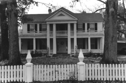
Its Register listings are the Dr. H. B. Ward House and the Dr. James Alvis Beavers House. Below: 1 old photo or paper, maps from 1974 on, and the census since 1880.
The Cuba post office opened in 1854, the earliest record of the town by name. Another post office, Cuba Station (1866), opened inside today’s town and later closed.
First census: 232 in 18802020 census: 306172 years
Founding year: the first Cuba post office (Blevins & Helbock, CC0).The full story ↓
What stands out about Cuba’s past
Read from the archive, the National Register and the record. The page puts what stands out first.
The Cuba post office existed prior to 1850, with nothing in the present-day area of the town of Cuba but wilderness. The first people to live in this site were a slaveowner named Mr. R.A. Clay, who moved from Autauga County with his family and approximately 100 slaves in 1852, and purchased all the land which later made up the town of Cuba. By 1861, the town was a thriving farming industry and had a sizable truck-crop enterprise. Also during this time, the Northeast and Southwest Railroad (later the Alabama Great Southern Railroad, Southern Railway and now Norfolk Southern) was being built. Clay donated land for the railroad right-of-way, built mainly by the people he enslaved. As the town was settled, the post office became known as Cuba Station. The Town of Cuba was incorporated in 1890 with Dr. A.L. Vaughan as its first mayor.
Founding dates: Wikidata, Wikipedia, the U.S. post office records of Blevins & Helbock (CC0) and the Census. Homes by year built: Census ACS 2020–24. National Register of Historic Places: National Park Service (list of May 22, 2026). Old photos, postcards and papers: Wikimedia Commons, the Library of Congress and other public archives, credited on each item’s page. Maps: U.S. Geological Survey historical topographic maps (via Esri) and Sanborn fire-insurance maps (Library of Congress). History text and census tables: Wikipedia (CC BY-SA 4.0). Places that used to be: USGS Geographic Names Information System (2021). How TownRatings grades history →
From Wikimedia Commons (8), the National Register of Historic Places (2), Wikipedia, Wikidata and Wikipedia for famous people, U.S. Geological Survey historical maps, U.S. Census counts (via Wikipedia), the US Post Offices dataset (Blevins & Helbock) and the USGS Geographic Names Information System. Archive images are copied here with their credits and licenses, shown on each photo’s page. Refreshed monthly.


 Date?
 2018
 2017
 2016
 2014
 2009
 2009
 2004