Guest, Sign inJoin

Post to Tenakee Springs

We’ll email a one-tap link to publish your post. No password, and nothing is public until you click it.
Already a member? Sign in
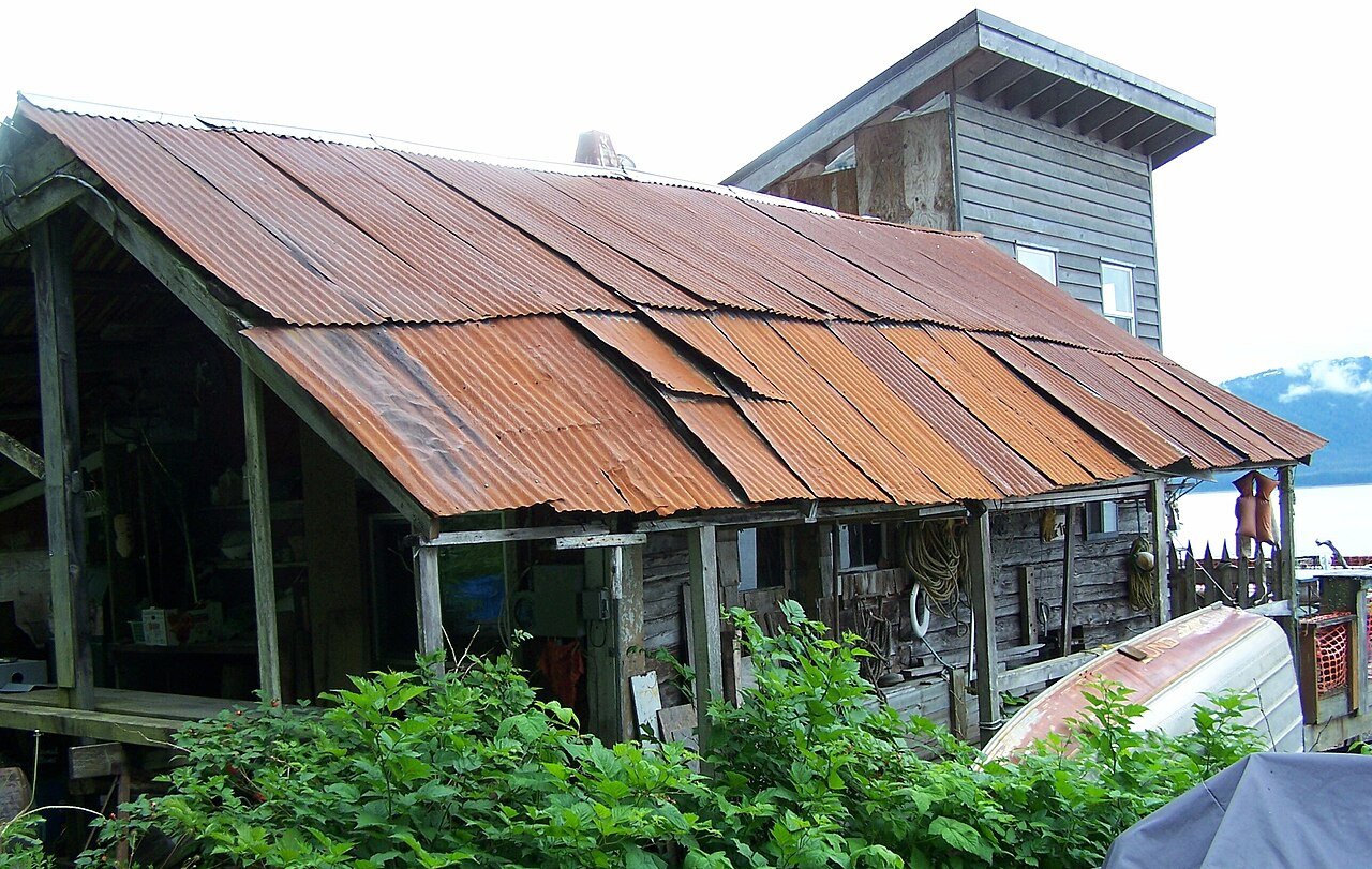
Building in Tenekee Springs AlaskaPhoto: 10point · CC BY 2.0
–Not graded
Outdoors in Tenakee Springs

More than half of Tenakee Springs’ land is conserved: 64%

64% of Tenakee Springs’ land is conserved, about 5,344 acres. 2.4 miles of mapped trail cross Tenakee Springs, 0.2 per square mile of land.

Conserved land
64%
5,344 acres · of 13.1 sq mi of land
Trails
2.4 mi
0.2 per sq mi of land
Near a park
under 1%
of residents within ½ mile
Lakes & rivers
1
The map

Conserved land, trails & bike routes

Tap a number to zoom to a park. Tap a layer to hide it.

1
Easements protect land from building but are usually private.© OpenStreetMap contributors · USGS PAD-US
Places to walk

Pick a walk

Directions go to the nearest trailhead or public parking.

Tongass National Forest

Managed by United States Forest Service
3,488 acres
Dog rules not recorded
No trailhead mapped yet
Who protects it

5,344 conserved acres

64% of Tenakee Springs’ land. Water is left out: Tenakee Springs has 13.1 square miles of land and 4.8 of water, so the share counts land only. Who manages Tenakee Springs’s conserved land, from the USGS Protected Areas Database. Approximate, because parcels can overlap.

U.S. Forest Service3,471 ac
State natural resources1,873 ac
National Forest · 3,471 acState Other or Unknown · 1,873 ac
Good to know

Conserved doesn’t always mean open to visitors. Public access isn’t recorded for 2 of 3 parcels. The walks above are places people visit.

The biggest protected parcels
Parcel (PAD-US)Managed byAcresPublic access
Tongass National Forest
National Forest
U.S. Forest Service3,471Open
State Patented
State Other or Unknown
State natural resources1,505Unknown
State Land Disposals - Other Than Municipal
State Other or Unknown
State natural resources368Unknown
Trails & water

3 named trails and 1 lakes & rivers

Named trails
Indian River Trail1.3 mi
West Tenakee Trail1.0 mi
East Tenakee Trail0.1 mi
Lakes & rivers tap for directions
When to get out

The best walking months in Tenakee Springs: June to August

NOAA’s 1991–2020 normals for the town and the daylight at its latitude. Outlined months have long days, highs of 59 to 86 °F and little rain for the place.

JanFebMarAprMayJunJulAugSepOctNovDec
Daylight (h)7.29.311.614.316.618.117.515.312.710.17.86.5
High (°F)343740495862656458483936
Rain (in)6.85.04.43.12.52.73.34.97.39.28.87.9

May is the driest month (2.5 in) and July the warmest (highs of 65 °F). 9.2 inches fall in October, the wettest month. The climate in Tenakee Springs →

Questions about parks and trails in Tenakee Springs

Are dogs allowed on Tenakee Springs’ trails?

Tongass National Forest doesn’t have dog rules recorded on the map; check the signs at the trailhead.

Is there public land near Tenakee Springs?

80,674 acres of parks and open public land lie inside Tenakee Springs or within 10 miles of it (PAD-US), 999 of them inside the city line.

Trail talk

Conditions, parking and favorite walks from Tenakee Springs neighbors.

Town Square →
Share a tip
Sources

Where this page comes from

Conserved and public land: USGS Protected Areas Database of the United States (PAD-US), service updated July 2026. Parks, trails, playgrounds, beaches and other places: OpenStreetMap (© OpenStreetMap contributors, ODbL), map data as of 2026-10-28. Land and water area: Census 2025 Gazetteer. Residents near a park: 2020 Census blocks. National Register: National Park Service. How TownRatings grades the outdoors →