Holy Cross was first counted by the census in 1880
Most of Holy Cross was built recently: 0.9% of its homes predate 1940 and the median home dates from 1982. Below: 10 old photos and papers, maps from 1952 on, and the census since 1880.
Peaked at 337 in 1930; 176 people lived here in 2020.
14 censuses, 1880–2020.
U.S. Census Bureau decennial counts, from the census table on Holy Cross’ Wikipedia page.
Places that used to be
Lost post offices, old corners and places now gone
Holy Cross’s post office has been open since 1912. Another post office, Koserefsky, opened and closed inside today’s town.
Koserefsky
1899–1912
Holy Cross
1912–today
18901960today
Hamlets and corners on the map
ClaikahakGost CreekIgnok
Gone or out of use
Kuyikanuikpullocale
US Post Offices dataset (Blevins & Helbock, CC0). Places and cemeteries from the USGS Geographic Names Information System (2021).
The story so far
Holy Cross, in brief
Wikipedia doesn’t have a history of Holy Cross yet. The photos, dates and memories neighbors add here are how it gets written.
Holy Cross (Degexit'an: Deloy Chet; Central Yupik: Ingirraller) is a city in Yukon-Koyukuk Census Area, Alaska, United States. As of the 2020 census, Holy Cross had a population of 176.
Its first post office opened in 1880. Its population held steady between the last two censuses: 178 in 2010, 176 in 2020.
Intro from Wikipedia. Population: U.S. Census Bureau.
Timeline
Holy Cross, 1890 to 1999
Woven from the archive, old maps, post office records, the National Register and the people born here.
Nothing in the archives for these yearsWeddings on Main Street, storms, parades, school pictures, the old store. If it’s in your family album, it belongs here.
Founding dates: Wikidata, Wikipedia, the U.S. post office records of Blevins & Helbock (CC0) and the Census. Homes by year built: Census ACS 2020–24. National Register of Historic Places: National Park Service (list of May 22, 2026). Old photos, postcards and papers: Wikimedia Commons, the Library of Congress and other public archives, credited on each item’s page. Maps: U.S. Geological Survey historical topographic maps (via Esri) and Sanborn fire-insurance maps (Library of Congress). History text and census tables: Wikipedia (CC BY-SA 4.0). Places that used to be: USGS Geographic Names Information System (2021). How TownRatings grades history →
From Wikimedia Commons (10), U.S. Geological Survey historical maps, U.S. Census counts (via Wikipedia), the US Post Offices dataset (Blevins & Helbock) and the USGS Geographic Names Information System. Archive images are copied here with their credits and licenses, shown on each photo’s page. Refreshed monthly.


 1901
 1904
 1904
 1909
 1914
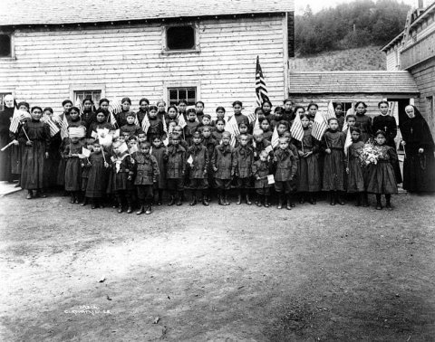 1914
