Most of Cold Bay was built recently: 0.0% of its homes predate 1940 and the median home dates from 1989. Below: 12 old photos and papers, maps from 1943 on, and the census since 1890.
Nothing in the archives for these yearsWeddings on Main Street, storms, parades, school pictures, the old store. If it’s in your family album, it belongs here.
There is evidence of prehistoric occupation by Aleuts and later Russian encampments. Cold Bay's significance to American history began with the Japanese invasion of the Aleutians in World War II. General Simon Bolivar Buckner, Jr. ordered the creation of Fort Randall, an airbase on the shores of Cold Bay, in 1942 as a part of a general expansion of American assets in the Aleutians. It (along with Otter Point) served as a base for the 11th Air Force to provide protection to the only deep water port in the Aleutians at the time, Dutch Harbor.
Founding dates: Wikidata, Wikipedia, the U.S. post office records of Blevins & Helbock (CC0) and the Census. Homes by year built: Census ACS 2020–24. National Register of Historic Places: National Park Service (list of May 22, 2026). Old photos, postcards and papers: Wikimedia Commons, the Library of Congress and other public archives, credited on each item’s page. Maps: U.S. Geological Survey historical topographic maps (via Esri) and Sanborn fire-insurance maps (Library of Congress). History text and census tables: Wikipedia (CC BY-SA 4.0). Places that used to be: USGS Geographic Names Information System (2021). How TownRatings grades history →
From Wikimedia Commons (12), Wikipedia, U.S. Geological Survey historical maps, U.S. Census counts (via Wikipedia), the US Post Offices dataset (Blevins & Helbock) and the USGS Geographic Names Information System. Archive images are copied here with their credits and licenses, shown on each photo’s page. Refreshed monthly.


 c. 1910
 c. 1912
 c. 1912
 c. 1912
 c. 1912
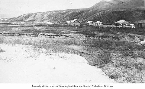 1919
 1933
 1933
 1933
 1942
 1954
 1972


