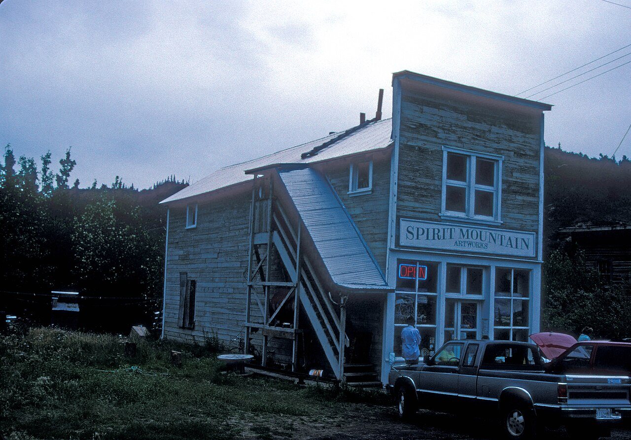
116 years in pictures
Census counts: 171 in 1920, a low of 31 in 1960, 101 in 2020. The archive holds 6 old photos and papers going back to 1914 and 2 maps from 1951 on.
2 places on the National Register of Historic Places.
- 1910Chitina is settled
Each edition grades its towns against each other only.

A town of 100, settled in 1910.
Chitina’s average commute is 4 minutes, where Alaska’s towns sit at 21 minutes and U.S. towns at 25 minutes. Of the 42 Alaska towns we compare, none has a lower share of adults with a bachelor’s degree than Chitina. The biggest place to walk is Wrangell-Saint Elias National Park, 39,597 acres with 18.8 miles of trail. Chitina has fewer than 1,000 residents, too few for fair grades; the figures below are still real.
Census counts: 171 in 1920, a low of 31 in 1960, 101 in 2020. The archive holds 6 old photos and papers going back to 1914 and 2 maps from 1951 on.
2 places on the National Register of Historic Places.
In a town this size, neighbors are the best guide. Ask them anything.
Ordered by what stands out in Chitina.
Storm and flood damage is expected to run higher than in 84% of U.S. communities. Expected losses in Chitina break down as 76% from avalanches and 11% from earthquakes.
FEMA National Risk Index · OpenFEMA
Chitina’s typical July afternoon high is recorded as 70°F.
NOAA U.S. Climate Normals, 1991–2020
11% of adults have diabetes in Chitina. Among 42 Alaska towns, just 4 have a higher share of adults who had a checkup this year than Chitina. This Alaska town does better than the Alaska average on 1 of 32 CDC measures and worse on 7.
| Chitina | Typical Alaska town | Typical U.S. town | |
|---|---|---|---|
| Yearly checkup (CDC PLACES) | 72% | 68% | 79% |
| High blood pressure (CDC PLACES) | 39% | 32% | 35% |
| Frequent physical distress (CDC PLACES) | 16% | 13% | 14% |
| Fair or poor health (CDC PLACES) | 21% | 18% | 19% |
| What stands out | Chitina | AK |
|---|---|---|
| More adults treating high blood pressure | 75.2% | 68% |
| More adults who have had cancer | 10.4% | 7% |
CDC PLACES 2025 · modeled estimates for adults · CMS · HRSA
Count the trails in 4 parks and preserves and they come to 21 miles. Chitina’s parks and preserves take up 39,894 acres in all.
| Biggest places to walk | Trails | Acres |
|---|---|---|
| 1. Wrangell-Saint Elias National Park | 18.8 mi | 39,597 |
| 2. Wrangell-Saint Elias National Preserve | — | 288 |
| 3. Wrangell-Saint Elias Wilderness | — | 7 |
Trails & parks © OpenStreetMap contributors · Conserved land: USGS PAD-US
Only 2 of the 42 Alaska towns we compare have a lower owner-occupancy rate than Chitina.
Census ACS, 2020–24 · Zillow Home Value Index · Redfin Data Center
Chitina is unincorporated, so Copper River Census Area and regional agencies provide most services.
EPA SDWIS (Oct 9, 2026) · HIFLD + EIA-861 2025 · Census 2020 ZCTAs · NCES 2024–25 · registration: vote.gov, updated Sep 30, 2026.
None within 15 miles of Chitina; the nearest are
About 3 of every 100 Chitina residents are enrolled in college, against 5 across Alaska.
CDP in Alaska, United States
Chitina (Ahtna Athabascan Tsedi Na' [tʃɛ.diː.näʔ] < tsedi "copper" + na' "river") is a census-designated place (CDP) in Copper River Census Area, Alaska, United States. As of the 2020 census, Chitina had a population of 101.
From Wikipedia, licensed CC BY-SA 4.0 · facts via Wikidata (CC0)
Short answers, built from the data on this page.
Chitina has fewer than 1,000 residents, too few for fair grades; the figures below are still real.
Ask a question, answer one, post a photo or an event. Free, and the parts only a neighbor would know are the parts worth reading.