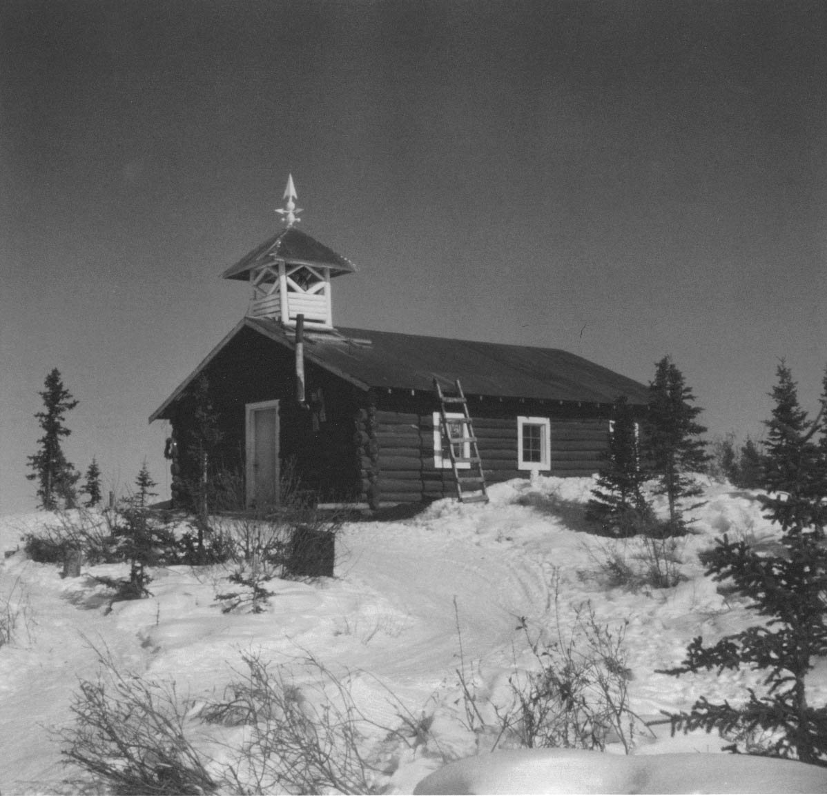
Photo: Troyer William A, U.S. Fish and Wildlife Service · Public domain
–Not graded
History · Arctic Village
Arctic Village’s post office opened in 1959, and 1 of its places is on the National Register
Most of Arctic Village was built recently: 0.0% of its homes predate 1940 and the median home dates from 1986. Its Register listing is the Mission Church. Below: 3 old photos and papers, maps from 1972 on, and the census since 1910.
Evidence from archaeological investigations indicate that the Arctic Village area may have been settled as early as 4500 BC. Around 500 AD the Athabascan speaking Gwichʼin people (often called Neetsʼaii Gwichʼin or "those who dwell to the north") came into the area with seasonal hunting and fishing camps. About 1900, the village became a permanent settlement.
Nothing in the archives for these yearsWeddings on Main Street, storms, parades, school pictures, the old store. If it’s in your family album, it belongs here.
Nothing in the archives for these yearsWeddings on Main Street, storms, parades, school pictures, the old store. If it’s in your family album, it belongs here.
The U.S. Geological Survey’s map of Arctic Village.
1972Arctic A-3 sheet · 1:63,360
U.S. Geological Survey historical topographic maps (public domain), via Esri’s collection of the scans. The red ring marks the center of Arctic Village.
Then & now
Stand where they stood
No then-and-now pairs yet. Take a photo from the same spot as an old one and they appear here side by side.
Retake this viewNatives in front of the church at Arctic Village. Alaska, 1926
Find the spot, match the angle, and add your photo. It becomes the first then-and-now pair on Arctic Village’s page.
Founding dates: Wikidata, Wikipedia, the U.S. post office records of Blevins & Helbock (CC0) and the Census. Homes by year built: Census ACS 2020–24. National Register of Historic Places: National Park Service (list of May 22, 2026). Old photos, postcards and papers: Wikimedia Commons, the Library of Congress and other public archives, credited on each item’s page. Maps: U.S. Geological Survey historical topographic maps (via Esri) and Sanborn fire-insurance maps (Library of Congress). History text and census tables: Wikipedia (CC BY-SA 4.0). Places that used to be: USGS Geographic Names Information System (2021). How TownRatings grades history →
From Wikimedia Commons (6), the National Register of Historic Places (1), Wikipedia, U.S. Geological Survey historical maps, U.S. Census counts (via Wikipedia), the US Post Offices dataset (Blevins & Helbock) and the USGS Geographic Names Information System. Archive images are copied here with their credits and licenses, shown on each photo’s page. Refreshed monthly.




 2010
 2007
 2004

