Casper’s post office opened in 1888, and 12% of its homes were built before 1940
More historic than 63% of U.S. towns · #11 of 28 in Wyoming. What drives it
23 places in town are on the National Register, among them three historic districts with 225 buildings between them. Below: 5 old photos and papers, maps from 1894 on, and the census since 1880.
The Casper post office opened in 1888, the earliest record of the town by name. Another post office, Caspar (1879), opened inside today’s city and later closed.
First census: 40 in 18802020 census: 59,038138 years
How historic is Casper?
B
More historic than 63% of U.S. towns, on its age, its old homes and the National Register.
Founding year: the first Casper post office (Blevins & Helbock, CC0).The full story ↓
History grade
What drives Casper’s History grade
On its age, its old homes and the National Register, Casper is more historic than 63% of U.S. towns, #11 of 28 in Wyoming. Its National Register listings hold the grade up; its age pulls it down.
B
HistoryA character grade: shown, never part of Casper’s overall grade.
Wyoming towns list more on the Register than most of the country (a typical Wyoming town has 25.1 per 10,000 residents, the U.S. 2.4), so Casper’s 41.8 sits above most of its state (74% of Wyoming towns have fewer) while its 246 historic buildings outnumber those of 94% of U.S. towns.
How sure. Graded on any two of the three inputs instead, the letter would range from C+ to A−. The pre-1940 share (±1.6 points) is firm at this size. The founding year is the first post office, not a stated founding date.
Founding year: the first post office (other dates in Quick answers). Homes: Census ACS 2020–24. National Register: National Park Service, May 2026 list; each listing counted once (boundary changes and added documentation belong to their listing), and a historic district counts its contributing buildings. How TownRatings grades history →
What stands out about Casper’s past
Read from the archive, the National Register and the record. The page puts what stands out first.
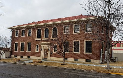
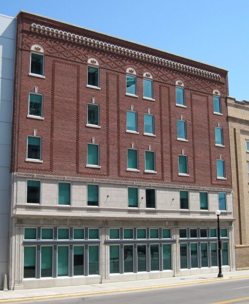
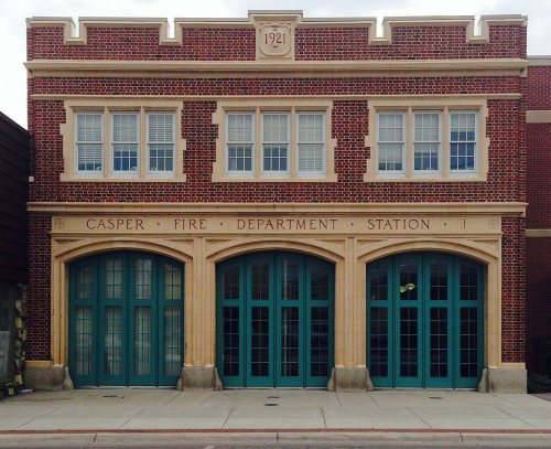
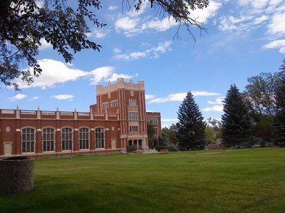
National Park Service, National Register of Historic Places. Photos from Wikimedia Commons, credited on each place’s page.
Every building
Casper, building by building, 1894–1921
Fire insurance maps drew every building, what it was made of and what it was used for, so insurers could price the risk of fire. Pick a year, then a sheet.
The city was established east of the former site of Fort Caspar, in an area that grew for European settlers during the mid-19th century mass migration of land seekers along the Oregon, California, and Mormon trails, where several nearby ferries offered passage across the North Platte River in the early 1840s. In 1859, Louis Guinard built a bridge and trading post near the original ferry locations, allowing overland travel to continue through the area.
Passages that mention Casper, cut from the printed page as they were published.
History of Natrona county, Wyoming, 1888-19221923 · page 258Read the page →
Read the text
Although a franchise was granted on March 9, 191 1, to "B. H, Hopkins, his successors and assigns, for the laying of oil pipe lines in the streets and alleys of the town of Casper, for the purpose of selling, furnishing and distributing petroleum or its products, and gas to consumers within the town of Casper," the first tangible evidence of the residents of Casper being supplied with natural gas was on January 13, 1920, when the New York Oil company, whose headquarters were in Casper, announced that a contract had been let to
Text read by machine from the scan; it may contain errors.
History of Natrona county, Wyoming, 1888-19221923Read the page →
Read the text
form to have the town of Casper incorporated: "Application for Incorporation "Notice Is hereby given that I will make application for the incorporation of the Town of Casper, before the board of county commissioners of Carbon county, at their regular May meeting, to be held at Rawlins, on the 6th day of May, A.D. 1889, or as soon thereafter as I can be heard. The said incorporation of the Town of Casper shall comprise two square miles, being bounded on the north by the line running east and west through the center of sections three, four and five; on the south by the line run-
Text read by machine from the scan; it may contain errors.
Scans and text from the Internet Archive. Books published in 1930 or earlier, which are in the public domain.
Timeline
Casper, 1879 to 1976
Woven from the archive, old maps, post office records, the National Register and the people born here.
Nothing in the archives for these yearsWeddings on Main Street, storms, parades, school pictures, the old store. If it’s in your family album, it belongs here.
The Casper post office opened in 1888, the earliest record of the town by name (U.S. post office records).
How does Casper rank for history?
Casper is more historic than 63% of U.S. towns, #11 of 28 in Wyoming. The History grade combines the town’s founding era, the share of homes built before 1940 and its National Register listings. It’s a character grade, so it isn’t part of the overall grade. How it works.
What is on the National Register in Casper?
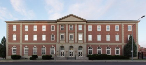
23 listings: 20 buildings and 3 historic districts, the Fort Caspar, the South Wolcott Street Historic District and the Casper Downtown Historic District, with 225 contributing buildings. 246 historic buildings in all.
How old are the homes in Casper?
12% of Casper’s homes were built before 1940 (Census estimate, ±1.6 points), against a typical 12% for a Wyoming town; the median home was built in 1975.
Founding dates: Wikidata, Wikipedia, the U.S. post office records of Blevins & Helbock (CC0) and the Census. Homes by year built: Census ACS 2020–24. National Register of Historic Places: National Park Service (list of May 22, 2026). Old photos, postcards and papers: Wikimedia Commons, the Library of Congress and other public archives, credited on each item’s page. Maps: U.S. Geological Survey historical topographic maps (via Esri) and Sanborn fire-insurance maps (Library of Congress). History text and census tables: Wikipedia (CC BY-SA 4.0). Places that used to be: USGS Geographic Names Information System (2021).
From Wikimedia Commons (3), the Library of Congress (2), Wikidata (1), the National Register of Historic Places (23), Wikipedia, Wikidata and Wikipedia for famous people, U.S. Geological Survey historical maps, U.S. Census counts (via Wikipedia), the US Post Offices dataset (Blevins & Helbock), the USGS Geographic Names Information System, Sanborn fire insurance maps (Library of Congress) and old county and town histories (Internet Archive). Archive images are copied here with their credits and licenses, shown on each photo’s page. Refreshed monthly.









 1912


