


The story
Read it all →How Wellsburg came to be
From Wikipedia’s history of Wellsburg.
The town was laid out in 1790, and its post office was opened on September 1, 1870.
Text from Wikipedia, licensed CC BY-SA 4.0.
Each edition grades its towns against each other only.
Among the most historic 1% of U.S. towns. What drives it
15 places in town are on the National Register, among them two historic districts with 703 buildings between them. Below: 13 old photos and papers, maps from 1884 on, and the census since 1870.
Wellsburg dates its founding to 1790 (Wikipedia’s history). The census first counted it in 1870.
Among the most historic 1% of U.S. towns, on its age, its old homes and the National Register.
On its age, its old homes and the National Register, Wellsburg is among the most historic 1% of U.S. towns. All 3 inputs are above most U.S. towns; its share of homes from before 1940 ranks highest and its age lowest.
West Virginia towns list more on the Register than most of the country (a typical West Virginia town has 29.6 per 10,000 residents, the U.S. 2.4), so Wellsburg’s 3,273 sits above most of its state (100% of West Virginia towns have fewer) while its 721 historic buildings outnumber those of 98% of U.S. towns.
Founding year: Wikipedia (other dates in Quick answers). Homes: Census ACS 2020–24. National Register: National Park Service, May 2026 list; each listing counted once (boundary changes and added documentation belong to their listing), and a historic district counts its contributing buildings. How TownRatings grades history →
Read from the archive, the National Register and the record. The page puts what stands out first.
The country’s official list of buildings and places worth saving. Boundary changes and added documentation are counted with their listing.


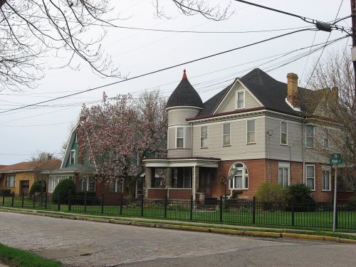
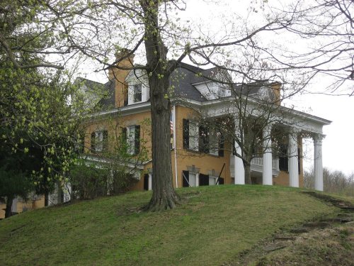
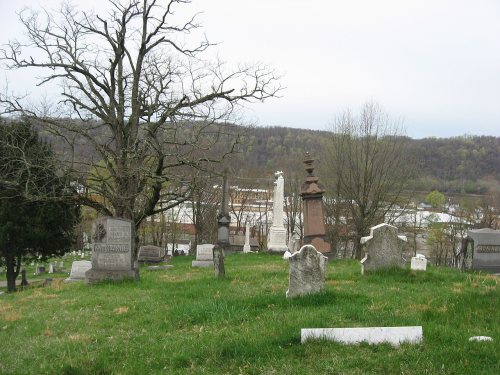
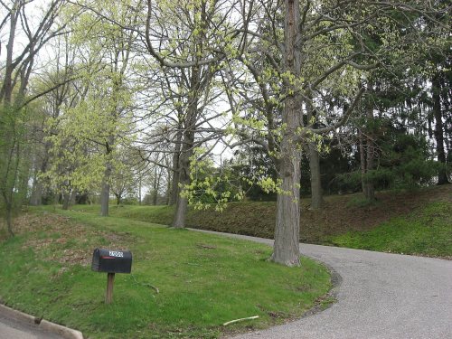


National Park Service, National Register of Historic Places. Photos from Wikimedia Commons, credited on each place’s page.
Drag across each photo to compare.

 c. 19302014
From Wikipedia’s history of Wellsburg.
The town was laid out in 1790, and its post office was opened on September 1, 1870.
Text from Wikipedia, licensed CC BY-SA 4.0.
Woven from the archive, old maps, post office records, the National Register and the people born here.
 Born hereIsaac H. Duval is born here
 Born hereJohn O. Pendleton is born here
 In the archiveChrist (Episcopal) Church rectory, Wellsburg, W.V
 On the mapFirst mapped by the U.S. Geological Survey
 In the archiveHigh school, Wellsburg, W. Va (84270)
 Born hereGlenn Davis is born here
2 decades in the archive, from the 1900s to the 1930s. Scroll each row; tap a photo for its story.
 2023Plaque dedicated to Captain Oliver Brown
 2023Capt. Oliver Brown Memorial Brooke Co. Cemetery
 2019Destruction of Historic Landmark
 2015Beallmore, also known as the William T. Jr., and June…
 2015The Wells Log House, built in 1788 by Alexander Wells…
 2015Buildings in the 800 block of Main Street
 2015The Longhorn Steakhouse in an old building
 2015The Brooke County Public Library and West Virginia To…
 2015Law and land office building
 2015The Wells Log House, built in 1788 by Alexander Wells…
 2015The Longhorn Steakhouse in an old building in
 2015The Brooke County Public Library and West Virginia To…
 2015Law and land office building in
 2015Buildings in the 800 block of Main Street in
 2014Brooke High School 2014-04-30 19-04
 2011Wellsburg Wharf
 2011Vancroft in Wellsburg, gates
 2011Miller's Tavern in
 2011Houses in the Wellsburg Historic District
 2011Harry and Louisiana Beall Paull Mansion
 2011Gen. I.H. Duval Mansion
 2011Elmhurst in
 2011David and Lucy Tarr Fleming Mansion approach
 2011Brooke Cemetery
 2008Wellsburg Wharf 2 (Taber Andrew Bain) - Flickr
 2008Wellsburg Wharf (Taber Andrew Bain) - Flickr
 2008Wellsburg (Taber Andrew Bain) - Flickr
 2008Ohio River at Wellsburg (Taber Andrew Bain) - Flickr
 2004WVMap-doton-Wellsburg
Every edition of the U.S. Geological Survey’s map of Wellsburg. Tap a year, or press play to watch the town change.

U.S. Geological Survey historical topographic maps (public domain), via Esri’s collection of the scans. The red ring marks the center of Wellsburg.
Fire insurance maps drew every building, what it was made of and what it was used for, so insurers could price the risk of fire. Pick a year, then a sheet.
 1884Sheet 1 of 2
Sanborn Map Company, via the Library of Congress. Editions published in 1930 or earlier, which are in the public domain.
Peaked at 6,398 in 1930; 2,450 people lived here in 2020.
16 censuses, 1870–2020.
U.S. Census Bureau decennial counts, from the census table on Wellsburg’s Wikipedia page.
Writers, athletes, leaders and more, ranked by how widely they’re known.
Wellsburg’s post office has been open since 1800. Another post office, Brooke Court House, opened and closed inside today’s town.
US Post Offices dataset (Blevins & Helbock, CC0). Places and cemeteries from the USGS Geographic Names Information System (2021).
Most archives stop around 1920. The photos from after that are in family albums, not libraries.
In 1790, according to Wikipedia’s history of the town. Wellsburg’s post office opened in 1800, and the census of 1870 counted 1,366 people here.
Wellsburg is among the most historic 1% of U.S. towns. The History grade combines the town’s founding era, the share of homes built before 1940 and its National Register listings. It’s a character grade, so it isn’t part of the overall grade. How it works.
15 listings: 11 buildings, among them the Miller's Tavern (listed 1978, the first), 2 historic districts, the Wellsburg Historic District and the Vancroft, with 703 contributing buildings, and 2 structures. 721 historic buildings in all.
61% of Wellsburg’s homes were built before 1940 (Census estimate, ±7.8 points), against a typical 13% for a West Virginia town; the median home was built in 1938.
What the archives can’t tell you, neighbors can.
Founding dates: Wikidata, Wikipedia, the U.S. post office records of Blevins & Helbock (CC0) and the Census. Homes by year built: Census ACS 2020–24. National Register of Historic Places: National Park Service (list of May 22, 2026). Old photos, postcards and papers: Wikimedia Commons, the Library of Congress and other public archives, credited on each item’s page. Maps: U.S. Geological Survey historical topographic maps (via Esri) and Sanborn fire-insurance maps (Library of Congress). History text and census tables: Wikipedia (CC BY-SA 4.0). Places that used to be: USGS Geographic Names Information System (2021).
From Wikimedia Commons (36), the Library of Congress (6), Wikidata (3), the National Register of Historic Places (15), Wikipedia, Wikidata and Wikipedia for famous people, U.S. Geological Survey historical maps, U.S. Census counts (via Wikipedia), the US Post Offices dataset (Blevins & Helbock), the USGS Geographic Names Information System and Sanborn fire insurance maps (Library of Congress). Archive images are copied here with their credits and licenses, shown on each photo’s page. Refreshed monthly.
 1902
 1902
 1902
 1902
 1902
 1902
 c. 1930
 c. 1930
 c. 1930
 c. 1930
 c. 1930


