WestfieldWI
A town of 573.
Is Westfield a good place to live?
The biggest park or preserve is Honey Creek State Natural Area, at 82 acres. Westfield has fewer than 1,000 residents, too few for fair grades; the figures below are still real.
573 people, and everyone knows the way
In a town this size, neighbors are the best guide. Ask them anything.
Moving to Westfield: who provides what
Who provides power, water and the rest in Westfield, and how to reach them.
EPA SDWIS (Oct 9, 2026) · HIFLD + EIA-861 2025 · Census 2020 ZCTAs · NCES 2024–25 · registration: vote.gov, updated Nov 18, 2024.
The data
Ordered by what stands out in Westfield.
Most of Westfield’s workers head elsewhere: there are 0.2 jobs for each of them
The median commute is under 19 miles. For working residents in Westfield, the share who work locally is 1.7%. Its median household income stands at $66,000, against $87,000 in Wisconsin’s towns and $80,000 across U.S. towns. The top destinations are Reedsburg (13%), Madison (10%) and Plain (8%).
| Westfield | Wisconsin towns | U.S. towns | |
|---|---|---|---|
| Working residents who work in town | 1.7% | 8.3% | 8% |
| Median household income | $66,000 | $87,000 | $80,000 |
| Below the poverty line | 5.7% | 6.4% | 9.6% |
| Average trip to work | 24 minutes | 22 minutes | 25 minutes |
Where working residents work
Census LEHD 2023 · ACS
The climate in Westfield brings snowy winters and pleasant summers
The July high in Westfield is 82°F.
Typical low → high °F
NOAA U.S. Climate Normals, 1991–2020
Westfield faces a high natural-hazard risk, led by inland flooding
On expected storm and flood damage, Westfield sits above 66% of U.S. communities. 66% of the town’s expected losses from natural hazards come from inland flooding, followed by cold waves at 13%.
FEMA National Risk Index · OpenFEMA
How healthy Westfield is
Westfield: 17% of adults report frequent mental distress. In Westfield, 18% of adults smoke cigarettes, and 42% have obesity.
| Westfield | Wisconsin towns | U.S. towns | |
|---|---|---|---|
| Get no exercise (CDC PLACES) | 32% | 26% | 25% |
| Smoke cigarettes (CDC PLACES) | 18% | 14% | 14% |
| Obesity (CDC PLACES) | 42% | 38% | 35% |
| Frequent physical distress (CDC PLACES) | 15% | 13% | 14% |
| What stands out | Westfield | WI |
|---|---|---|
| More older adults who have lost all their teeth | 14.2% | 9.9% |
| More smokers | 17.9% | 13.6% |
| More adults with COPD | 8.2% | 6.5% |
CDC PLACES 2025 · modeled estimates for adults · CMS · HRSA
| Biggest places to walk | Trails | Acres |
|---|---|---|
| 1. Honey Creek State Natural Area | — | 82 |
Trails & parks © OpenStreetMap contributors · Conserved land: USGS PAD-US
Camp Randall Stadium and 20 more within 40 miles
Museums, parks, gardens and other places to visit around Westfield. Close and well known come first.
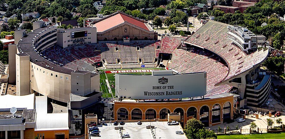 39 mi Stadium & arenaCamp Randall Stadium
 14 mi Park & preserveIce Age Trail
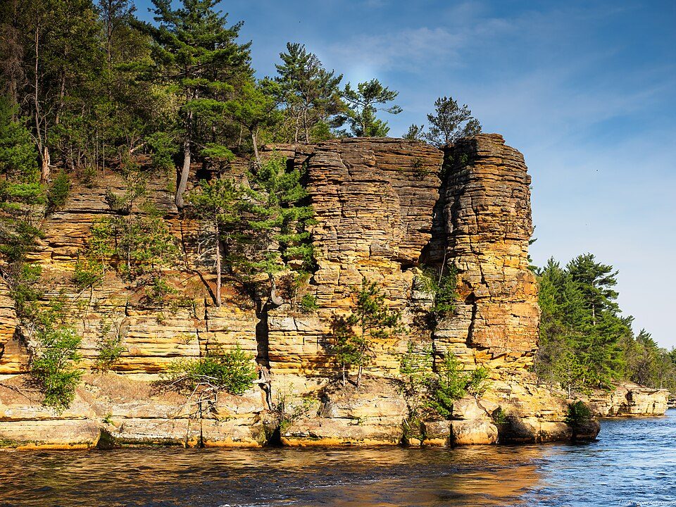 19 mi Canyon & gorgeDells of the Wisconsin River
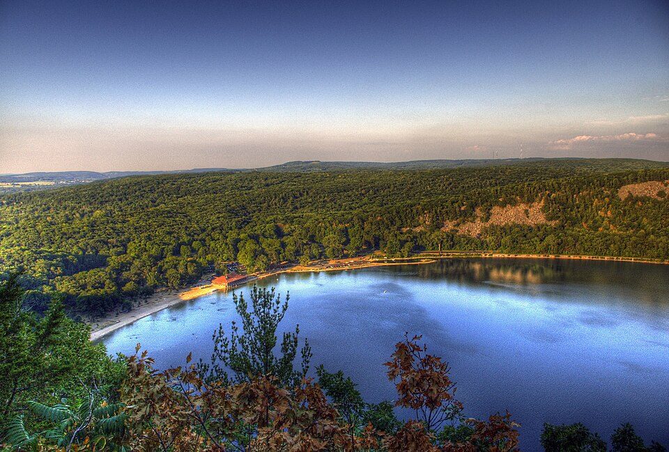 15 mi State parkDevil's Lake State Park17 mi Theme parkNoah's Ark Water Park7 mi MuseumMid-Continent Railway Museum
Photo credits
Camp Randall Stadium: Carol M. Highsmith, Public domain · Ice Age Trail: MDuchek, CC BY-SA 3.0 · Dells of the Wisconsin River: atramos, CC BY 2.0 · Devil's Lake State Park: CrispAir at en.wikipedia, CC BY 3.0


Everything we know about Westfield
Colleges nearby
None within 15 miles of Westfield; the nearest are
About 3 of every 100 Westfield residents are enrolled in college, against 6 across Wisconsin.
98% of working residents leave Westfield for work
Where Westfield’s working residents go each day. Line width shows the share.
Census LEHD 2023
About Westfield
Town in Wisconsin, United States
The Town of Westfield is located in Sauk County, Wisconsin, United States. The population was 582 at the 2020 census.
From Wikipedia, licensed CC BY-SA 4.0 · facts via Wikidata (CC0)
- Area
- 36 sq mi
- Elevation
- 1,010 ft
- Area code
- 608
Questions about Westfield
Short answers, built from the data on this page.
Is Westfield, WI a good place to live?
Westfield has fewer than 1,000 residents, too few for fair grades; the figures below are still real.