124 years in pictures
Census counts: 6,645 in 1910, 60,325 in 2020. The archive holds 6 old photos and papers going back to 1887 and 5 maps from 1892 on.
9 places on the National Register of Historic Places.
- 1902West Allis is settled
Each edition grades its towns against each other only.

West Allis's standout: natural-hazard risk is low. Overall it grades C+, ranked 308th of 357 in Wisconsin. It is easier to get around on foot or by transit than 92% of U.S. towns. Its weakest subject is schools: its schools rank behind 87% of the state's. West Allis has 9 places on the National Register of Historic Places, among them West Allis Post Office and Wadhams Gas Station. 56% of households own their home in West Allis, against 74% in Wisconsin’s towns and 73% across U.S. towns. Greenfield Park, at 284 acres with 2.5 miles of trail, is the biggest park or preserve.
Where West Allis beats most towns.
Each subject compared with towns across the country (schools within Wisconsin), ordered by how far West Allis is from typical.
Its grades run from A+ for hazard risk (better than 96% of comparable towns) to D for schools (better than 13%), so the C+ overall blends very different results.
How TownRatings grades towns →
Census counts: 6,645 in 1910, 60,325 in 2020. The archive holds 6 old photos and papers going back to 1887 and 5 maps from 1892 on.
9 places on the National Register of Historic Places.
Museums, parks, gardens and other places to visit around West Allis. Close and well known come first.
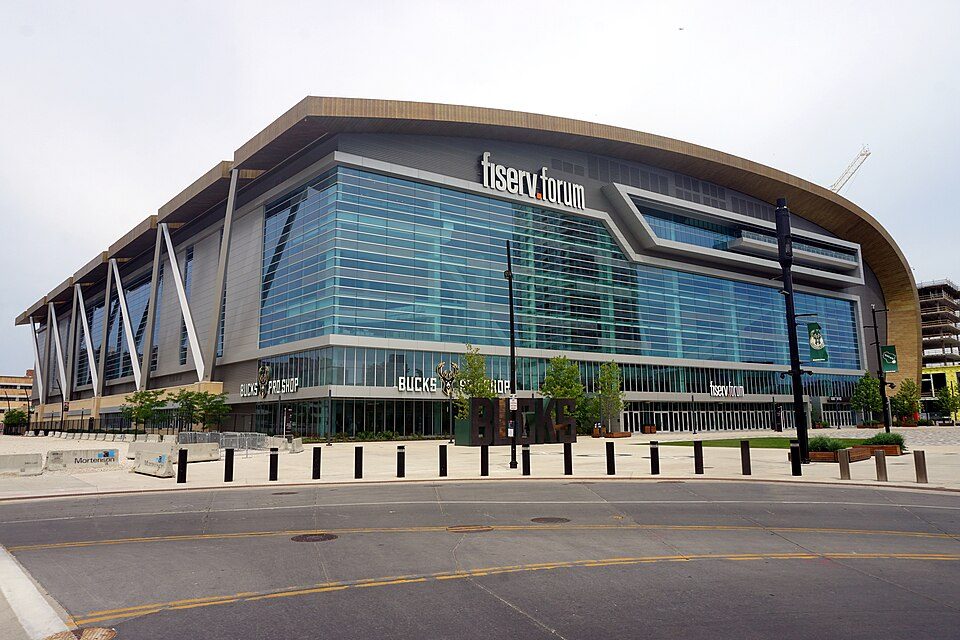
6 mi Stadium & arenaFiserv Forum
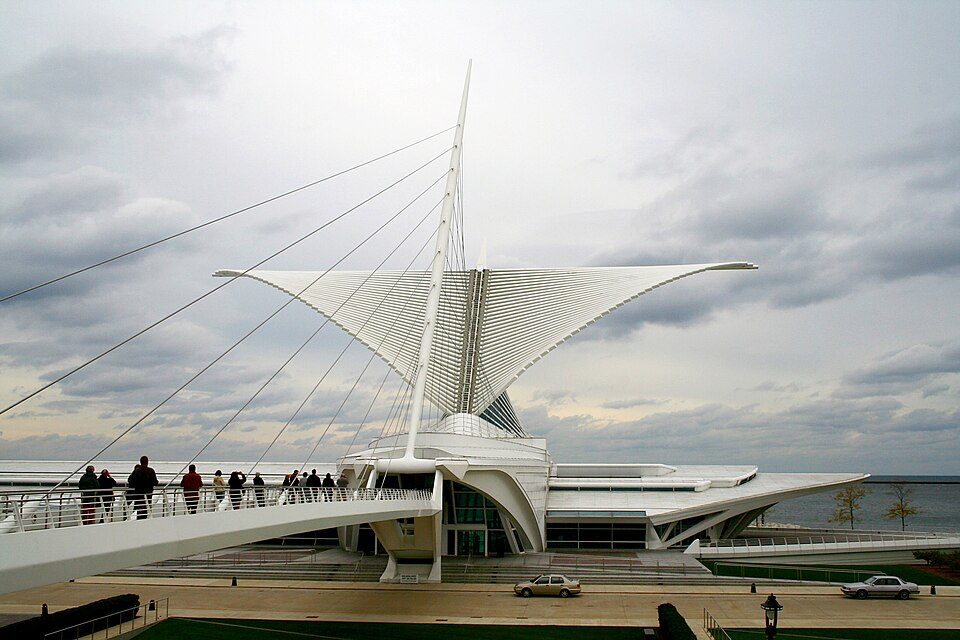
7 mi MuseumMilwaukee Art Museum350K visitors a year
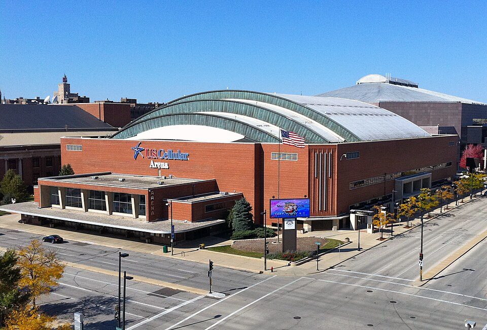
6 mi Stadium & arenaUW–Milwaukee Panther Arena
6 mi MuseumHarley-Davidson Museum300K visitors a year
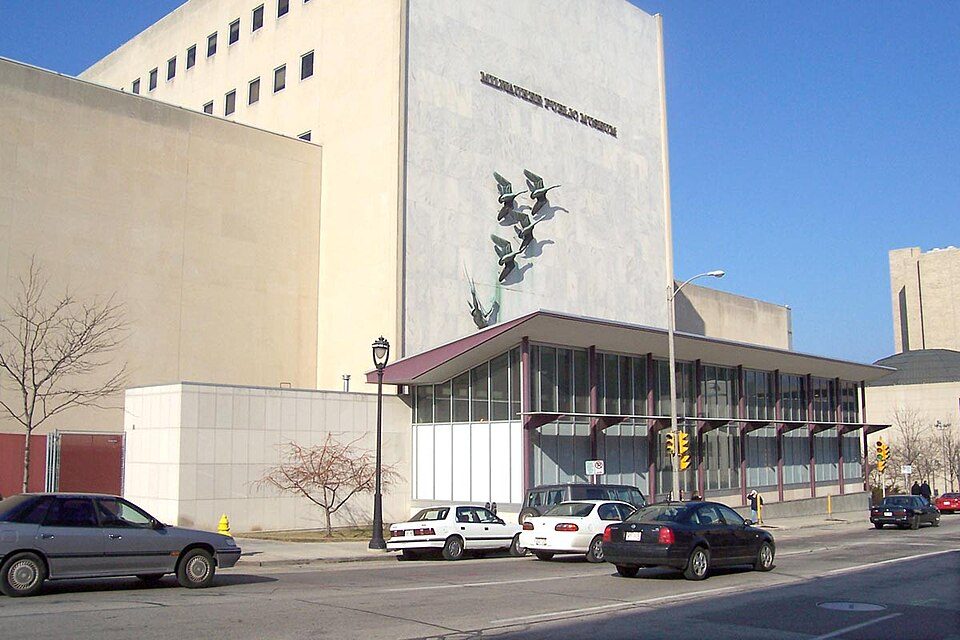
6 mi MuseumNature & Culture Museum of Wisconsin
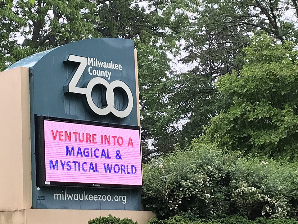
2 mi Zoo & aquariumMilwaukee County ZooFiserv Forum: Michael Barera, CC BY-SA 4.0 · Milwaukee Art Museum: Michael Hicks (Mulad), CC BY 2.0 · UW–Milwaukee Panther Arena: Shadowlink1014, Public domain · Harley-Davidson Museum: Dori, CC BY-SA 3.0 us · Nature & Culture Museum of Wisconsin: The original uploader was Sulfur at English Wikipedia., CC BY-SA 3.0 · Milwaukee County Zoo: Awkwafaba, CC BY-SA 3.0
Who provides power, water and the rest in West Allis, and how to reach them.
EPA SDWIS (Oct 9, 2026) · HIFLD + EIA-861 2025 · Census 2020 ZCTAs · NCES 2024–25 · registration: vote.gov, updated Nov 18, 2024.
Ordered by what stands out in West Allis.
West Allis is healthier than towns with similar incomes, trades workers with Milwaukee and other neighbors and is safe by national standards but not by Wisconsin’s.
Expected storm and flood damage is lower than in 93% of U.S. communities. Since 1979, 26 flood insurance claims have been paid out in West Allis.
FEMA flood insurance claims · FEMA National Risk Index · OpenFEMA
Its public schools are run by the West Allis-West Milwaukee School District. Two of its 17 schools are below, each with why it’s listed.
| School | Level | Students | Letter |
|---|---|---|---|
| Frank Lloyd Wright IntermediateLargest public middle schoolGrades 6–8 | Grades 6–8 | 902 | C− |
| Nathan Hale HighLargest public high schoolGrades 9–12 | Grades 9–12 | 1,134 | C− |
NCES · EDFacts · graded within WI on state tests and graduation
| West Allis | Wisconsin towns | U.S. towns | |
|---|---|---|---|
| Conserved land | 6.9% | 3.8% | 4.3% |
| Miles of trail per square mile | 0.4 miles per square mile | 0.4 | 0.4 |
| Biggest places to walk | Trails | Acres |
|---|---|---|
| 1. Greenfield Park | 2.5 mi | 284 |
| 2. LaFollette Park | 0.8 mi | 19 |
| 3. Root River Parkway | 0.1 mi | 111 |
Trails & parks © OpenStreetMap contributors · Conserved land: USGS PAD-US
At 29.8 crimes per 1,000 residents a year, it reports more crime than 89% of Wisconsin’s graded towns. Reported crimes fell from 1,544 to 1,123 over the last three FBI years, a drop beyond ordinary year-to-year swings.
West Allis’ property crime rate is 17 per 1,000 residents.
| West Allis | Wisconsin towns | U.S. towns | |
|---|---|---|---|
| Property crimes per 1,000 (2025) | 17 per 1,000 residents | 6.3 | 9.9 |
| Violent crimes per 1,000 (2025) | 1.8 per 1,000 residents | 1.1 | 1.6 |
FBI crime data, 2025 · crimes reported to police
The Mt Mary College weather station records that 40 inches of snow fall in a normal winter: more than most of the country, but less than 80% of Wisconsin places with climate records. January nights average 14.1°: colder than most of the country, but milder than 98% of Wisconsin places with climate records; July afternoons average 81.8°.
West Allis has cold, snowy winters and pleasant summers. The January low in West Allis is 14°F.
| West Allis | Wisconsin towns | U.S. towns | |
|---|---|---|---|
| January low | 14°F | 11°F | 22°F |
| July high | 82°F | 82°F | 85°F |
NOAA U.S. Climate Normals, 1991–2020
The typical West Allis home is worth about $272,000, up 4.7% in a year, 19% below the Wisconsin typical home.
| West Allis | Wisconsin towns | U.S. towns | |
|---|---|---|---|
| Median rent | $1,007 a month | $1,080 a month | $1,185 a month |
| Renters paying 30%+ of income on rent | 41% | 39% | 48% |
Zillow Home Value Index · Redfin Data Center
West Allis has about as many jobs (31,436) as working residents, but only 2,933 people both live and work here.
Most working residents leave West Allis for work: only 10% work in town. 12% of residents live below the poverty line in West Allis. Jobs based in West Allis fell to 31,436 in 2023, 2,619 fewer than in 2013.
| West Allis | Wisconsin towns | U.S. towns | |
|---|---|---|---|
| Below the poverty line | 12% | 6.3% | 9.6% |
| Average trip to work | 21 minutes | 22 minutes | 25 minutes |
| Median household income | $68,000 | $88,000 | $80,000 |
| Work from home | 10% | 12% | 11% |
Census LEHD 2023 · ACS
Against the 10,289 U.S. towns with household incomes like West Allis’s, it is healthier than 81%, so its B isn’t only a matter of income.
West Allis beats the Wisconsin average on 1 of 32 CDC measures and trails it on 3. 33% of West Allis adults feel lonely.
| West Allis | Wisconsin towns | U.S. towns | |
|---|---|---|---|
| Feel lonely (CDC PLACES) | 33% | 30% | 33% |
| Binge drink (CDC PLACES) | 19% | 20% | 16% |
| Depression (CDC PLACES) | 25% | 24% | 23% |
| Sleep under 7 hours (CDC PLACES) | 34% | 32% | 36% |
| What stands out | West Allis | WI |
|---|---|---|
| Fewer adults who have had cancer | 7.8% | 8.6% |
| More uninsured adults | 9.4% | 8% |
CDC PLACES 2025 · modeled estimates for adults · CMS · HRSA
No broad age group is more than 4 points off the Wisconsin average. 30% of adults 25 and older have a bachelor’s degree or more, vs 33% across Wisconsin.
| West Allis | Wisconsin towns | U.S. towns | |
|---|---|---|---|
| Under 18 | 19% | 21% | 22% |
| Median age | 39.7 years | 42.1 years | 40.5 years |
| Aged 65 or older | 17% | 20% | 18% |
50% women, 50% men
That’s an even split within the survey’s margin of ±1.3 points. Across Wisconsin, 49.9% of residents are women. Median age: women 40.3, men 39.2.
| West Allis | WI | U.S. | |
|---|---|---|---|
| Under 10 | 11.1% | 11.2% | 11.6% |
| 10 to 17 | 8.2% | 10.2% | 10.3% |
| 18 to 24 | 6.1% | 9.3% | 9.1% |
| 25 to 34 | 18.2% | 12.6% | 13.7% |
| 35 to 44 | 13.1% | 12.7% | 13.2% |
| 45 to 54 | 11.3% | 11.8% | 12.2% |
| 55 to 64 | 14.7% | 13.8% | 12.7% |
| 65 to 74 | 12% | 11.2% | 10.2% |
| 75 and older | 5.3% | 7.3% | 7% |
| No diploma | 8% | 6.4% | 10.4% |
| High school | 31.1% | 29.4% | 26% |
| Some college | 21.7% | 19.5% | 19.1% |
| Associate’s | 9.7% | 11.3% | 8.8% |
| Bachelor’s | 21.9% | 22% | 21.6% |
| Graduate | 7.7% | 11.4% | 14.1% |
U.S. Census Bureau · ACS 2020-2024 5-year estimates
16 within 15 miles of the center of West Allis
About 5 of every 100 West Allis residents are enrolled in college, about the same as Wisconsin.
9 places in West Allis on the National Register of Historic Places.
19 notable people were born in West Allis.


City in Wisconsin, United States
West Allis is a city in Milwaukee County, Wisconsin, United States. A suburb of Milwaukee, it is part of the Milwaukee metropolitan area. The population was 60,325 at the 2020 census, making it the eleventh-most populous city in Wisconsin.
From Wikipedia, licensed CC BY-SA 4.0 · facts via Wikidata (CC0)
5 towns share a border with West Allis.
Brookfield next door grades higher for schools (A to West Allis’s D) and lower for cost of living (D to B−).
| Town | WI rank | Overall | Cost | Safety | Schools | Health |
|---|---|---|---|---|---|---|
| West Allis | #308 | C+ | B− | C | D | B |
| Milwaukee | #357 | D− | C+ | D− | D− | D |
| West Milwaukee | #349 | D | C+ | D− | D | C+ |
| Greenfield | #258 | B− | C− | C | B− | A− |
| New Berlin | #52 | A | C− | B+ | A | A |
| Brookfield | #40 | A | D | B+ | A | A |
Short answers, built from the data on this page.
West Allis grades C+ overall, better than 36% of U.S. towns and #308 of 357 in Wisconsin. It grades B for health, C for safety and D for schools. Schools is its weak spot, with a D.
That is 3.5 years of the area's median household income ($78,218 across the Milwaukee-Waukesha, WI metro area). Cost of living, which also weighs rents, property taxes and how many households pay 30% or more of their income for housing, grades B−.
19 notable people were born here, including Liberace and Terry A. Davis.