Mosinee’s post office opened in 1857, and 17% of its homes were built before 1940
More historic than 58% of U.S. towns · #172 of 362 in Wisconsin. What drives it
Its Register listings are the Dessert, Joseph, Library and the Karl Mathie House. Below: 1 old photo or paper, maps from 1963 on, and the census since 1880.
The Mosinee post office opened in 1857, the earliest record of the town by name. Another post office, Little Bull Falls (1852), opened inside today’s city and later closed.
First census: 201 in 18802020 census: 4,452169 years
How historic is Mosinee?
B
More historic than 58% of U.S. towns, on its age, its old homes and the National Register.
Founding year: the first Mosinee post office (Blevins & Helbock, CC0).The full story ↓
History grade
What drives Mosinee’s History grade
On its age, its old homes and the National Register, Mosinee is more historic than 58% of U.S. towns, #172 of 362 in Wisconsin. Its share of homes from before 1940 holds the grade up; its age pulls it down.
B
HistoryA character grade: shown, never part of Mosinee’s overall grade.
Wisconsin towns list more on the Register than most of the country (a typical Wisconsin town has 3.0 per 10,000 residents, the U.S. 2.4), so Mosinee’s 4.4 sits near the middle of its state (65% of Wisconsin towns have fewer) while its 2 listings outnumber those of 60% of U.S. towns.
How sure. Graded on any two of the three inputs instead, the letter would range from C+ to B+. The pre-1940 share is a Census survey estimate (±6.6 points). The founding year is the first post office, not a stated founding date.
Founding year: the first post office (other dates in Quick answers). Homes: Census ACS 2020–24. National Register: National Park Service, May 2026 list; each listing counted once (boundary changes and added documentation belong to their listing), and a historic district counts its contributing buildings. How TownRatings grades history →
What stands out about Mosinee’s past
Read from the archive, the National Register and the record. The page puts what stands out first.
The traditional inhabitants of the area were the Ojibwe, the Potawatomi and the Menominee. However, the name is the Hochunk Mōsį́nį, the "Cold Country," from mō, an old form of mą, meaning "earth, ground, land, country"; and sį́nį, "cold." The Ojibwe ceded the territory to the United States in 1837 when they sold most of their land in what would become Wisconsin, though they were guaranteed the right to continue hunting, fishing, and gathering wild rice on the ceded lands. Similarly, the Potawatomi gave up their land claims in Wisconsin in 1833, and the Menominee ceded territory in this area in the 1836 Treaty of the Cedars. These treaties coincided with the establishment of the first sawmill in the area by a white settler, John L. Moore, in 1836, and enabled white settlement to begin in the area. Lumber quickly became the most important industry and drew other businesses and settlers t…
Passages that mention Mosinee, cut from the printed page as they were published.
History of Marathon County, Wisconsin1913 · page 157Read the page →
Read the text
to the city of Wausau before the close of the year 1874; "That there shall be a station on said railroad in range 6 or range 7 in township 26 and said line of railroad shall touch at a point and have a station within threefourths of a mile of Little Bull Falls in the town of Mosinee and from said point on the most feasible and direct route to the city of Wausau aforesaid, and have a station and depot at said city of Wausau within three-fourths of a mile of the courthouse on the east side of the Wisconsin river, provided the right of way is furnished free to said company one hundred feet in width within and through the limits of said city. That active operations
Text read by machine from the scan; it may contain errors.
History of Marathon County, Wisconsin1913 · page 572Read the page →
Read the text
Its territory consists of township 27, range 5, and a large part, about nine sections in the south part of township 27, range 6 east. This town was settled from the village of Mosinee in early days and is included in what was then generally known as the "Irish Settlement." which stretched over the present towns of Mosinee, Emmett, and Cleveland. The whole of this town is splendid farm land, and there are some of the very finest farms that
Text read by machine from the scan; it may contain errors.
Scans and text from the Internet Archive. Books published in 1930 or earlier, which are in the public domain.
Timeline
Mosinee, 1852 to 2001
Woven from the archive, old maps, post office records, the National Register and the people born here.
Nothing in the archives for these yearsWeddings on Main Street, storms, parades, school pictures, the old store. If it’s in your family album, it belongs here.
The Mosinee post office opened in 1857, the earliest record of the town by name (U.S. post office records).
How does Mosinee rank for history?
Mosinee is more historic than 58% of U.S. towns, #172 of 362 in Wisconsin. The History grade combines the town’s founding era, the share of homes built before 1940 and its National Register listings. It’s a character grade, so it isn’t part of the overall grade. How it works.
What is on the National Register in Mosinee?
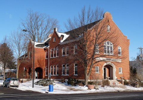
Two places: the Dessert, Joseph, Library (listed 1980) and the Karl Mathie House (1980).
How old are the homes in Mosinee?
17% of Mosinee’s homes were built before 1940 (Census estimate, ±6.6 points), against a typical 12% for a Wisconsin town; the median home was built in 1972.
Founding dates: Wikidata, Wikipedia, the U.S. post office records of Blevins & Helbock (CC0) and the Census. Homes by year built: Census ACS 2020–24. National Register of Historic Places: National Park Service (list of May 22, 2026). Old photos, postcards and papers: Wikimedia Commons, the Library of Congress and other public archives, credited on each item’s page. Maps: U.S. Geological Survey historical topographic maps (via Esri) and Sanborn fire-insurance maps (Library of Congress). History text and census tables: Wikipedia (CC BY-SA 4.0). Places that used to be: USGS Geographic Names Information System (2021).
From Wikimedia Commons (11), the Library of Congress (1), Wikidata (2), the National Register of Historic Places (2), Wikipedia, Wikidata and Wikipedia for famous people, U.S. Geological Survey historical maps, U.S. Census counts (via Wikipedia), the US Post Offices dataset (Blevins & Helbock), the USGS Geographic Names Information System and old county and town histories (Internet Archive). Archive images are copied here with their credits and licenses, shown on each photo’s page. Refreshed monthly.


 2014
 2014
 2014
 2014
 2014
 2014
 2012
 2010
 2008
 2007
 2007


