Milton dates to 1838, and 24% of its homes were built before 1940
More historic than 92% of U.S. towns · #28 of 362 in Wisconsin. What drives it
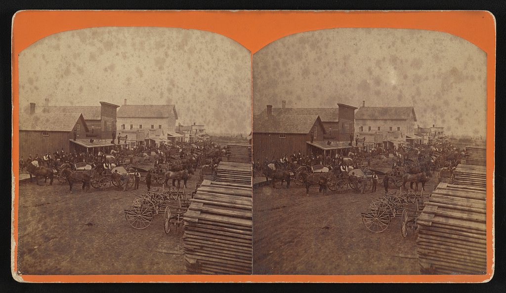
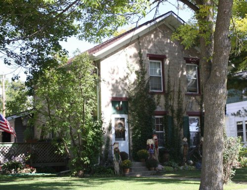
19 places in town are on the National Register, among them the Milton House, a National Historic Landmark, and three historic districts with 18 buildings between them. Below: 3 old photos and papers, maps from 1891 on, and the census since 1880.
Founding year: Wikidata. First post office: 1839.The full story ↓
History grade
What drives Milton’s History grade
On its age, its old homes and the National Register, Milton is more historic than 92% of U.S. towns, #28 of 362 in Wisconsin. All 3 inputs are above most U.S. towns; its National Register listings ranks highest and its age lowest.
A
HistoryA character grade: shown, never part of Milton’s overall grade.
Wisconsin towns list more on the Register than most of the country (a typical Wisconsin town has 3.0 per 10,000 residents, the U.S. 2.4), so Milton’s 75.4 sits above most of its state (92% of Wisconsin towns have fewer) while its 43 historic buildings outnumber those of 84% of U.S. towns.
How sure. Graded on any two of the three inputs instead, the letter would range from A− to A. The pre-1940 share is a Census survey estimate (±5.4 points). Two sources give 1838.
Founding year: Wikidata (other dates in Quick answers). Homes: Census ACS 2020–24. National Register: National Park Service, May 2026 list; each listing counted once (boundary changes and added documentation belong to their listing), and a historic district counts its contributing buildings. How TownRatings grades history →
What stands out about Milton’s past
Read from the archive, the National Register and the record. The page puts what stands out first.
The city was formed as a result of the 1967 merger of the villages of Milton and Milton Junction. In November of that year, ballots were cast by 1,093 voters from both villages (Milton: 515 to 47 in favor of the merge; Milton Junction: 322 to 201 in favor of the merge), and the referendum to merge the two was approved by 77%.
Originally named Prairie du Lac, Milton was settled in 1838 by Joseph Goodrich, who came from Alfred, New York with his family to the locality for religious and educational reasons. As soon as he moved he organized a Seventh Day Baptist Church in November 1840, and in 1844 a school that would later become a college. He also built an inn, a Milton House, without crossing two trade routes.
The village of Milton in the town of Milton also became incorporated on September 17, under the general statutes. But little more than seven decades have passed since the first hearth stone was laid in Rock county. Within that comparatively brief period it has become one of the most prosperous and highly developed counties of the state, with a population of nearly 60,000. The valuation of its taxable property for the present year, as fixed by the tax commission of the state, is $73,657,-
Text read by machine from the scan; it may contain errors.
To the Hon. Joseph Goodrich belongs the honor of establishing the first school which later developed into Milton College. It was he who in 1838 selected the site for the village of Milton and built the first house. It was he who planned and had erected the edifice first used for the academy, and paid the cost of construction, about three hundred dollars. For the first three years he had the sole management of the school, paid all the losses for the teacher's salary and the incidental expenses, and for many years
Text read by machine from the scan; it may contain errors.
The history of Rock County, Wisconsin1879 · page 518Read the page →
Read the text
"At this time [1856] the town numbers between 1,300 and 1,400 inhabitants, of which between 300 and 400 reside in the so-called village of Milton. We are now benefited by the ' Milwaukee & Mississippi Railroad,' and also the ' Janesville Branch,' alias ' Southern Wisconsin Railroad." [The railroads in the town, as at present named, are the Prairie du Chien Division of the C, M. & St. P. R. R., and the Monroe Branch of the same road ; they have have also the C. & N.-W. Railway.] The benefits of a speedy market, and ready communication with the East and South are apparent. Property has increased rapidly in value ; money more plenty, and consequently business is brisk and every branch of industry is on the pro-
Text read by machine from the scan; it may contain errors.
The history of Rock County, Wisconsin1879 · page 321Read the page →
Read the text
Rock River rises in Fond du Lac County, follows a tortuous course through Dodge and Jefferson Counties, running through Lake Koshkonong, from which it debouches on Section 7, in Milton Town, and traverses the entire width of Rock County from north to south, its general course being a little east of the center of Townships 1, 2, 3 and 4, Range 12 east. On either side of the river, from the point where it leaves Lake Koshkonong in the town of Milton till it crosses the State line at Beloit, the shores are dotted, at frequently recurring intervals, with belts of timber and with openings. The following table gives the distances between certain points on the river, the descent and the elevation above Lake Michigan of each point named :
Text read by machine from the scan; it may contain errors.
Scans and text from the Internet Archive. Books published in 1930 or earlier, which are in the public domain.
Timeline
Milton, 1838 to 1998
Woven from the archive, old maps, post office records, the National Register and the people born here.
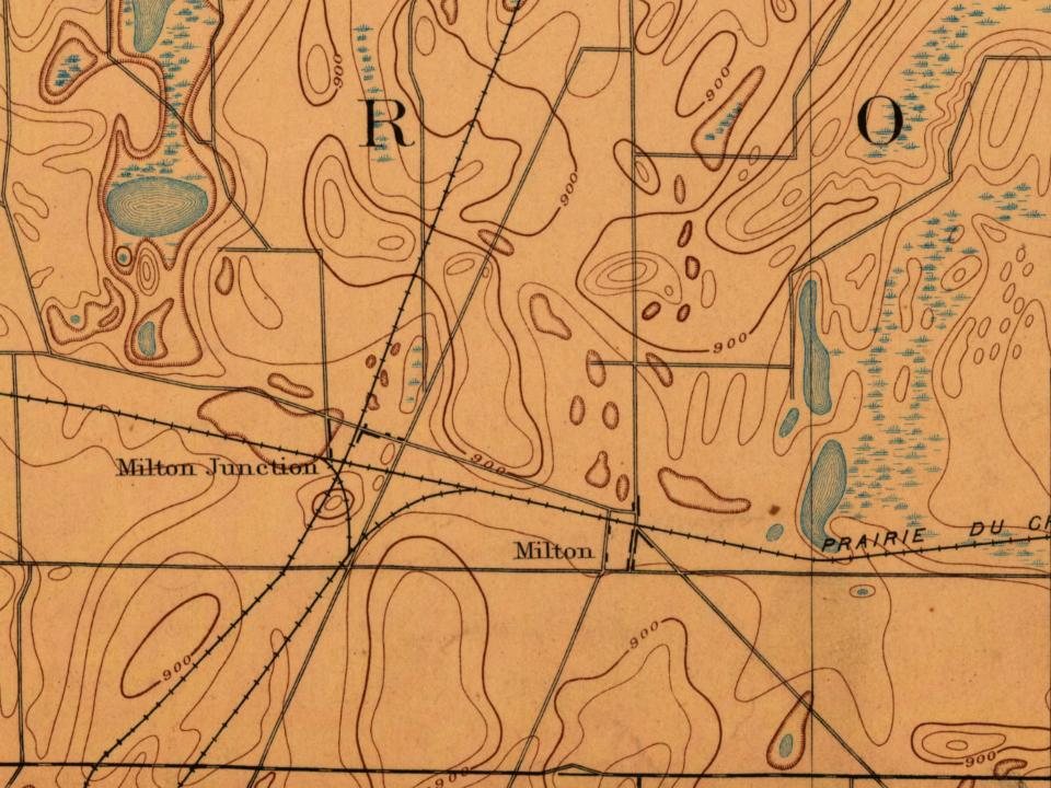
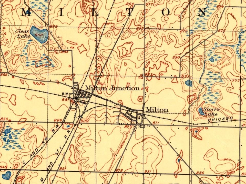
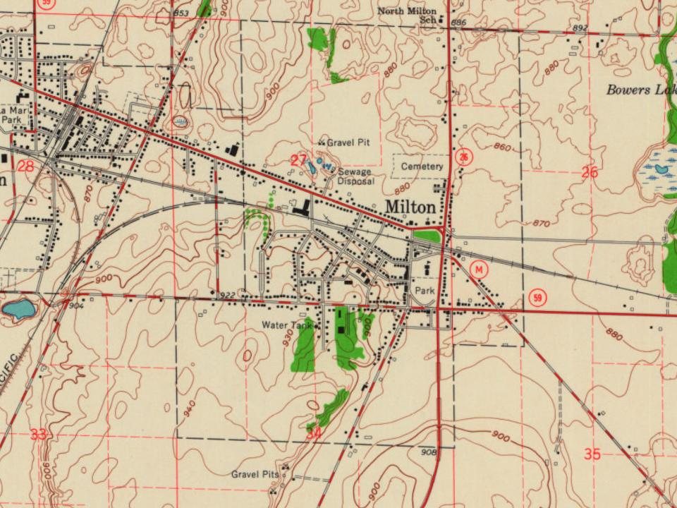
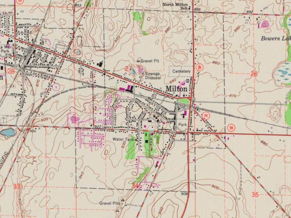
Fire insurance maps drew every building, what it was made of and what it was used for, so insurers could price the risk of fire. Pick a year, then a sheet.
Lost post offices, old corners, places now gone and burying grounds
Milton’s post office has been open since 1839. Two other post offices opened and closed inside today’s town.
Milton
1839–today
West Milton
1859–1870
Milton Junction
1870–1974
18301930today
Hamlets and corners on the map
Milton Junction
Gone or out of use
Milton CollegeschoolMilton Junction Post Officepost office
3cemeteries and burying grounds inside Milton
MiltonMilton JunctionSaint Mary
US Post Offices dataset (Blevins & Helbock, CC0). Places and cemeteries from the USGS Geographic Names Information System (2021).
Questions about Milton’s history
What year was Milton founded?
In 1838, according to Wikidata. Milton’s post office opened in 1839, and the census of 1880 counted 508 people here.
How does Milton rank for history?
Milton is more historic than 92% of U.S. towns, #28 of 362 in Wisconsin. The History grade combines the town’s founding era, the share of homes built before 1940 and its National Register listings. It’s a character grade, so it isn’t part of the overall grade. How it works.
What is on the National Register in Milton?
19 listings: 16 buildings, among them the Milton House (a National Historic Landmark since 1998), and 3 historic districts, the Milton College Historic District, the Merchant Row Historic District and the Parkview Historic District, with 18 contributing buildings. 43 historic buildings in all.
How old are the homes in Milton?
24% of Milton’s homes were built before 1940 (Census estimate, ±5.4 points), against a typical 12% for a Wisconsin town; the median home was built in 1974.
Founding dates: Wikidata, Wikipedia, the U.S. post office records of Blevins & Helbock (CC0) and the Census. Homes by year built: Census ACS 2020–24. National Register of Historic Places: National Park Service (list of May 22, 2026). Old photos, postcards and papers: Wikimedia Commons, the Library of Congress and other public archives, credited on each item’s page. Maps: U.S. Geological Survey historical topographic maps (via Esri) and Sanborn fire-insurance maps (Library of Congress). History text and census tables: Wikipedia (CC BY-SA 4.0). Places that used to be: USGS Geographic Names Information System (2021).
From the Library of Congress (3), Wikidata (3), the National Register of Historic Places (19), Wikipedia, Wikidata and Wikipedia for famous people, U.S. Geological Survey historical maps, U.S. Census counts (via Wikipedia), the US Post Offices dataset (Blevins & Helbock), the USGS Geographic Names Information System, Sanborn fire insurance maps (Library of Congress) and old county and town histories (Internet Archive). Archive images are copied here with their credits and licenses, shown on each photo’s page. Refreshed monthly.


 ★ Landmark








 1860
 1860
