Maple GroveWI
A town of 940.
Is Maple Grove a good place to live?
Among 363 Wisconsin towns, just 10 have a lower share of adults with a bachelor’s degree than Maple Grove. Laney School is on the National Register of Historic Places. Maple Grove has fewer than 1,000 residents, too few for fair grades; the figures below are still real.
940 people, and everyone knows the way
In a town this size, neighbors are the best guide. Ask them anything.
Moving to Maple Grove: who provides what
Who provides power, water and the rest in Maple Grove, and how to reach them.
EPA SDWIS (Oct 9, 2026) · HIFLD + EIA-861 2025 · Census 2020 ZCTAs · NCES 2024–25 · registration: vote.gov, updated Nov 18, 2024.
The data
Ordered by what stands out in Maple Grove.
Very low risk in Maple Grove, with cold waves at the top
Expected storm and flood damage is lower than in 84% of U.S. communities.
FEMA National Risk Index · OpenFEMA
Fewer of Maple Grove’s working residents work locally than in the typical Wisconsin or U.S. town
1.1% of working residents work locally in Maple Grove, against 8.3% in Wisconsin’s towns and 8% across U.S. towns. Jobs based in Maple Grove grew to 222 in 2023, 64 more than in 2013. The top destinations are Green Bay (13%), Ashwaubenon (6%) and Pulaski (4%).
| Maple Grove | Wisconsin towns | U.S. towns | |
|---|---|---|---|
| Working residents who work in town | 1.1% | 8.3% | 8% |
| Below the poverty line | 5.5% | 6.4% | 9.6% |
| Average trip to work | 24 minutes | 22 minutes | 25 minutes |
Where working residents work
Census LEHD 2023 · ACS
Snowy winters and pleasant summers in Maple Grove
Maple Grove has cold, snowy winters and pleasant summers. At 80°F, Maple Grove’s July high is below both Wisconsin’s towns (82°F) and U.S. towns (85°F).
Typical low → high °F
NOAA U.S. Climate Normals, 1991–2020
How healthy Maple Grove is
Maple Grove beats the Wisconsin average on 1 of 32 CDC measures and trails it on 0. 20% of Maple Grove adults binge drink.
| Maple Grove | Wisconsin towns | U.S. towns | |
|---|---|---|---|
| Binge drink (CDC PLACES) | 20% | 20% | 16% |
| Obesity (CDC PLACES) | 40% | 38% | 35% |
| Sleep under 7 hours (CDC PLACES) | 32% | 32% | 36% |
| Feel lonely (CDC PLACES) | 31% | 30% | 33% |
| What stands out | Maple Grove | WI |
|---|---|---|
| Fewer older adults who have lost all their teeth | 8.3% | 9.9% |
CDC PLACES 2025 · modeled estimates for adults · CMS · HRSA
Conserved land covers 0% of Maple Grove
2.6 miles of trail in 0 parks and preserves. The trail density in Maple Grove is 0.1 miles per square mile.
Trails & parks © OpenStreetMap contributors · Conserved land: USGS PAD-US
Lambeau Field and 8 more within 40 miles
Museums, parks, gardens and other places to visit around Maple Grove. Close and well known come first.
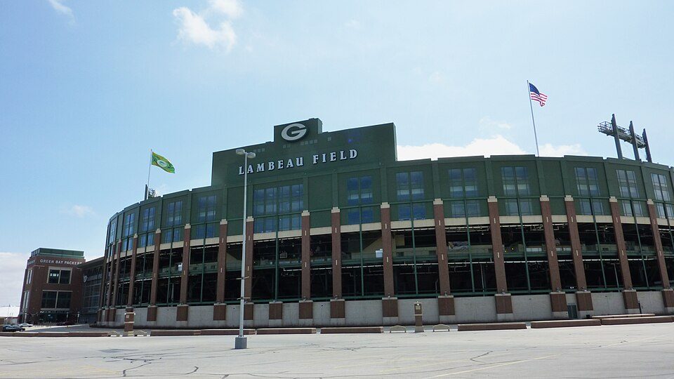 Big draw15 mi Stadium & arenaLambeau Field
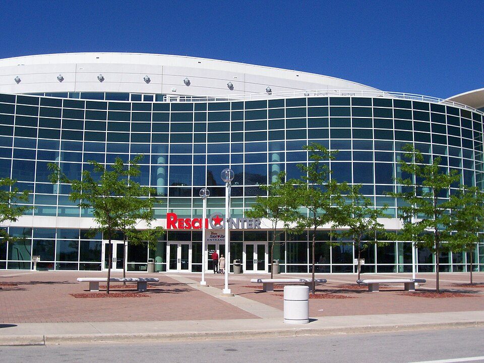 15 mi Stadium & arenaResch Center
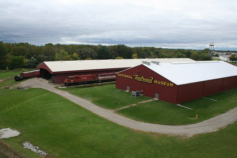 16 mi MuseumNational Railroad Museum
 17 mi Theme parkBay Beach Amusement Park11 mi Zoo & aquariumNortheastern Wisconsin Zoo
 26 mi MuseumThe History Museum at the Castle
Photo credits
Lambeau Field: JL1Row, CC BY-SA 3.0 · Resch Center: User Royalbroil on en.wikipedia, CC BY-SA 2.5 · National Railroad Museum: Dual Freq, CC BY 3.0 · Bay Beach Amusement Park: Royalbroil, CC BY-SA 3.0 · The History Museum at the Castle: Sirala at English Wikipedia, Public domain


Everything we know about Maple Grove
Colleges nearby
2 within 15 miles of the center of Maple Grove
About 3 of every 100 Maple Grove residents are enrolled in college, against 6 across Wisconsin.
99% of working residents leave Maple Grove for work
Where Maple Grove’s working residents go each day. Line width shows the share.
Census LEHD 2023
About Maple Grove
Town in Wisconsin, United States
Maple Grove is a town in Shawano County, Wisconsin, United States. The population was 939 at the 2020 census. The unincorporated communities of Hofa Park, Laney, and Rose Lawn are located in the town. The unincorporated communities of Angelica, Frazer Corners, and Pittsfield are also located partially in the town.
From Wikipedia, licensed CC BY-SA 4.0 · facts via Wikidata (CC0)
- Area
- 35 sq mi
- Elevation
- 869 ft
Questions about Maple Grove
Short answers, built from the data on this page.
Is Maple Grove, WI a good place to live?
Maple Grove has fewer than 1,000 residents, too few for fair grades; the figures below are still real.