Fifield dates to 1876, and 3 of its places are on the National Register
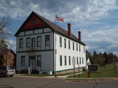
Most of Fifield was built recently: 10% of its homes predate 1940 and the median home dates from 1982. Its Register listings are the Fifield Town Hall, the Round Lake Logging Dam and the Fifield Fire Lookout Tower. Below: maps from 1894 on.
Lost post offices, old corners, places now gone and burying grounds
Fifield’s post office has been open since 1877. Two other post offices opened and closed inside today’s town.
Fifield
1877–today
Flambeau Station
1877–1879
Coolidge
1883–1892
18701950today
Hamlets and corners on the map
Coolidge
Gone or out of use
Caro Timber Picnic GroundlocaleDivine Rapids SchoolschoolPleasant View SchoolschoolSailor Creek SchoolschoolSouth Fork Fire Towertower
1cemetery inside Fifield
Forest Home
US Post Offices dataset (Blevins & Helbock, CC0). Places and cemeteries from the USGS Geographic Names Information System (2021).
Every building
Fifield, building by building, 1894–1909
Fire insurance maps drew every building, what it was made of and what it was used for, so insurers could price the risk of fire. Pick a year, then a sheet.
Fifield was founded in 1876, where the Wisconsin Central Railroad crossed the Flambeau River's south fork in the big northern forest. The town is named after Sam Fifield, a politician and businessman who was Wisconsin's 14th lieutenant governor.
As logging boomed and the population grew, a town hall was built in 1882, but it burned in the fire of 1893, along with Fifield's business district of 60 buildings. The next spring, the town rebuilt the hall with the same dimensions, headed by carpenter Theodore Ristin.
Founding dates: Wikidata, Wikipedia, the U.S. post office records of Blevins & Helbock (CC0) and the Census. Homes by year built: Census ACS 2020–24. National Register of Historic Places: National Park Service (list of May 22, 2026). Old photos, postcards and papers: Wikimedia Commons, the Library of Congress and other public archives, credited on each item’s page. Maps: U.S. Geological Survey historical topographic maps (via Esri) and Sanborn fire-insurance maps (Library of Congress). History text and census tables: Wikipedia (CC BY-SA 4.0). Places that used to be: USGS Geographic Names Information System (2021). How TownRatings grades history →
From Wikimedia Commons (3), Wikidata (3), the National Register of Historic Places (3), Wikipedia, Wikidata and Wikipedia for famous people, U.S. Geological Survey historical maps, the US Post Offices dataset (Blevins & Helbock), the USGS Geographic Names Information System and Sanborn fire insurance maps (Library of Congress). Archive images are copied here with their credits and licenses, shown on each photo’s page. Refreshed monthly.




 2009
 2009
 2004

