Founding year: the first Deerfield post office (Blevins & Helbock, CC0).The full story ↓
History grade
What drives Deerfield’s History grade
On its age, its old homes and the National Register, Deerfield is more historic than 60% of U.S. towns, #163 of 362 in Wisconsin. Its age holds the grade up; its National Register listings pull it down.
B
HistoryA character grade: shown, never part of Deerfield’s overall grade.
Wisconsin towns list more on the Register than most of the country (a typical Wisconsin town has 3.0 per 10,000 residents, the U.S. 2.4), so Deerfield’s 0.0 sits below most of its state (28% of Wisconsin towns have fewer) while its 0 listings outnumber those of 23% of U.S. towns.
How sure. Graded on any two of the three inputs instead, the letter would range from C+ to A−. The pre-1940 share is a Census survey estimate (±6.1 points). The founding year is the first post office, not a stated founding date.
Founding year: the first post office (other dates in Quick answers). Homes: Census ACS 2020–24. National Register: National Park Service, May 2026 list; each listing counted once (boundary changes and added documentation belong to their listing), and a historic district counts its contributing buildings. How TownRatings grades history →
What stands out about Deerfield’s past
Read from the archive, the National Register and the record. The page puts what stands out first.
Passages that mention Deerfield, cut from the printed page as they were published.
History of Dane County, Wisconsin ... preceded by a history of Wisconsin, statistics of the state, and an abstract of its laws and constitution and of the Constitution of the United States1880 · page 855Read the page →
Read the text
limits at the village of Cambridge, on Section 12, passes through the village of Clinton, on Sections 13, 24, 23, and thence through Sections 26, 25 and 36, into the town of Albion ; the Koshkonong Creek, in the southern part, which has its rise in small streams in the center of the town; and Mud Creek, which runs north into the town of Deerfield. Koshkonong prairie extends through the town from southwest to northeast and into the town of Deerfield. The northern portion of the town is marshy, with scattering oak openings ; the western part prairie and openings, with marsh on Koshkonong Creek and its tributaries ; the eastern part, openings and prairie.
Text read by machine from the scan; it may contain errors.
History of Dane County, Wisconsin ... preceded by a history of Wisconsin, statistics of the state, and an abstract of its laws and constitution and of the Constitution of the United States1880 · page 1174Read the page →
Read the text
HAXS C. JACOBSOW, farmer. Sec. 10; P. 0. Cambridge; was born in Norway in 1839, and emigrated to Dane Co., Wis., with his parents in 1853; they located in the town of Christiana, where fchey afterward died. Our subject settled on a farm on Sec. 35, town of Deerfield, in 1863, and made that his home till 1872, when he bought a farm of 239i acres on Sec. 10, town of Christiana, and 40 acres on Sec. 34, town of Deerfield ; he has since resided on Sec. 10, town of Christiana. He enlisted in Co. I, 49th W. V. I., in February, 1865, under Col. Fellows, of Milwaukee, and served with his regiment in the Army of the West, until mustered out at Benton Barracks in October, 1865. He was married, in Christiana, in 1872, to Miss Johanna Olson, a native of Norway, and who came to Wisconsin 1870 ; their
Text read by machine from the scan; it may contain errors.
A history of Madison, the capital of Wisconsin1874 · page 399Read the page →
Read the text
The Township of Deerfield lies on the eastern border of Dane county, in township 7 north, of range 12 east. The town is very well watered by Koshkonong creek, which enters the town on the west line, runs easterly and empties into what is known as Krogh's Mill Po?id} a large body of water which covers a portion of six sections of land. Mud creek enters the town on the south line, and run¬ ning north empties into this pond — large enough in area to be called a lake. Goose Lake lies in the northeast comer on sections 1, 2, 11 and 12.
Text read by machine from the scan; it may contain errors.
Scans and text from the Internet Archive. Books published in 1930 or earlier, which are in the public domain.
Fire insurance maps drew every building, what it was made of and what it was used for, so insurers could price the risk of fire. Pick a year, then a sheet.
Sanborn Map Company, via the Library of Congress. Editions published in 1930 or earlier, which are in the public domain.
People over time
Deerfield, census by census
Grew from 338 people in 1890 to 2,507 in 2020, 7 times over.
14 censuses, 1890–2020.
U.S. Census Bureau decennial counts, from the census table on Deerfield’s Wikipedia page.
Questions about Deerfield’s history
What year was Deerfield founded?
The Deerfield post office opened in 1846, the earliest record of the town by name (U.S. post office records).
How does Deerfield rank for history?
Deerfield is more historic than 60% of U.S. towns, #163 of 362 in Wisconsin. The History grade combines the town’s founding era, the share of homes built before 1940 and its National Register listings. It’s a character grade, so it isn’t part of the overall grade. How it works.
How old are the homes in Deerfield?
18% of Deerfield’s homes were built before 1940 (Census estimate, ±6.1 points), against a typical 12% for a Wisconsin town; the median home was built in 1984.
Founding dates: Wikidata, Wikipedia, the U.S. post office records of Blevins & Helbock (CC0) and the Census. Homes by year built: Census ACS 2020–24. National Register of Historic Places: National Park Service (list of May 22, 2026). Old photos, postcards and papers: Wikimedia Commons, the Library of Congress and other public archives, credited on each item’s page. Maps: U.S. Geological Survey historical topographic maps (via Esri) and Sanborn fire-insurance maps (Library of Congress). History text and census tables: Wikipedia (CC BY-SA 4.0). Places that used to be: USGS Geographic Names Information System (2021).
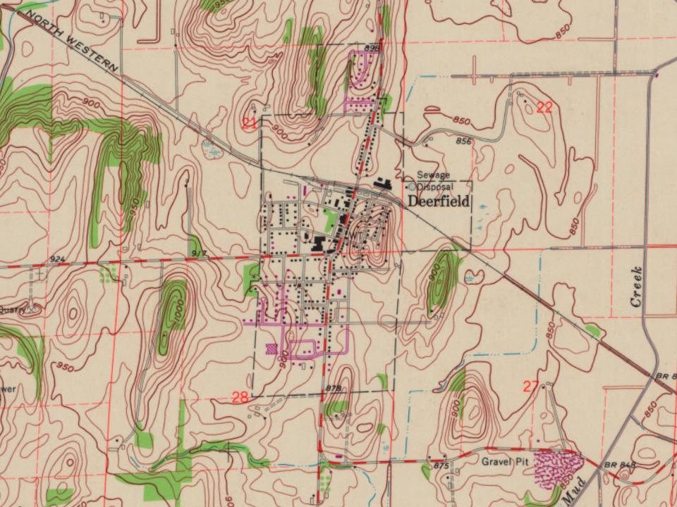
From Wikimedia Commons (12), Wikipedia, Wikidata and Wikipedia for famous people, U.S. Geological Survey historical maps, U.S. Census counts (via Wikipedia), the US Post Offices dataset (Blevins & Helbock), the USGS Geographic Names Information System, Sanborn fire insurance maps (Library of Congress) and old county and town histories (Internet Archive). Archive images are copied here with their credits and licenses, shown on each photo’s page. Refreshed monthly.




 2014
 2014
 2013
 2013
 2013
 2013
 2013
 2013
 2013
 2013
 2008
 2008
