
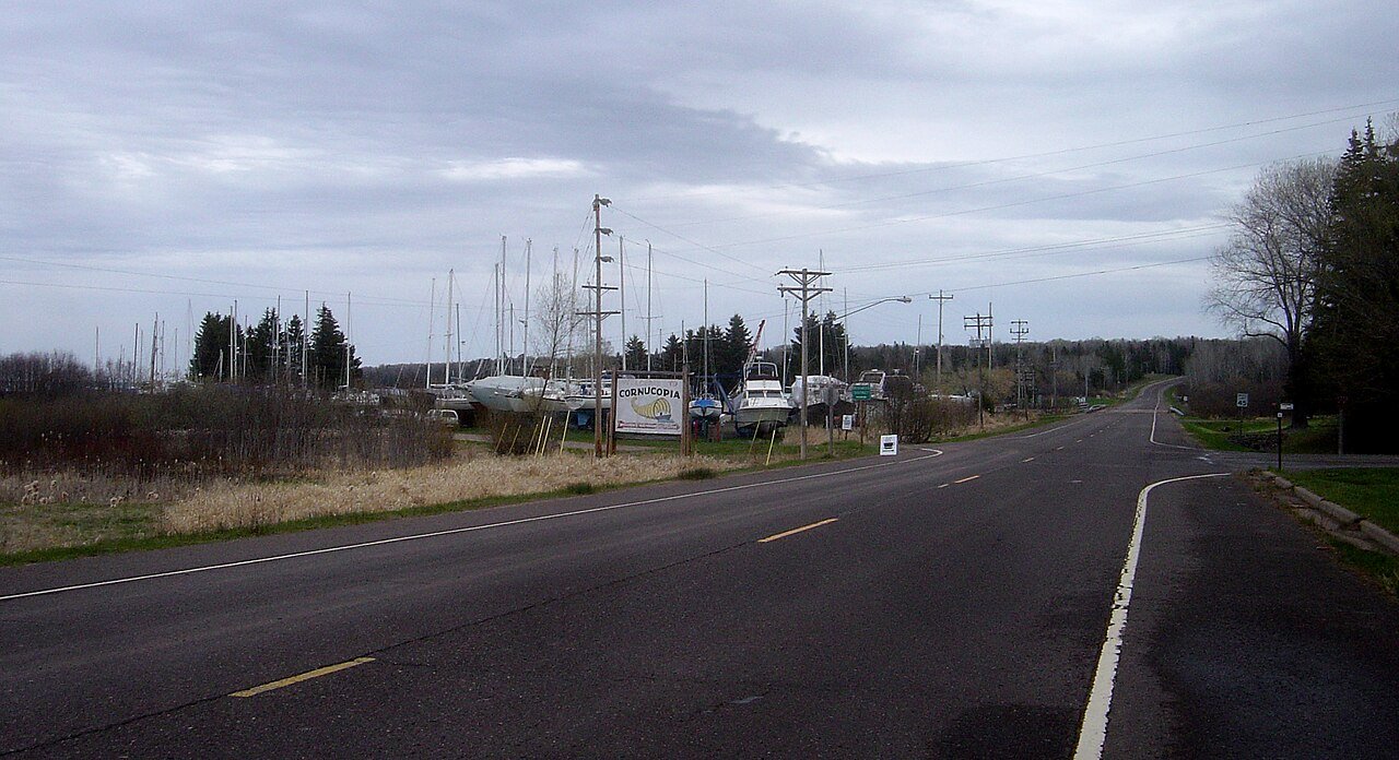
Boat in, 2004
Cornucopia’s story
124 years in pictures
The archive holds 6 old photos and papers going back to 2004 and 2 maps from 1964 on.
- 1902Cornucopia is settled
Each edition grades its towns against each other only.
A town of 108, settled in 1902.
65% of adults 25 and older hold a bachelor’s degree or more in Cornucopia, where Wisconsin’s towns sit at 32% and U.S. towns at 29%. No town among the 363 in Wisconsin we compare has a higher share of households owning their home than Cornucopia. 30% of the land in Cornucopia is conserved, above both the Wisconsin town median (3.8%) and the median of U.S. towns (4.3%). The biggest park or preserve is Lost Creek Bog State Natural Area, at 427 acres. Cornucopia has fewer than 1,000 residents, too few for fair grades; the figures below are still real.
In a town this size, neighbors are the best guide. Ask them anything.
The archive holds 6 old photos and papers going back to 2004 and 2 maps from 1964 on.
Cornucopia is unincorporated, so Bayfield County and regional agencies provide most services.
EPA SDWIS (Oct 9, 2026) · HIFLD + EIA-861 2025 · Census 2020 ZCTAs · NCES 2024–25 · registration: vote.gov, updated Nov 18, 2024.
Ordered by what stands out in Cornucopia.
Of the losses FEMA expects in Cornucopia, 60% come from cold waves and 26% from inland flooding. Expected storm and flood damage is lower than in 99% of U.S. communities.
FEMA National Risk Index · OpenFEMA
For Cornucopia, the trail network density is 1.1 miles per square mile. 2.5 miles of trail in 3 parks and preserves. Parks and preserves locally: 3, covering 543 acres.
| Biggest places to walk | Trails | Acres |
|---|---|---|
| 1. Swenson Forest Preserve | 2.2 mi | 101 |
| 2. Cornucopia Beach | 0.4 mi | 15 |
| 3. Lost Creek Bog State Natural Area | — | 427 |
Trails & parks © OpenStreetMap contributors · Conserved land: USGS PAD-US
Cornucopia has cold, snowy winters and cool summers. July afternoons reach 76°, January nights drop to 7° and about 74 inches of snow falls in a winter.
NOAA U.S. Climate Normals, 1991–2020
Zillow Home Value Index · Redfin Data Center
Two figures for adults in Cornucopia: 16% have diabetes, 14% binge drink. CDC measures, 32 in all: Cornucopia beats Wisconsin on 5 and trails on 10. No town among the 358 in Wisconsin we compare has a higher share of adults who have high blood pressure than Cornucopia. 28% of adults feel lonely here.
| Cornucopia | Wisconsin towns | U.S. towns | |
|---|---|---|---|
| High blood pressure (CDC PLACES) | 45% | 33% | 35% |
| Diabetes (CDC PLACES) | 16% | 11% | 12% |
| Binge drink (CDC PLACES) | 14% | 20% | 16% |
| Frequent physical distress (CDC PLACES) | 16% | 13% | 14% |
| What stands out | Cornucopia | WI |
|---|---|---|
| Fewer binge drinkers | 14.3% | 19% |
| More adults treating high blood pressure | 85.1% | 77.8% |
| More adults with heart disease | 11.1% | 6.6% |
CDC PLACES 2025 · modeled estimates for adults · CMS · HRSA
None within 15 miles of Cornucopia; the nearest are
About 0 of every 100 Cornucopia residents are enrolled in college, against 6 across Wisconsin.
Census-designated place in Wisconsin, United States
Cornucopia is an unincorporated census-designated place in the town of Bell in northern Bayfield County, Wisconsin, United States. It is situated on Lake Superior at the northern end of the Bayfield Peninsula. It is along Wisconsin Highway 13 and County Highway C. As of the 2020 census, its population was 103, an increase over the figure of 98 tabulated in 2010. The community borders the lake at Siskiwit Bay, between Roman's Point and Mawikwe (formerly Squaw) Point. It is near a mainland portion of the Apostle Islands National Lakeshore, which features the Mawikwe Bay Sea Caves. Most residents of the Town of Bell with Cornucopia mailing addresses are considered residents of Cornucopia.
From Wikipedia, licensed CC BY-SA 4.0 · facts via Wikidata (CC0)
Short answers, built from the data on this page.
Cornucopia has fewer than 1,000 residents, too few for fair grades; the figures below are still real.