Beloit dates to 1836, and 27% of its homes were built before 1940
More historic than 95% of U.S. towns · #10 of 362 in Wisconsin. What drives it
29 places in town are on the National Register, among them four historic districts with 281 buildings between them. Below: 10 old photos and papers, maps from 1884 on, and the census since 1860.
Founding year: Wikidata. First post office: 1838.The full story ↓
History grade
What drives Beloit’s History grade
On its age, its old homes and the National Register, Beloit is more historic than 95% of U.S. towns, #10 of 362 in Wisconsin. All 3 inputs are above most U.S. towns; its National Register listings ranks highest and its age lowest.
A+
HistoryA character grade: shown, never part of Beloit’s overall grade.
Wisconsin towns list more on the Register than most of the country (a typical Wisconsin town has 3.0 per 10,000 residents, the U.S. 2.4), so Beloit’s 85.9 sits above most of its state (93% of Wisconsin towns have fewer) while its 314 historic buildings outnumber those of 95% of U.S. towns.
How sure. Graded on any two of the three inputs instead, the letter would range from A to A+. The pre-1940 share (±2.3 points) is firm at this size. Two sources give 1836.
Founding year: Wikidata (other dates in Quick answers). Homes: Census ACS 2020–24. National Register: National Park Service, May 2026 list; each listing counted once (boundary changes and added documentation belong to their listing), and a historic district counts its contributing buildings. How TownRatings grades history →
What stands out about Beloit’s past
Read from the archive, the National Register and the record. The page puts what stands out first.
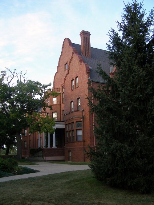
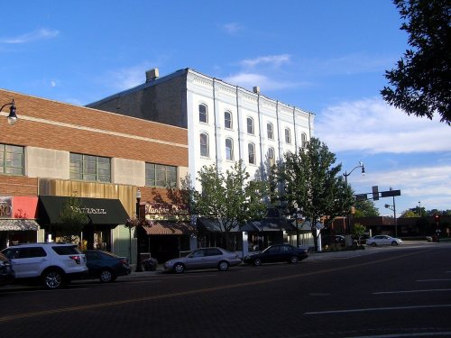
National Park Service, National Register of Historic Places. Photos from Wikimedia Commons, credited on each place’s page.
Every building
Beloit, building by building, 1884–1926
Fire insurance maps drew every building, what it was made of and what it was used for, so insurers could price the risk of fire. Pick a year, then a sheet.
Twelve men in Colebrook, New Hampshire created the "New England Emigrating Company" in October 1836, and sent Horace White to find a suitable region of Wisconsin in which to settle. The level fields and the water power of Turtle Creek and "unlimited gravel" in the area around what is now Beloit fixed the site of the village and farms. White purchased the land. At the same time as the Colebrook settlers, six families from Bedford, New Hampshire, arrived and settled in the region. They said the Rock River Valley had a "New England look" that made them feel at home. The village was platted in 1838 and was planned with wide streets, building on the New England model.
Passages that mention Beloit, cut from the printed page as they were published.
The history of Rock County, Wisconsin1879 · page 387Read the page →
Read the text
An agreement made and entered into this 21st day of May, 1853, between the town of Beloit, by .John Easterly, George B. Sanderson and Allen Warden, the Board of Supervisors of said party of the first part, and the Kacine, Janesville & Mississippi liailroad Company, party of the second part, witnesseth : Whereas, The Board of Supervisors of the said town of Beloit subscribed for and in behalf of said town, for 1 ,000 shares of the capital stock of said Company, by an article of subscription dated this day, in pursuance of an act of the Legislature of the State of Wisconsin, entitled "an act to authorize the town of Beloit to aid in the construction of a certain railroad from the city of Racine to the village of Beloit," approved February 10, 1853. Now, in consideration of said subscription by the town of Beloit aforesaid, and of $1 in hand paid, by the party of the
Text read by machine from the scan; it may contain errors.
The history of Rock County, Wisconsin1879 · page 504Read the page →
Read the text
There are no villages in the town of Beloit ; but the city is wholly within its limits. It has two railroads — the Madison Division of the Chicago & North- Western and the Western Union. The former enters the town from the south at Beloit and leaves it on Section 3, passing into the tow^n of Rock ; the latter, after passing i;n a southwest direction through the towns of Clinton and Turtle, enters the town of Beloit near the city, and, running a short distance in the place last mentioned, passes into Illinois. The town is well watered and timbered, and is one of the wealthiest agricultural towns in the county.- Most of the farms are large and under a high state of cultivation. The improvements are excellent. The town has but one post
Text read by machine from the scan; it may contain errors.
Scans and text from the Internet Archive. Books published in 1930 or earlier, which are in the public domain.
Timeline
Beloit, 1836 to 1982
Woven from the archive, old maps, post office records, the National Register and the people born here.
Nothing in the archives for these yearsWeddings on Main Street, storms, parades, school pictures, the old store. If it’s in your family album, it belongs here.
Beloit Municipal HospitalhospitalBeloit SanitariumhospitalBoutelle QuarrymineCentral Christian ChurchchurchFirst Church of Christ ScientistchurchFirst Conservative Baptist ChurchchurchFree Methodist ChurchchurchGrace Methodist ChurchchurchKindom Hall of Jehovahs WitnesseschurchParker Public SchoolschoolSeventh Day Adventist ChurchchurchThe Israel of Gods Churchchurch
4cemeteries and burying grounds inside Beloit
CalvaryEast LawnMount ThaborOakwood
US Post Offices dataset (Blevins & Helbock, CC0). Places and cemeteries from the USGS Geographic Names Information System (2021).
Help out
Finish Beloit’s story
Most archives stop around 1920. The photos from after that are in family albums, not libraries.
Decades since 1900 with photos
00s10s20s30s40s50s60s70s80s90s
0 of 10 decades. The empty ones are waiting for someone’s album.
In 1836, according to Wikidata. Beloit’s post office opened in 1838, and the census of 1860 counted 4,098 people here.
How does Beloit rank for history?
Beloit is more historic than 95% of U.S. towns, #10 of 362 in Wisconsin. The History grade combines the town’s founding era, the share of homes built before 1940 and its National Register listings. It’s a character grade, so it isn’t part of the overall grade. How it works.
What is on the National Register in Beloit?
29 listings: 24 buildings, among them the Rasey House (listed 1974, the first), 4 historic districts with 281 contributing buildings, and 1 site. 314 historic buildings in all.
How old are the homes in Beloit?
27% of Beloit’s homes were built before 1940 (Census estimate, ±2.3 points), against a typical 12% for a Wisconsin town; the median home was built in 1957.
Founding dates: Wikidata, Wikipedia, the U.S. post office records of Blevins & Helbock (CC0) and the Census. Homes by year built: Census ACS 2020–24. National Register of Historic Places: National Park Service (list of May 22, 2026). Old photos, postcards and papers: Wikimedia Commons, the Library of Congress and other public archives, credited on each item’s page. Maps: U.S. Geological Survey historical topographic maps (via Esri) and Sanborn fire-insurance maps (Library of Congress). History text and census tables: Wikipedia (CC BY-SA 4.0). Places that used to be: USGS Geographic Names Information System (2021).
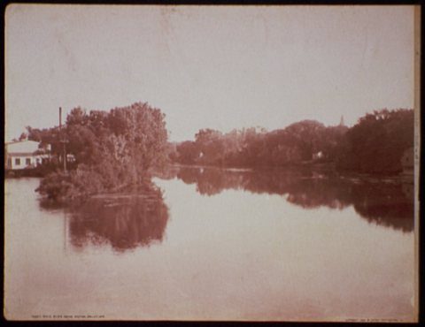
From Wikimedia Commons (3), the Library of Congress (7), Wikidata (11), the National Register of Historic Places (29), Wikipedia, Wikidata and Wikipedia for famous people, U.S. Geological Survey historical maps, U.S. Census counts (via Wikipedia), the US Post Offices dataset (Blevins & Helbock), the USGS Geographic Names Information System, Sanborn fire insurance maps (Library of Congress) and old county and town histories (Internet Archive). Archive images are copied here with their credits and licenses, shown on each photo’s page. Refreshed monthly.




 1880
 1887
 1898
 1898
 1898
 1898
 1898


