141 years in pictures
Census counts: 483 in 1900, 12,543 in 2020. The archive holds 4 old photos and papers going back to 1905 and 4 maps from 1956 on.
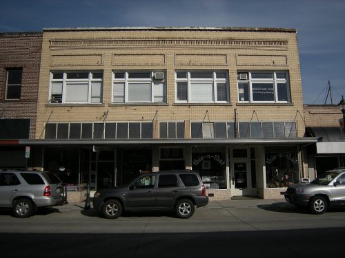
2 places on the National Register of Historic Places.
- 1885Enumclaw is settled

Each edition grades its towns against each other only.

Enumclaw grades B+ overall, 47th among Washington's 285 graded towns, with clear strengths and some subjects that lag. CDC estimates put its residents' health ahead of 89% of the country and 16% of its land is conserved. On the other side, FEMA rates its natural-hazard risk higher than 76% of U.S. communities, with earthquakes at the top. 17% of the land in Enumclaw is conserved, against 4% in Washington’s towns and 4.3% across U.S. towns. Enumclaw has 2 places on the National Register of Historic Places, among them Louis and Ellen Olson House and Trommald Building. Enumclaw is more walkable than 80% of U.S. towns.
Where Enumclaw beats most towns.
10,669 counted in 2010 and 12,543 in 2020; an estimated 13,172 in 2025.
Growth hasn’t slowed: 5.1% since 2020, after 17.6% in the decade before.
U.S. Census 2010 & 2020 counts · Census Bureau estimate, July 1, 2025
Each subject compared with towns across the country (schools within Washington), ordered by how far Enumclaw is from typical.
How TownRatings grades towns →
Census counts: 483 in 1900, 12,543 in 2020. The archive holds 4 old photos and papers going back to 1905 and 4 maps from 1956 on.
2 places on the National Register of Historic Places.
Who provides power, water and the rest in Enumclaw, and how to reach them.
EPA SDWIS (Oct 9, 2026) · HIFLD + EIA-861 2025 · Census 2020 ZCTAs · NCES 2024–25 · registration: vote.gov, updated Sep 30, 2026.
Ordered by what stands out in Enumclaw.
Enumclaw fares better on crime within Washington than nationally and has cooler summers than nearly all U.S. towns.
Just over a quarter of adults have obesity in Enumclaw, where Washington’s towns sit at 33% and U.S. towns at 35%. The share of adults in Enumclaw who had a checkup this year: 70%. On the CDC’s 31 measures, Enumclaw is ahead of Washington on 12 and behind on 3.
| Enumclaw | Washington towns | U.S. towns | |
|---|---|---|---|
| Obesity (CDC PLACES) | 26% | 33% | 35% |
| Sleep under 7 hours (CDC PLACES) | 29% | 33% | 36% |
| Yearly checkup (CDC PLACES) | 70% | 71% | 79% |
| Diabetes (CDC PLACES) | 7.7% | 9.8% | 12% |
| What stands out | Enumclaw | WA |
|---|---|---|
| Fewer adults facing a utility shut-off | 4% | 5.1% |
| Fewer adults with diabetes | 7.7% | 9.5% |
| More adults with depression | 28% | 25.1% |
CDC PLACES 2025 · modeled estimates for adults · CMS · HRSA
Public schools: the Enumclaw School District. Two of its 8 schools are shown below, with the reason for each. 5 public schools serve Enumclaw, with 1,880 students in all.
| School | Level | Students | Letter |
|---|---|---|---|
| Enumclaw Middle SchoolLargest public middle schoolGrades 6–8 | Grades 6–8 | 522 | – |
| Enumclaw Sr High SchoolLargest public high schoolGrades 9–12 | Grades 9–12 | 1,333 | – |
NCES · EDFacts · graded within WA on state tests and graduation
The trail network density for Enumclaw comes to 0.9 miles per square mile. Trails run 4.9 miles in 14 parks and preserves. Also worth knowing: the biggest park or preserve is Mahler Park, at 28 acres.
| Biggest places to walk | Trails | Acres |
|---|---|---|
| 1. Mahler Park | 0.1 mi | 28 |
| 2. Anderson Riverview Park | — | 26 |
| 3. Boise Creek Park | 0.1 mi | 21 |
Trails & parks © OpenStreetMap contributors · Conserved land: USGS PAD-US
Expected losses in Enumclaw break down as 75% from earthquakes and 23% from inland flooding. The national flood insurance program has paid 2 claims here since 1996. Federal disaster aid has reached households in Enumclaw after 7 declared disasters, most recently in 2025.
FEMA disaster declarations and aid · FEMA flood insurance claims · FEMA National Risk Index · OpenFEMA
July afternoons average 76°, cooler than in 98% of U.S. towns; January nights average 33.5°.
Enumclaw’s January low is 34°F. About 4 inches of snow falls in a winter.
| Enumclaw | Washington towns | U.S. towns | |
|---|---|---|---|
| July high | 76°F | 77°F | 85°F |
| January low | 34°F | 35°F | 22°F |
NOAA U.S. Climate Normals, 1991–2020
The average trip to work in Enumclaw is 33 minutes. Commuting out is the norm here: 17% of working residents work locally. Between 2013 and 2023, jobs here rose by 812, to 5,005. Half of commuters travel less than 19 miles.
| Enumclaw | Washington towns | U.S. towns | |
|---|---|---|---|
| Average trip to work | 33 minutes | 27 minutes | 25 minutes |
| Median household income | $121,000 | $98,000 | $80,000 |
| Work from home | 14% | 15% | 11% |
| Below the poverty line | 7.5% | 7.9% | 9.6% |
Census LEHD 2023 · ACS
For Enumclaw, the midpoint rent is $1,954 a month. Bidding over the asking price: 38% of homes sold here. On the market here: a median 18 days to sell.
| Enumclaw | Washington towns | U.S. towns | |
|---|---|---|---|
| Median rent | $1,954 a month | $1,737 a month | $1,185 a month |
| Households that own their home | 74% | 70% | 73% |
Census ACS, 2020–24 · Zillow Home Value Index · Redfin Data Center
At 18.4 crimes per 1,000 residents a year, it reports less crime than 73% of Washington’s graded towns. Reported crimes fell from 275 to 174 over the last three FBI years, a drop beyond ordinary year-to-year swings.
Enumclaw’s violent crime rate stands at 0.5 per 1,000 residents. In Enumclaw, the property crime rate is 12.5 per 1,000 residents.
| Enumclaw | Washington towns | U.S. towns | |
|---|---|---|---|
| Violent crimes per 1,000 (2025) | 0.5 per 1,000 residents | 1.5 | 1.6 |
| Property crimes per 1,000 (2025) | 12.5 per 1,000 residents | 15.1 | 9.9 |
FBI crime data, 2025 · crimes reported to police
Museums, parks, gardens and other places to visit around Enumclaw. Close and well known come first.
Big draw33 mi LookoutSpace Needle
Big draw32 mi Stadium & arenaLumen Field
Big draw34 mi Stadium & arenaClimate Pledge Arena
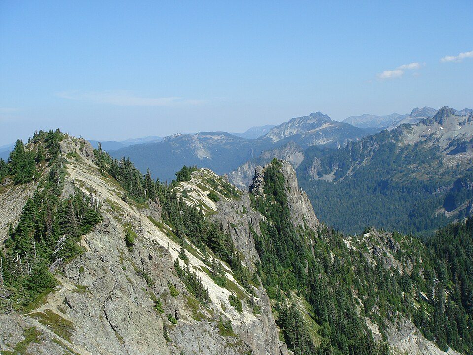
14 mi National ParkMount Rainier National Park1.6M visitors a year
31 mi Stadium & arenaT-Mobile Park
32 mi Ancient siteSeattle UndergroundSpace Needle: Another Believer, CC BY-SA 4.0 · Lumen Field: "Smart Destinations", GoSeattleCard.com, and Go Seattle Card Blog, CC BY-SA 2.0 · Climate Pledge Arena: Sea Cow, CC BY-SA 4.0 · Mount Rainier National Park: Ricardo Martins from Gent, Belgium, CC BY 2.0 · T-Mobile Park: MyName (Cacophony), CC BY-SA 3.0 · Seattle Underground: Mark Hursh, CC BY-SA 3.0
1 within 15 miles of the center of Enumclaw
About 3 of every 100 Enumclaw residents are enrolled in college, against 6 across Washington.
16.5% of the town is conserved land, across 14 parks and preserves.
2 places in Enumclaw on the National Register of Historic Places.
City in Washington, United States
Enumclaw ( EE-nəm-klaw) is a city in King County, Washington, United States. The population was 12,543 at the 2020 census. The Enumclaw Plateau, on which the city resides, was formed by a volcanic mudflow (lahar) from Mount Rainier approximately 5,700 years ago.
From Wikipedia, licensed CC BY-SA 4.0 · facts via Wikidata (CC0)
Short answers, built from the data on this page.
By most measures, yes. Enumclaw grades B+ overall, better than 72% of U.S. towns and #47 of 285 in Washington. It grades A for health, B− for safety and B+ for schools. Hazard risk is its weak spot, with a C−.
That is 5.7 years of the area's median household income ($115,177 across the Seattle-Tacoma-Bellevue, WA metro area). Cost of living, which also weighs rents, property taxes and how many households pay 30% or more of their income for housing, grades C.