190 years in pictures
Census counts: 28 in 1810, a low of 28 in 1810, 551 in 2020. The archive holds 3 old photos and papers going back to 2004 and 3 maps from 1920 on.
- 1836Jay is settled
Each edition grades its towns against each other only.

Jay’s average trip to work is 40 minutes, above both the Vermont town median (23 minutes) and the median of U.S. towns (25 minutes). Of the 72 Vermont towns we compare, none has a higher share of households owning their home than Jay. 31% of the land in Jay is conserved, above both the Vermont town median (14%) and the median of U.S. towns (4.3%). The biggest place to walk is Jay State Forest, 1,920 acres with 6.7 miles of trail. Jay has fewer than 1,000 residents, too few for fair grades; the figures below are still real.
Where Jay beats most towns.
In a town this size, neighbors are the best guide. Ask them anything.
Census counts: 28 in 1810, a low of 28 in 1810, 551 in 2020. The archive holds 3 old photos and papers going back to 2004 and 3 maps from 1920 on.
Who provides power, water and the rest in Jay, and how to reach them.
EPA SDWIS (Oct 9, 2026) · HIFLD + EIA-861 2025 · Census 2020 ZCTAs · NCES 2024–25 · registration: vote.gov, updated Aug 3, 2026.
Ordered by what stands out in Jay.
Most working residents leave Jay for work: only 17% work in town. Jobs based in Jay fell to 720 in 2023, 60 fewer than in 2013. The top destinations are Newport (20%), Derby (9%) and Troy (7%).
| Jay | Vermont towns | U.S. towns | |
|---|---|---|---|
| Working residents who work in town | 17% | 16% | 8% |
| Median household income | $75,000 | $80,000 | $80,000 |
Census LEHD 2023 · ACS
Its public schools are run by the Jay/Westfield Joint Elementary School District. Its one school is below.
| School | Level | Students | Letter |
|---|---|---|---|
| Jay/Westfield Joint Elementary SchoolLargest public elementary schoolGrades PK–6 | Grades PK–6 | 81 | C |
NCES · EDFacts
Adults 35 to 64 are 61% of residents (39% statewide); adults 18 to 34 are 10% of residents (22% statewide). Jay’s median age is 52.1 years. Jay has lost 2.4% of its people since 2020, down to 539 in the Census Bureau’s 2025 estimate.
| Jay | Vermont towns | U.S. towns | |
|---|---|---|---|
| Median age | 52.1 years | 43.7 years | 40.5 years |
| Bachelor’s degree or more, 25+ | 45% | 40% | 29% |
49% women, 51% men
That’s an even split within the survey’s margin of ±8.2 points. Across Vermont, 50.4% of residents are women.
| Jay | VT | U.S. | |
|---|---|---|---|
| Under 10 | 8.7% | 9.1% | 11.6% |
| 10 to 17 | 5.5% | 8.8% | 10.3% |
| 18 to 24 | 3.4% | 10% | 9.1% |
| 25 to 34 | 6.4% | 11.9% | 13.7% |
| 35 to 44 | 20.6% | 12.3% | 13.2% |
| 45 to 54 | 18.3% | 12% | 12.2% |
| 55 to 64 | 21.7% | 14.5% | 12.7% |
| 65 to 74 | 5.1% | 13% | 10.2% |
| 75 and older | 10.4% | 8.5% | 7% |
| No diploma | 7.5% | 5.1% | 10.4% |
| High school | 22.7% | 26.8% | 26% |
| Some college | 16.8% | 15.8% | 19.1% |
| Associate’s | 8% | 8.6% | 8.8% |
| Bachelor’s | 28.4% | 25.2% | 21.6% |
| Graduate | 16.8% | 18.6% | 14.1% |
Census population estimates, 2025 · U.S. Census Bureau · ACS 2020-2024 5-year estimates · in a town of 500, single groups can be off by several points
32 miles of trail in 1 park or preserve. The trail density in Jay is 0.9 miles per square mile.
| Biggest places to walk | Trails | Acres |
|---|---|---|
| 1. Jay State Forest | 6.7 mi | 1,920 |
Trails & parks © OpenStreetMap contributors · Conserved land: USGS PAD-US
Expected storm and flood damage is lower than in 80% of U.S. communities. One flood insurance claim has been paid in Jay since 2011.
FEMA flood insurance claims · FEMA National Risk Index · OpenFEMA
No town among the 72 in Vermont we compare has a lower July high than Jay. Jay has cold winters and cool summers, with plenty of rain.
NOAA U.S. Climate Normals, 1991–2020
Only 1 of the 72 Vermont towns we compare have a higher share of adults who sleep under 7 hours than Jay. 22% of adults get no exercise outside work in Jay. Jay beats the Vermont average on 0 of 31 CDC measures and trails it on 5.
| Jay | Vermont towns | U.S. towns | |
|---|---|---|---|
| Sleep under 7 hours (CDC PLACES) | 36% | 30% | 36% |
| Obesity (CDC PLACES) | 33% | 30% | 35% |
| Depression (CDC PLACES) | 25% | 27% | 23% |
| Diabetes (CDC PLACES) | 9.5% | 9.1% | 12% |
| What stands out | Jay | VT |
|---|---|---|
| More older adults who have lost all their teeth | 12.7% | 10.1% |
| More adults sleeping under 7 hours | 35.5% | 28.6% |
| More smokers | 13.6% | 11.2% |
CDC PLACES 2025 · modeled estimates for adults · CMS · HRSA
The typical Jay home is worth about $425,000, up 6.2% in a year, 8% above the Vermont typical home.
Zillow Home Value Index · Redfin Data Center
None within 15 miles of Jay; the nearest are
About 2 of every 100 Jay residents are enrolled in college, against 7 across Vermont.
Where Jay’s working residents go each day. Line width shows the share.
Census LEHD 2023
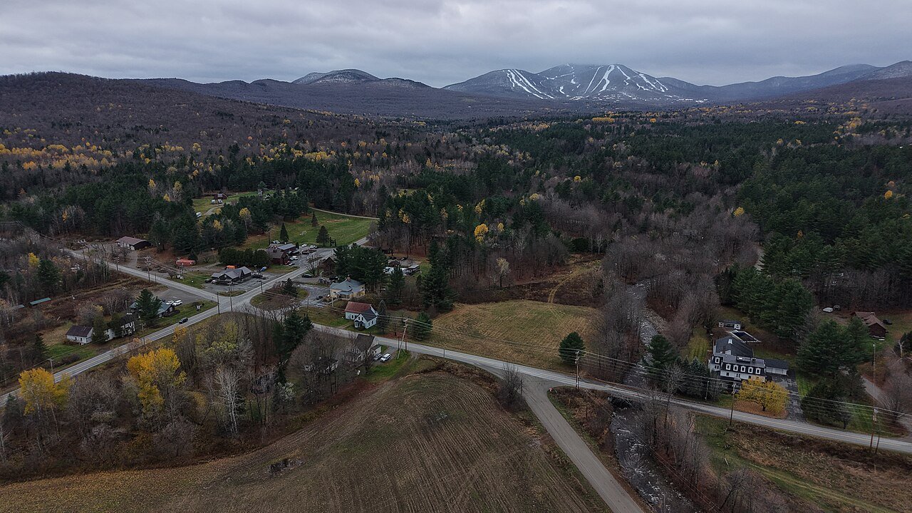
Town in Vermont, United States
Jay is one of the northernmost towns in Orleans County, Vermont, United States, located on the Canada–US border. The population was 551 at the 2020 census. Jay is named for John Jay, one of the Founding Fathers of the United States. The US Census Bureau estimated that the town's population had increased by 13.1% between 2000 and 2005, the seventh largest increase in the state. Jay is also home to the Jay Challenge, a three-part stage-race, typically held in July.
From Wikipedia, licensed CC BY-SA 4.0 · facts via Wikidata (CC0)
Short answers, built from the data on this page.
Jay has fewer than 1,000 residents, too few for fair grades; the figures below are still real.