Guest, Sign inJoin

Post to Washington

We’ll email a one-tap link to publish your post. No password, and nothing is public until you click it.
Already a member? Sign in
–Not graded
History · Washington

Washington dates to 1796, and 70% of its homes were built before 1940

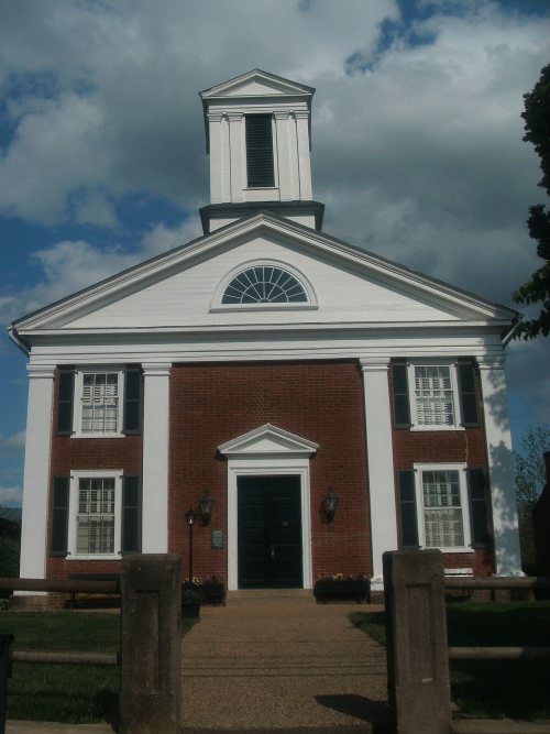
3 places in town are on the National Register, among them a historic district with 147 buildings. Below: 2 old photos and papers, maps from 1961 on, and the census since 1880.

1796founded
3on the National Register
70%homes built before 1940
2old photos & papers
1famous people
From Washington’s archive · credits on each photo
Quick answers

How Washington began

When was Washington founded?

1796

Washington dates its founding to 1796 (Wikipedia’s history). The census first counted it in 1880.

First census: 254 in 18802020 census: 86230 years
Founding year: Wikipedia.The full story ↓

What stands out about Washington’s past

Read from the archive, the National Register and the record. The page puts what stands out first.

★ What stands out · On the National Register

3 listings protect 149 historic buildings

The country’s official list of buildings and places worth saving.

places listed
3
National Historic Landmarks
0
none yet
historic buildings protected
149
each building in a district counts
first listed
1975
Washington Historic District
BuildingsDistricts

Architectural styles listings

Jeffersonian Style1
Edwardian1
Gothic Revival1
Roman Revival1
Colonial Revival1
Tudor Revival1

National Park Service, National Register of Historic Places. Photos from Wikimedia Commons, credited on each place’s page.

Help out

Start Washington’s collection

The first neighbors to add old photos shape how Washington’s history is told.

Decades since 1900 with photos
00s10s20s30s40s50s60s70s80s90s
1 of 10 decades. The empty ones are waiting for someone’s album.
The story

How Washington came to be

From Wikipedia’s history of Washington.

Read it all →

The first recorded official document relating to the land that became the town of Washington was a land grant in the year 1735 from King George II of Great Britain to Thomas, James, and Elizabeth Kennerly. The three siblings received 1,750 acres of land located "between the mountains and the fork of the Rushy River," in what was then Orange County, for importing six people into the colony of Virginia, payment of seven pounds five shillings of "good and lawful money," and an annual fee of one shilling for every fifty acres of land. At this time there were virtually no Native Americans in the area and the way was open to English settlement of the Piedmont region of Virginia.

Text from Wikipedia, licensed CC BY-SA 4.0.

From the old history books

What they wrote about Washington, 1857–1903

Passages that mention Washington, cut from the printed page as they were published.

If the object of the enemy was to proceed direct to Washington, the road by Bladensburg offered fewer obstructions than that over the Eastern Branch Bridge, although it was six miles further ; and yet, if I had retired toward Bladensburg, I should have been removed so much further from annoying or …
History of the invasion and capture of Washington, and the events which preceded and followed1857 · page 318Read the page →
Read the text

If the object of the enemy was to proceed direct to Washington, the road by Bladensburg offered fewer obstructions than that over the Eastern Branch Bridge, although it was six miles further ; and yet, if I had retired toward Bladensburg, I should have been removed so much further from annoying or impeding the enemy, if he proceeded to Fort Washington, and I should have left the road to Washington City, by the Eastern Branch Bridge, open to him, which, although I had, as I supposed, left a secure arrangement

Text read by machine from the scan; it may contain errors.
About this time the militia was transferred from the State's service to the service of the United States, to serve six months. A portion of the Washington county militia marched for the city of Washington a few days after Colonel Coleman marched for the Northern Neck, and, upon the return of Colema…
History of southwest Virginia, 1746-1786, Washington County, 1777-18701903 · page 462Read the page →
Read the text

About this time the militia was transferred from the State's service to the service of the United States, to serve six months. A portion of the Washington county militia marched for the city of Washington a few days after Colonel Coleman marched for the Northern Neck, and, upon the return of Coleman's forces to Fort Mitchell, the field and staff officers of his command were ordered to Washington city. The troop of cavalry and riflemen were ordered to Charles City courthouse, from which point they passed to Camp

Text read by machine from the scan; it may contain errors.
Assistant Adjutant-general of Militia, came to me from Washington with a message from General Winder informing me that General Winder had retreated from Battalion Old Fields into the City of Washington across the bridge, which he had ordered to be burned ; and that the general expected I would resi…
History of the invasion and capture of Washington, and the events which preceded and followed1857 · page 335Read the page →
Read the text

Assistant Adjutant-general of Militia, came to me from Washington with a message from General Winder informing me that General Winder had retreated from Battalion Old Fields into the City of Washington across the bridge, which he had ordered to be burned ; and that the general expected I would resist the enemy as long as possible should he move against me in that direction.

Text read by machine from the scan; it may contain errors.
The first postoffice in Southwestern Virginia was established at Abingdon on the 25th day of April, 1793, with Gerrard T. Conn as postmaster, and this was the only postoffice to be foimd in the county of Washington, until the year 1833. It is hard to believe that the citizens of this county for for…
History of southwest Virginia, 1746-1786, Washington County, 1777-18701903 · page 634Read the page →
Read the text

The first postoffice in Southwestern Virginia was established at Abingdon on the 25th day of April, 1793, with Gerrard T. Conn as postmaster, and this was the only postoffice to be foimd in the county of Washington, until the year 1833. It is hard to believe that the citizens of this county for forty years had but one postoffice and one place at which they could mail their letters and receive their mail.

Text read by machine from the scan; it may contain errors.

Scans and text from the Internet Archive. Books published in 1930 or earlier, which are in the public domain.

Timeline

Washington, 1796 to 1961

Woven from the archive, old maps, post office records, the National Register and the people born here.

  1. 18th century
  2. 1796
    FoundingWashington is established
  3. 1797In the archive1797 plan of the town of Washington, Virginia2
  4. 19th century
  5. 1892Born hereCurry Carter is born here
  6. 20th century
  7. 1900CensusPopulation peaks at 300
  8. 1940In the archiveFarmer plowing his field of four acres. Near Washington, Virginia
  9. 1961On the mapFirst mapped by the U.S. Geological Survey
By decade

Washington, decade by decade

2 decades in the archive, from the 1790s to the 1940s. Scroll each row; tap a photo for its story.

1950s–1990snothing yet
Nothing in the archives for these yearsWeddings on Main Street, storms, parades, school pictures, the old store. If it’s in your family album, it belongs here.
Add from your album
On the map

Washington on the map, 1961 to 1994

Every edition of the U.S. Geological Survey’s map of Washington. Tap a year, or press play to watch the town change.

Washington on the 1961 USGS mapWashington on the 1971 USGS mapWashington on the 1994 USGS map1961Sperryville sheet · 1:62,500

U.S. Geological Survey historical topographic maps (public domain), via Esri’s collection of the scans. The red ring marks the center of Washington.

Then & now

Stand where they stood

No then-and-now pairs yet. Take a photo from the same spot as an old one and they appear here side by side.

Farmer plowing his field of four acres. Near Washington, Virginia
Retake this viewFarmer plowing his field of four acres. Near Washington, Virginia, 1940

Find the spot, match the angle, and add your photo. It becomes the first then-and-now pair on Washington’s page.

Retake this view · +15
People over time

Washington, census by census

01002003001880190019201940196019802000Peak: 300

Peaked at 300 in 1900; 135 people lived here in 2010.

14 censuses, 1880–2010.

U.S. Census Bureau decennial counts, from the census table on Washington’s Wikipedia page.

Places that used to be

Places now gone

Gone or out of use
The Washington AcademyschoolWashington Female AcademyschoolWashington Methodist ChurchchurchWashington Presbyterian Churchchurch

Places and cemeteries from the USGS Geographic Names Information System (2021).

Questions about Washington’s history

What year was Washington founded?

In 1796, according to Wikipedia’s history of the town. the census of 1880 counted 254 people here.

What is on the National Register in Washington?

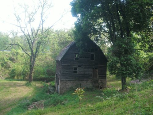
Three places: the Washington Historic District (listed 1975), the Calvert Mill/Washington Mill (1982) and the Washington School (2019).

Memory lane

What the archives can’t tell you, neighbors can.

Town Square →
Start a conversation
Sources

Where this page comes from

Founding dates: Wikidata, Wikipedia, the U.S. post office records of Blevins & Helbock (CC0) and the Census. Homes by year built: Census ACS 2020–24. National Register of Historic Places: National Park Service (list of May 22, 2026). Old photos, postcards and papers: Wikimedia Commons, the Library of Congress and other public archives, credited on each item’s page. Maps: U.S. Geological Survey historical topographic maps (via Esri) and Sanborn fire-insurance maps (Library of Congress). History text and census tables: Wikipedia (CC BY-SA 4.0). Places that used to be: USGS Geographic Names Information System (2021). How TownRatings grades history →

From Wikimedia Commons (5), the Library of Congress (1), the National Register of Historic Places (3), Wikipedia, Wikidata and Wikipedia for famous people, U.S. Geological Survey historical maps, U.S. Census counts (via Wikipedia), the USGS Geographic Names Information System and old county and town histories (Internet Archive). Archive images are copied here with their credits and licenses, shown on each photo’s page. Refreshed monthly.