Tazewell dates to 1800, and 15% of its homes were built before 1940
More historic than 86% of U.S. towns · #24 of 253 in Virginia. What drives it
4 places in town are on the National Register, among them two historic districts with 118 buildings between them. Below: 4 old photos and papers, maps from 1897 on, and the census since 1880.
Founding year: Wikidata. First post office: 1803.The full story ↓
History grade
What drives Tazewell’s History grade
On its age, its old homes and the National Register, Tazewell is more historic than 86% of U.S. towns, #24 of 253 in Virginia. All 3 inputs are above most U.S. towns; its National Register listings ranks highest and its share of homes from before 1940 lowest.
A
HistoryA character grade: shown, never part of Tazewell’s overall grade.
Virginia towns list more on the Register than most of the country (a typical Virginia town has 3.6 per 10,000 residents, the U.S. 2.4), so Tazewell’s 276 sits above most of its state (83% of Virginia towns have fewer) while its 121 historic buildings outnumber those of 90% of U.S. towns.
NoteThe founding year comes from Wikidata alone; no second source gives 1800.
How sure. Graded on any two of the three inputs instead, the letter would range from B+ to A. The pre-1940 share is a Census survey estimate (±6.2 points).
Founding year: Wikidata (other dates in Quick answers). Homes: Census ACS 2020–24. National Register: National Park Service, May 2026 list; each listing counted once (boundary changes and added documentation belong to their listing), and a historic district counts its contributing buildings. How TownRatings grades history →
What stands out about Tazewell’s past
Read from the archive, the National Register and the record. The page puts what stands out first.
Named Jeffersonville until 1892, Tazewell developed near the headwaters of the Clinch River.
Tazewell is said to be one of the smallest towns in the United States to have once operated a streetcar. Chartered as the Tazewell Railway and Light Company, it operated from Tazewell station and industrial complexes in North Tazewell to downtown along Main Street and its lining government buildings, hotels, restaurants, and other businesses. The trolley started operations in 1892 as a horsecar and it was electrified in 1904. The fare was five cents. By 1920, the streetcar was competing with automobiles and it closed in 1933.
Passages that mention Tazewell, cut from the printed page as they were published.
Annals of Tazewell County, Virginia from 1800 to 19221922 · page 316Read the page →
Read the text
J. N. Harman and Bettie, his wife, conveyed to C. A. Banks, Albert Crockett, and Stuart Crockett, Trustees of the Christian Church, (colored) of the Town of Tazewell, a certain lot lying on west side of Railroad Avenue about half way between the town of Tazewell and the railway station.
Text read by machine from the scan; it may contain errors.
History of Tazewell county and southwest Virginia, 1748-19201920 · page 432Read the page →
Read the text
eighteenth century. He married a Miss Roberts, and moved to that part of Augusta County, Virginia, now embraced in the county of Rockbridge. Three of his sons, Thomas, James and Robert, were among the first settlers in the present Tazewell County. Thomas and James settled on Bluestone, not very far from the present town of Graham; and Robert located near Plum Creek, about two miles west of present town of Tazewell. They came here about 1771 or 1772.
Text read by machine from the scan; it may contain errors.
History of Tazewell county and southwest Virginia, 1748-19201920 · page 365Read the page →
Read the text
and Southwest Virginia 365 The line as located by the original act ran through the present Tazewell County about six miles east of the town of Tazewell, placing the greater portion of the present Tazewell County in Washington County. By the act of May, 1777, the line was located about six miles west of the town, and the larger part of the territory was in Montgomery. In other words, all the country west of the line which ran by Morris' Knob was in Washington, while all east of that
Text read by machine from the scan; it may contain errors.
Annals of Tazewell County, Virginia from 1800 to 19221922 · page 224Read the page →
Read the text
“State of Virginia Tazewell County, to wit, On the 16th day of October 1882, personally appeared in open Court, before the County Court of Tazewell County in the State of Virginia now sitting William Cecil a resident of Tazewell County and State of Virginia aged about eighty-three years, who being first duly sworn, according to Lawr, doth on his oath make the following declaration, in order to obtain the benefit of the Act of Congress passed June 7th 1832. That he entered the service of the United
Text read by machine from the scan; it may contain errors.
Scans and text from the Internet Archive. Books published in 1930 or earlier, which are in the public domain.
Timeline
Tazewell, 1800 to 1974
Woven from the archive, old maps, post office records, the National Register and the people born here.
Nothing in the archives for these yearsWeddings on Main Street, storms, parades, school pictures, the old store. If it’s in your family album, it belongs here.
Every edition of the U.S. Geological Survey’s map of Tazewell. Tap a year, or press play to watch the town change.
1916Pounding Mill sheet · 1:62,500
U.S. Geological Survey historical topographic maps (public domain), via Esri’s collection of the scans. The red ring marks the center of Tazewell.
Every building
Tazewell, building by building, 1897–1923
Fire insurance maps drew every building, what it was made of and what it was used for, so insurers could price the risk of fire. Pick a year, then a sheet.
In 1800, according to Wikidata. Tazewell’s post office opened in 1803, and the census of 1880 counted 508 people here.
How does Tazewell rank for history?
Tazewell is more historic than 86% of U.S. towns, #24 of 253 in Virginia. The History grade combines the town’s founding era, the share of homes built before 1940 and its National Register listings. It’s a character grade, so it isn’t part of the overall grade. How it works.
What is on the National Register in Tazewell?
4 listings: 2 buildings, among them the James Wynn House (listed 1992, the first), and 2 historic districts, the Tazewill Historic District and the Tazewell Historic District, with 118 contributing buildings. 121 historic buildings in all.
How old are the homes in Tazewell?
15% of Tazewell’s homes were built before 1940 (Census estimate, ±6.2 points), against a typical 1.9% for a Virginia town; the median home was built in 1964.
Founding dates: Wikidata, Wikipedia, the U.S. post office records of Blevins & Helbock (CC0) and the Census. Homes by year built: Census ACS 2020–24. National Register of Historic Places: National Park Service (list of May 22, 2026). Old photos, postcards and papers: Wikimedia Commons, the Library of Congress and other public archives, credited on each item’s page. Maps: U.S. Geological Survey historical topographic maps (via Esri) and Sanborn fire-insurance maps (Library of Congress). History text and census tables: Wikipedia (CC BY-SA 4.0). Places that used to be: USGS Geographic Names Information System (2021).
From Wikimedia Commons (29), Wikidata (3), the National Register of Historic Places (4), Wikipedia, Wikidata and Wikipedia for famous people, U.S. Geological Survey historical maps, U.S. Census counts (via Wikipedia), the US Post Offices dataset (Blevins & Helbock), the USGS Geographic Names Information System, Sanborn fire insurance maps (Library of Congress) and old county and town histories (Internet Archive). Archive images are copied here with their credits and licenses, shown on each photo’s page. Refreshed monthly.


 1974
 1974
 1974
 2017
 2017
 2013
 2013
 2012
 2012
 2012
 2012
 2012
 2012
 2012
 2012
 2012
 2012
 2012
 2012
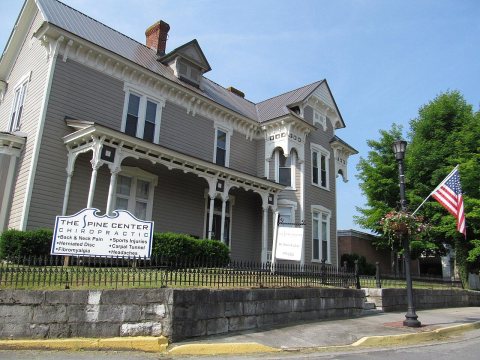 2012
 2012
 2012
 2012
 2012
 2012
 2009
 2006
 2005


