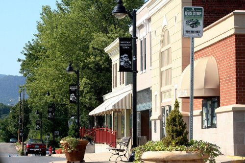
4 places in town are on the National Register, among them a historic district with 451 buildings. Below: 12 old photos and papers, maps from 1905 on, and the census since 1880.
Founding year: Wikidata; Wikipedia’s history section gives the same year. First post office: 1882.The full story ↓
History grade
What drives Shenandoah’s History grade
On its age, its old homes and the National Register, Shenandoah is more historic than 94% of U.S. towns. All 3 inputs are above most U.S. towns; its National Register listings ranks highest and its share of homes from before 1940 lowest.
A
HistoryA character grade: shown, never part of Shenandoah’s overall grade.
Virginia towns list more on the Register than most of the country (a typical Virginia town has 3.6 per 10,000 residents, the U.S. 2.4), so Shenandoah’s 1,579 sits above most of its state (98% of Virginia towns have fewer) while its 456 historic buildings outnumber those of 97% of U.S. towns.
How sure. Graded on any two of the three inputs instead, the letter would range from A− to A+. The pre-1940 share is a Census survey estimate (±6.0 points). Two sources give 1837.
Founding year: Wikidata (other dates in Quick answers). Homes: Census ACS 2020–24. National Register: National Park Service, May 2026 list; each listing counted once (boundary changes and added documentation belong to their listing), and a historic district counts its contributing buildings. How TownRatings grades history →
What stands out about Shenandoah’s past
Read from the archive, the National Register and the record. The page puts what stands out first.
National Park Service, National Register of Historic Places. Photos from Wikimedia Commons, credited on each place’s page.
Every building
Shenandoah, building by building, 1905–1924
Fire insurance maps drew every building, what it was made of and what it was used for, so insurers could price the risk of fire. Pick a year, then a sheet.
Nothing in the archives for these yearsWeddings on Main Street, storms, parades, school pictures, the old store. If it’s in your family album, it belongs here.
The town was founded in 1837 by two brothers, Daniel and Henry Forrer, who settled in the area to take advantage of the natural resources found in and around Shenandoah. The natural resources included extensive iron ore deposits, hardwood, high-grade limestone, and waterpower. The proximity to the South Fork of the Shenandoah River was also a great benefit and was later used by the Forrers to transport iron ore and other commodities produced by the Shenandoah Iron Works to broader markets downstream.
Passages that mention Shenandoah, cut from the printed page as they were published.
History of the campaign of Gen. T.J. (Stonewall) Jackson in the Shenandoah Valley of Virginia1880 · page 61Read the page →
Read the text
west of it, thus turning the Confederate flank. Ashby destroyed the greater part of the railroad property and bridges as he retired, but failed in his attempt to burn the turnpike bridge over the north fork of the Shenandoah. Here the Federals pressed him closely, seized the bridge and extinguished the fire before it had made any headway. Ashby's horse was badly wounded, but bore him safely from the field before it fell dead. On the same day Jackson broke up his camp at Rude's hill and retreated before the advancing enemy in the direc-
Text read by machine from the scan; it may contain errors.
History of the campaign of Gen. T.J. (Stonewall) Jackson in the Shenandoah Valley of Virginia1880 · page 138Read the page →
Read the text
Next day Jackson continued his retreat, and on the 5th reached Harrisonburg, which he entered before mid-day. Here he changed Jackson's flank while Fremont attacked him in rear. He continues: "About 5 P.M. next day my advance reached the Shenandoah at Honeyville, but found the Whitehouse bridge and the Columbia bridge both burned, thus cutting oif all hope of attacking his flank at New Market, , . . I then pushed forward the advance as rapidly as possible in hope of finding the bridge at Conrad's Store still standing, but that bridge was also found burned." (Shields's report.)
Text read by machine from the scan; it may contain errors.
Scans and text from the Internet Archive. Books published in 1930 or earlier, which are in the public domain.
Timeline
Shenandoah, 1837 to 1944
Woven from the archive, old maps, post office records, the National Register and the people born here.
In 1837, according to Wikidata and Wikipedia’s history of the town. Shenandoah’s post office opened in 1882, and the census of 1880 counted 197 people here.
How does Shenandoah rank for history?
Shenandoah is more historic than 94% of U.S. towns. The History grade combines the town’s founding era, the share of homes built before 1940 and its National Register listings. It’s a character grade, so it isn’t part of the overall grade. How it works.
What is on the National Register in Shenandoah?
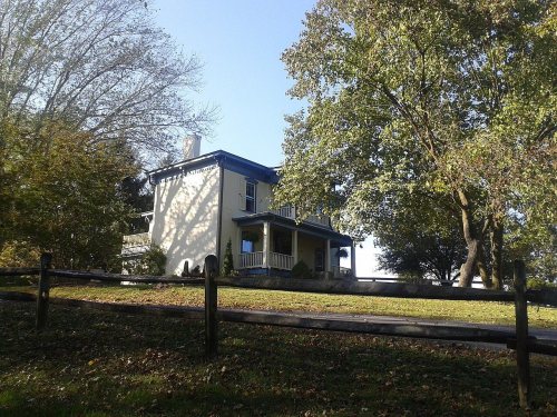
4 listings: 3 buildings, among them the Shenandoah Land and Improvement Company Office (listed 1978, the first), and 1 historic district, the Shenandoah Historic District, with 451 contributing buildings. 456 historic buildings in all.
How old are the homes in Shenandoah?
22% of Shenandoah’s homes were built before 1940 (Census estimate, ±6.0 points), against a typical 1.9% for a Virginia town; the median home was built in 1973.
Founding dates: Wikidata, Wikipedia, the U.S. post office records of Blevins & Helbock (CC0) and the Census. Homes by year built: Census ACS 2020–24. National Register of Historic Places: National Park Service (list of May 22, 2026). Old photos, postcards and papers: Wikimedia Commons, the Library of Congress and other public archives, credited on each item’s page. Maps: U.S. Geological Survey historical topographic maps (via Esri) and Sanborn fire-insurance maps (Library of Congress). History text and census tables: Wikipedia (CC BY-SA 4.0). Places that used to be: USGS Geographic Names Information System (2021).
From Wikimedia Commons (12), the National Register of Historic Places (4), Wikipedia, Wikidata and Wikipedia for famous people, U.S. Geological Survey historical maps, U.S. Census counts (via Wikipedia), the US Post Offices dataset (Blevins & Helbock), the USGS Geographic Names Information System, Sanborn fire insurance maps (Library of Congress) and old county and town histories (Internet Archive). Archive images are copied here with their credits and licenses, shown on each photo’s page. Refreshed monthly.



 1936
 1936
 1936
 1936
 1936
 1936
 1936
 1936
 1936
 1936
 1936
 1936