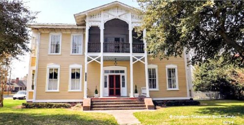
The Boykins post office opened in 1883, the earliest record of the town by name. Another post office, Boykins Depot (1836), opened inside today’s town and later closed.
First census: 173 in 18902020 census: 516143 years
Founding year: the first Boykins post office (Blevins & Helbock, CC0).The full story ↓
What stands out about Boykins’ past
Read from the archive, the National Register and the record. The page puts what stands out first.
John Boykin acquired a tract to the south of what became the town on the road to Severn, North Carolina, which lay partly in Virginia and partly in North Carolina. In 1829 Boykin and his wife sold the land and moved to Alabama. In 1835, Edward Beaton, one of three brothers who were living in Isle of Wight County near the Blackwater River, came to Southampton County and acquired the tract of land that is now known as Boykins from Francis Rochelle. Beaton, who was a continuous resident of Boykins until his death in 1880, is given credit for the founding of the town.
Fire insurance maps drew every building, what it was made of and what it was used for, so insurers could price the risk of fire. Pick a year, then a sheet.
Founding dates: Wikidata, Wikipedia, the U.S. post office records of Blevins & Helbock (CC0) and the Census. Homes by year built: Census ACS 2020–24. National Register of Historic Places: National Park Service (list of May 22, 2026). Old photos, postcards and papers: Wikimedia Commons, the Library of Congress and other public archives, credited on each item’s page. Maps: U.S. Geological Survey historical topographic maps (via Esri) and Sanborn fire-insurance maps (Library of Congress). History text and census tables: Wikipedia (CC BY-SA 4.0). Places that used to be: USGS Geographic Names Information System (2021). How TownRatings grades history →
From Wikimedia Commons (4), the Library of Congress (1), Wikidata (1), the National Register of Historic Places (1), Wikipedia, U.S. Geological Survey historical maps, U.S. Census counts (via Wikipedia), the US Post Offices dataset (Blevins & Helbock), the USGS Geographic Names Information System and Sanborn fire insurance maps (Library of Congress). Archive images are copied here with their credits and licenses, shown on each photo’s page. Refreshed monthly.


 Date?
 2017
 2017
 2017
 2005