
Red Brick School House 1897, 2014
Benson’s story
155 years in pictures
Census counts: 1,451 in 2000, 1,492 in 2020. The archive holds 2 old photos and papers going back to 2014 and 2 maps from 1964 on.
- 1871Benson is settled
Each edition grades its towns against each other only.
A town of 1,776, settled in 1871.
Benson’s best subject grades are an A for schools and cost of living. Only 8 of Utah’s 173 towns score higher on cost of living. On the outdoors, just 14 of Utah’s 173 towns do worse. The biggest park or preserve is Bud Phelps Wildlife Management Area, at 280 acres. Benson has fewer than 2,500 residents, so it gets subject grades but no overall grade.
Where Benson beats most towns.
Where Benson’s working residents go each day. Line width shows the share.
Census LEHD 2023
Each subject compared with towns across the country (schools within Utah), ordered by how far Benson is from typical.
How TownRatings grades towns →
Census counts: 1,451 in 2000, 1,492 in 2020. The archive holds 2 old photos and papers going back to 2014 and 2 maps from 1964 on.
Benson is unincorporated, so Cache County and regional agencies provide most services.
EPA SDWIS (Oct 9, 2026) · HIFLD + EIA-861 2025 · Census 2020 ZCTAs · NCES 2024–25 · registration: vote.gov, updated Mar 13, 2026.
Ordered by what stands out in Benson.
Half the trips to work are shorter than 7 miles. Benson had 188 jobs in 2023, up 67 from 2013. In Benson, the average trip to work is 20 minutes, below both the Utah town median (22 minutes) and the median of U.S. towns (25 minutes). The top destinations are Logan (34%), North Logan (8%) and Salt Lake City (5%).
| Benson | Utah towns | U.S. towns | |
|---|---|---|---|
| Average trip to work | 20 minutes | 22 minutes | 25 minutes |
| Working residents who work in town | 0.8% | 8.4% | 8% |
| Median household income | $93,000 | $101,000 | $80,000 |
| Below the poverty line | 7.9% | 6.2% | 9.6% |
Census LEHD 2023 · ACS
The share of adults in Benson who had a checkup this year is 72%, close to Utah’s towns (72%) and below U.S. towns (79%). CDC measures, 32 in all: Benson beats Utah on 2 and trails on 13. 10% of Benson adults binge drink. Only 10 of the 119 Utah towns we compare have a higher share of adults who smoke cigarettes than Benson.
| Benson | Utah towns | U.S. towns | |
|---|---|---|---|
| Binge drink (CDC PLACES) | 10% | 11% | 16% |
| Sleep under 7 hours (CDC PLACES) | 32% | 34% | 36% |
| Yearly checkup (CDC PLACES) | 72% | 72% | 79% |
| Frequent physical distress (CDC PLACES) | 15% | 12% | 14% |
| What stands out | Benson | UT |
|---|---|---|
| Fewer binge drinkers | 10% | 12.4% |
| More adults treating high blood pressure | 70.2% | 65.6% |
| More adults with COPD | 7.1% | 4.6% |
CDC PLACES 2025 · modeled estimates for adults · CMS · HRSA
In July, afternoons reach 90°; in January, nights fall to 17°, and about 39 inches of snow falls in a winter.
NOAA U.S. Climate Normals, 1991–2020
Of the losses FEMA expects in Benson, 47% come from earthquakes and 30% from inland flooding. On expected storm and flood damage, Benson sits below 57% of U.S. communities.
FEMA National Risk Index · OpenFEMA
For residents in Benson, the share who are 65 or older is 12%. The age mix tracks Utah closely: no broad group is more than 4 points off. The town’s age of the median resident stands at 32.6 years. 35% of adults 25 and older have a bachelor’s degree or more, vs 38% across Utah.
| Benson | Utah towns | U.S. towns | |
|---|---|---|---|
| Median age | 32.6 years | 32.6 years | 40.5 years |
| Aged 65 or older | 12% | 11% | 18% |
| Bachelor’s degree or more, 25+ | 35% | 36% | 29% |
Somewhere between 41% and 63% women
The Census survey reached too few of Benson’s residents to say more: its margin here is ±11.2 points. Across Utah, 49.3% of residents are women.
| Benson | UT | U.S. | |
|---|---|---|---|
| Under 10 | 20.7% | 14.6% | 11.6% |
| 10 to 17 | 8% | 13.2% | 10.3% |
| 18 to 24 | 7.3% | 11.6% | 9.1% |
| 25 to 34 | 17.1% | 14.8% | 13.7% |
| 35 to 44 | 20.8% | 13.8% | 13.2% |
| 45 to 54 | 3.8% | 11% | 12.2% |
| 55 to 64 | 9.9% | 9.1% | 12.7% |
| 65 to 74 | 8% | 7.3% | 10.2% |
| 75 and older | 4.3% | 4.6% | 7% |
| No diploma | 7.1% | 6.6% | 10.4% |
| High school | 26.5% | 22.3% | 26% |
| Some college | 23.3% | 23.5% | 19.1% |
| Associate’s | 8% | 9.9% | 8.8% |
| Bachelor’s | 16.5% | 24.7% | 21.6% |
| Graduate | 18.6% | 13% | 14.1% |
U.S. Census Bureau · ACS 2020-2024 5-year estimates · in a town of 1,800, single groups can be off by several points
Typical home values rose 5.2% in the year to September 2026. In Benson, 74% of households live in a home they own.
Census ACS, 2020–24 · Zillow Home Value Index · Redfin Data Center
In 1 park or preserve, walkers have 21 miles of trail. Benson’s density of trails is 0.6 miles per square mile.
| Benson | Utah towns | U.S. towns | |
|---|---|---|---|
| Miles of trail per square mile | 0.6 miles per square mile | 1.1 | 0.4 |
| Conserved land | 1.5% | 3.4% | 4.3% |
| Biggest places to walk | Trails | Acres |
|---|---|---|
| 1. Bud Phelps Wildlife Management Area | 0.3 mi | 280 |
Trails & parks © OpenStreetMap contributors · Conserved land: USGS PAD-US
Museums, parks, gardens and other places to visit around Benson. Close and well known come first.
 35 mi LakeBear Lake
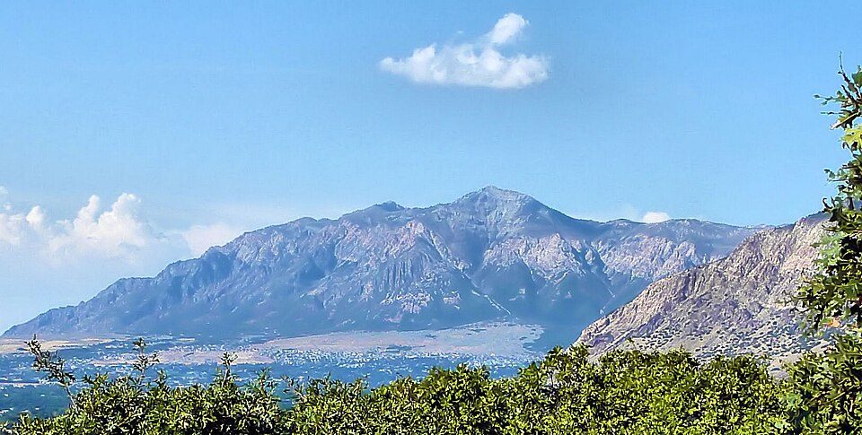 27 mi MountainBen Lomond Mountain38 mi Ski areaSnowbasin Resort157 runs · 3,000 ft vertical
 27 mi National Historical ParkGolden Spike National Historical Park54K visitors a year27 mi Ski areaPowder Mountain Ski Resort155 runs · 2,755 ft vertical25 mi Ski areaBeaver Mountain54 runs · 1,607 ft vertical
Bear Lake: kla4067, CC BY 2.0 · Ben Lomond Mountain: Joe Tordiff, CC BY-SA 2.0 · Golden Spike National Historical Park: Unknown, Public domain
1 within 15 miles of the center of Benson
About 3 of every 100 Benson residents are enrolled in college, against 8 across Utah.
Census-designated place in Cache County, Utah
Benson is a census-designated place (CDP) in Cache County, Utah, United States. It is immediately south of Amalga, across Utah State Route 218, and is west of the Logan-Cache Airport. The population was 1,492 at the 2020 census. It is included in the Logan, Utah-Idaho Metropolitan Statistical Area. As of February 2024, the Benson community was engaged in the process of becoming an incorporated municipality.
From Wikipedia, licensed CC BY-SA 4.0 · facts via Wikidata (CC0)
5 towns share a border with Benson.
| Town | UT rank | Overall | Cost | Safety | Schools | Health |
|---|---|---|---|---|---|---|
| Benson | — | — | A | — | A | B+ |
| Peter | — | — | — | — | — | — |
| Logan | #88 | B | B− | B− | B | A− |
| Amalga | — | — | — | — | — | — |
| Cache | — | — | — | — | — | — |
| Wellsville | #6 | A+ | C+ | — | A | A+ |
Benson has fewer than 2,500 residents, so it gets subject grades but no overall grade. Benson and Wellsville report no FBI crime data of their own. Peter, Amalga and Cache aren’t graded (fewer than 1,000 residents, or not enough data). Compare Benson with a neighbor →
Short answers, built from the data on this page.
Not for the area. Cost of living, which also weighs rents, property taxes and how many households pay 30% or more of their income for housing, grades A.


