Police Scotland doesn’t publish street-level crime, so Kilmarnock has no Safety Grade and, without it, no overall grade. Its other subjects are graded below. Its strongest subject is cost of living (A+): the 22nd most affordable of 296 Scottish towns: median sale £115,900, 2.7 years of area income; rent £656 a month. Its weakest is health (D): life expectancy 75.8 for men, 79.5 for women.
Each subject compared with the 2,160 UK towns with an overall grade (schools within Scotland), ordered by how far Kilmarnock is from typical. American towns are graded separately.
Police Scotland doesn’t publish street-level crime, so Kilmarnock has no Safety Grade and, without it, no overall grade. Its other subjects are graded below.
Registers of Scotland data-zone sale prices · Scottish Government council tax · Scotland’s Census 2022 tenure · OGL
SchoolsB−
Results at Kilmarnock’s schools beat 51% of Scottish towns
Two of its 17 schools are below, each with why it’s listed. The grade uses the secondaries its children go to; Scotland publishes no primary results by school.
Scottish Government · school statistics and leavers’ resultsSee all 17 schools →
Health
Life expectancy in Kilmarnock is shorter than in 95% of UK towns
Women here live to 79.5 on average and men to 75.8 (2020–24). These answers aren’t adjusted for age, so young towns look healthier; the Health Grade uses age-adjusted measures, including life expectancy and early deaths.
Scotland’s Census 2022, general health and disability · Public Health Scotland life expectancy by intermediate zone, 2020–24 · OGL
Work & commute
In Kilmarnock, 18% of commuters go on foot, by bike or by public transport, against 16% in East Ayrshire’s towns and 27% in Scotland’s towns
Scotland’s Census was taken on 20 March 2022, a year after England and Wales’s lockdown census; 26% of workers were mainly at home, and shares here are of those who travelled.
80% of commuters drove, below East Ayrshire’s towns (82%) but above Scotland’s towns (70%). For 45% of commuters, work was under 5 km away.
Historic Environment Scotland list, October 2026 · OGL
Who lives here
Children make up 17% of Kilmarnock, above East Ayrshire’s towns and Scotland’s towns
In the comparison, Kilmarnock comes above both East Ayrshire’s towns (16%) and Scotland’s towns (15%). The median resident of Kilmarnock is 42.5 years old. People aged 15 to 24 make up 11% of the town.
42.5median age
KilmarnockEast AyrshireScotland
Ages · share of residents
19%
Under 1515–2425–4445–6465+
Qualifications · residents 16 and older
No qualifications21%
Apprenticeship8%
Highers or similar11%
Degree level24%
Women and men · all residents
52% women, 48% men
WomenScotlandMen
About 93 men for every 100 women. Across Scotland, 51% of residents are women.
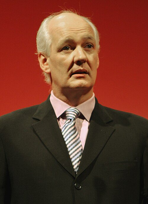
Jim Brown: Robyburns, CC BY-SA 4.0 · Colin Mochrie: Colin_Mochrie_at_BANFF,_2008.jpg: kris krüg derivative work: Keraunoscopia, CC BY-SA 3.0 · James McDougal Hart: George G. Rockwood, Public domain · William McIlvanney: nonsenseferret, CC BY-SA 3.0 · Steven Cree: JackieM8, CC BY-SA 4.0
Kilmarnock’s neighbours
The nearest towns and villages, from National Records of Scotland’s 2022 localities. See them on the map →
No Scottish town has a Safety Grade or an overall grade yet: Police Scotland doesn’t publish street-level crime. People: Census 2022. Miles: centre to centre.
Questions about Kilmarnock
Is Kilmarnock expensive to live in?
Homes cost less than in most UK towns: the median sale over three years was £115,900, against £277,000 in the typical town in England and Wales. On cost of living it is the 22nd most affordable of 296 Scottish towns.
Does Kilmarnock flood?
Surface water isn’t included. Check a specific address on GOV.UK’s flood risk service.
How much is council tax in Kilmarnock?
Band D council tax in Kilmarnock is £1,717 for 2026–27, less than in 88% of UK towns (council, county, police and fire). Your own bill depends on your home’s band; check it on GOV.UK.
About Kilmarnock
Large town in East Ayrshire, Scotland
Kilmarnock is a locality of 47,073 people, in the East Ayrshire council area. TownRatings uses National Records of Scotland’s 2022 localities as Scotland’s towns: the physical town, as people mean the word, rather than a council area, so its figures cover the town itself. Localities split the big settlements into their towns, as ONS’s 2022 boundaries split conurbations in England and Wales.
Built from NRS geography and Census 2022
Population
47,073 (Census 2022)
Council
East Ayrshire
Nation
Scotland
Area
6.3 sq mi (16.4 km²)
NRS code
S52000351
Sources: Scotland’s Census 2022 (National Records of Scotland), output areas summed to the NRS 2022 locality · Registers of Scotland house price statistics, medians and quartiles of residential sales by 2022 data zone, 2004 to 2025 (the 2023 to 2025 headline brought to early-2025 prices with each council’s medians) · Scottish Government, Council Tax by band 2026-27; Scottish Water charges 2026-27 · Scottish Government, Recorded Crime in Scotland (crimes, offences and clear-up rates by council area, 2016-17 to 2025-26); Scottish Index of Multiple Deprivation 2020v2 crime domain and SIMD crime indicators (2014/15, 2017/18), 2011 data zones with Census 2022 residents · ONS gross disposable household income by council (2022), scaled to household income on England and Wales’s councils, with Scotland’s Census 2022 households · DWP / ONS Claimant Count via Nomis (2022 data zones, January to August 2026), over residents aged 16 to 64 at Scotland’s Census 2022; council series since 2015 · Scottish Government school contact list (31 July 2026) and school summary statistics (pupil census, September 2025); School Information Dashboard leavers’ attainment by school, 2022-23 to 2024-25 (data.gov.scot) · TownRatings grades: our own summary of the data, ranked against UK towns only. All under the Open Government Licence v3.0.